- Mustang, Texas
-
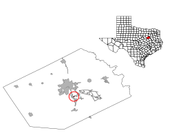
Mustang, Texas — Town — Location of Mustang, Texas
Coordinates: 32°0′45″N 96°25′52″W / 32.0125°N 96.43111°WCoordinates: 32°0′45″N 96°25′52″W / 32.0125°N 96.43111°W Country United States State Texas County Navarro Area – Total 0.1 sq mi (0.3 km2) – Land 0.1 sq mi (0.3 km2) – Water 0.0 sq mi (0.0 km2) Elevation 390 ft (119 m) Population (2000) – Total 47 – Density 372.6/sq mi (143.9/km2) Time zone Central (CST) (UTC-6) – Summer (DST) CDT (UTC-5) FIPS code 48-50184[1] GNIS feature ID 1388614[2] Mustang is a town in Navarro County, Texas, United States. The population was 47 at the 2000 census.
Contents
Geography
Mustang is located at 32°00′45″N 96°25′52″W / 32.012629°N 96.431178°W (32.012629, -96.431178).[3] It is situated at the northeast corner of the junction of Interstate 45 and FM 739 in central Navarro County.[4]
According to the United States Census Bureau, the town has a total area of 0.1 square miles (0.26 km2), all of it land.
History
Mustang was incorporated in 1973 for the purpose of selling alcohol in what was then a dry Navarro County.[5] The incorporation effort was led by William "Bill" McKie, a former Corsicana city attorney. On October 30, 1973, the town approved beer sales. In a March 25, 1975 election, residents voted 20-0 in favor of selling hard liquor as well as mixed beverages. Mustang had a population of 12 in the 1980 Census, which grew to 35 in 1990.[4] By the mid-1990s, the town lost its status as the primary alcohol stop in the county as other nearby communities began to repeal their Blue laws.[6] The population of Mustang rose to 47 in 2000. Town founder Bill McKie negotiated a deal to sell Mustang to Tommy Sinclair, who leased a club in the community, on June 5, 2005 for $600,000. The transaction wasn't completed, however, and Sinclair filed a lawsuit in October 2005 for the right to buy the property. McKie died on November 11, 2005, and his wife Marsha took over legal proceedings on her late husband's behalf. Since McKie's death, legal wrangling over ownership of the town and financial issues have plagued Mustang. In November 2006, the city of Angus threatened to cut off water service to the community over an unpaid bill that totaled $3,400.[6] Mrs. McKie, acting on the town's behalf, personally paid the bill. The case over ownership went back to court in April 2007. Four months later, Sinclair was given possession of Mustang, but not the deed. He promptly evicted much of the town council as well as the city secretary and fire chief.[5] The evictions went to court in November 2007 and a majority of the council left town, but refused to resign their posts. In February 2008, the two council members living in residence called for an election to be held that coming May. The town's disputed ownership status led to the holding of two separate council elections on May 10, 2008. The first election, endorsed by Tommy Sinclair, elected a mayor and five aldermen. The vote was canvassed on May 17. In the second called election, three aldermen positions were left open. Those results were canvassed on May 14. Eight votes were cast in both elections; six votes in one and two in the other. Both governments claimed legitimacy.[7]
Tommy Sinclair and two others were indicted on June 25, 2009 by a Navarro County grand jury in connection with the October 1, 2008 death of a Houston man after an alleged altercation at his cabaret in Mustang.[8]
Demographics
Historical populations Census Pop. %± 1970 7 — 1980 12 71.4% 1990 35 191.7% 2000 47 34.3% Est. 2008 54 14.9% As of the census[1] of 2000, there were 47 people, 20 households, and 12 families residing in the town. The population density was 372.6 people per square mile (139.6/km2). There were 23 housing units at an average density of 182.3 per square mile (68.3/km2). The racial makeup of the town was 89.36% White, 8.51% African American, and 2.13% from two or more races.
There were 20 households out of which 40.0% had children under the age of 18 living with them, 30.0% were married couples living together, 25.0% had a female householder with no husband present, and 40.0% were non-families. 40.0% of all households were made up of individuals and 5.0% had someone living alone who was 65 years of age or older. The average household size was 2.35 and the average family size was 3.08.
In the town the population was spread out with 36.2% under the age of 18, 12.8% from 18 to 24, 27.7% from 25 to 44, 21.3% from 45 to 64, and 2.1% who were 65 years of age or older. The median age was 26 years. For every 100 females there were 104.3 males. For every 100 females age 18 and over, there were 114.3 males.
The median income for a household in the town was $46,250, and the median income for a family was $46,667. Males had a median income of $31,250 versus $0 for females. The per capita income for the town was $75,692. There were no families and 3.8% of the population living below the poverty line, including no under eighteens and 100.0% of those over 64.
Education
Public education in the town of Mustang is provided by the Corsicana Independent School District.
References
- ^ a b "American FactFinder". United States Census Bureau. http://factfinder.census.gov. Retrieved 2008-01-31.
- ^ "US Board on Geographic Names". United States Geological Survey. 2007-10-25. http://geonames.usgs.gov. Retrieved 2008-01-31.
- ^ "US Gazetteer files: 2010, 2000, and 1990". United States Census Bureau. 2011-02-12. http://www.census.gov/geo/www/gazetteer/gazette.html. Retrieved 2011-04-23.
- ^ a b "Mustang, Texas". The Handbook of Texas online. http://www.tshaonline.org/handbook/online/articles/MM/hrmuv.html. Retrieved 2009-07-06.
- ^ a b "Confusion over Mustang elections". Janet Jacobs, Corsicana Daily Sun. 2008-04-19. http://www.corsicanadailysun.com/local/local_story_110205543.html. Retrieved 2009-07-06.
- ^ a b "As trial looms, city wonders: Is Mustang down to last call?" (PDF). Laredo Morning Times. 2006-12-25. http://airwolf.lmtonline.com/news/archive/122506/pagea7.pdf. Retrieved 2009-07-06.
- ^ "Mustang: A town with two councils". Janet Jacobs, Corsicana Daily Sun. 2008-05-18. http://www.corsicanadailysun.com/news/local_story_141004119.html. Retrieved 2009-07-06.
- ^ "Sinclair indicted for club death". Bob Belcher, Corsicana Daily Sun. 2009-06-25. http://www.corsicanadailysun.com/local/local_story_176192739.html. Retrieved 2009-07-06.
Municipalities and communities of Navarro County, Texas Cities 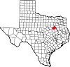
Towns Blooming Grove | Dawson | Emhouse | Mildred | Mustang | Navarro | Oak Valley | Powell | Retreat | Richland | Streetman‡
Unincorporated
communitiesChatfield | Purdon
Ghost town Rush Creek
Footnotes ‡This populated place also has portions in an adjacent county or counties
Categories:- Populated places in Navarro County, Texas
- Towns in Texas
- Populated places established in 1973


Wikimedia Foundation. 2010.