- Wappingers Falls Historic District
Infobox nrhp
name = Wappingers Falls Historic District
nrhp_type = hd
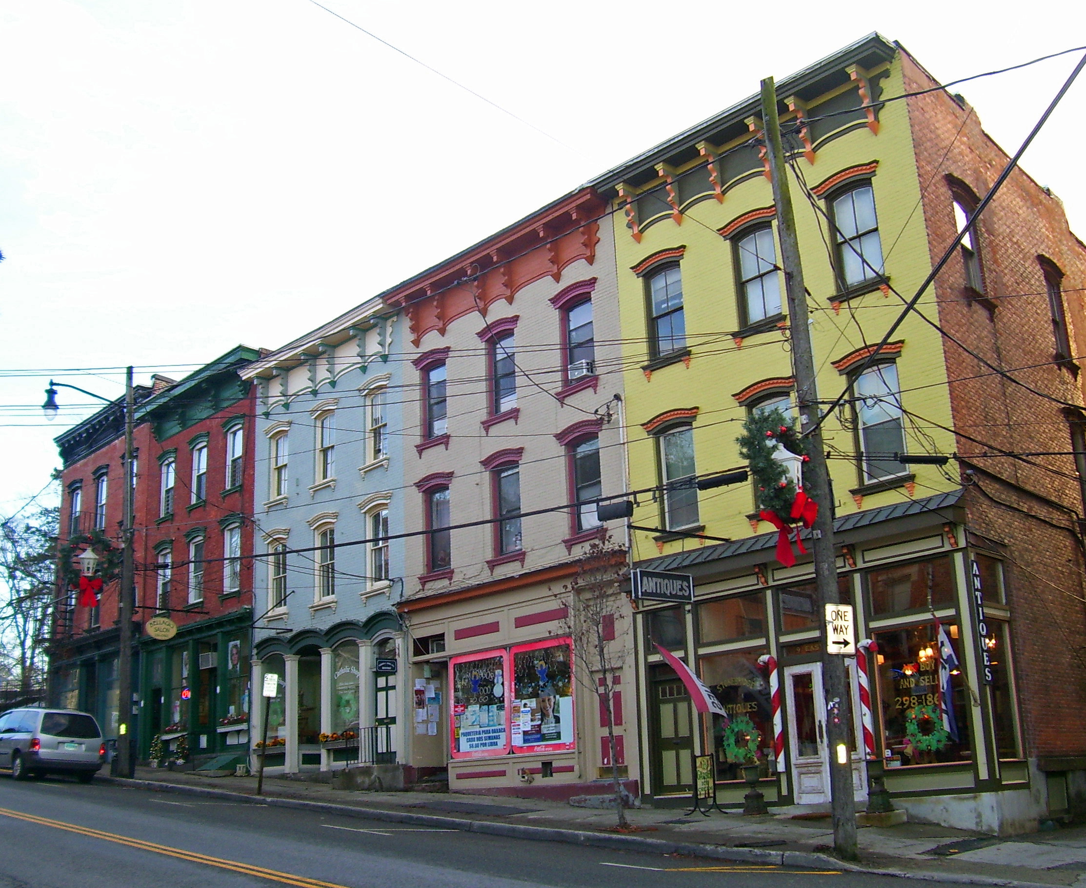
caption = Buildings along Main Street between Mesier Park and Wappingers Creek
lat_degrees = 41
lat_minutes = 35
lat_seconds = 53
lat_direction = N
long_degrees = 73
long_minutes = 55
long_seconds = 07
long_direction = W
location = Wappingers Falls, NY
nearest_city = Poughkeepsie
area = 90 acres (36 ha)cite web|last=Larson|first=Neil|title=National Register of Historic Places nomination form, Wappingers Falls Historic District|url=http://www.oprhp.state.ny.us/hpimaging/hp_view.asp?GroupView=1822|date=1984-08-03|accessdate=2008-03-24]
built = mid 18th-mid 20th century
architect =
architecture = Late Victorian
designated =
added = 1984
established =
visitation_num =
visitation_year =
refnum = 84002380
mpsub = Wappingers Falls MRA
governing_body = Village of Wappingers Falls; private residences and businesses.The Wappingers FallsHistoric District is in the center of that village in Dutchess County,New York ,United States . It is a 90-acre (36 ha) area roughly centered along South Avenue and West Main Street NY 9D andWappingers Creek . It includes Mesier Park in the center of the village and many adjacent residential neighborhoods, roughly bounded by Elm, Park, Walker, Market and McKinley streets.Much of the district was built in the wake of the
industrialization of Wappingers Falls in the 19th century, and its styles represent a cross-section of that century. However, the contributing properties include older buildings, like the ca. 1740 Mesier-Brewer House, and newer ones like the Village Hall, formerly apost office designed under the supervision ofFranklin D. Roosevelt during his presidency.History
In 1819 a small
cotton mill was built in the hollow created by the creek as it descends from Lake Wappinger to drain into the nearbyHudson River . By 1856 it had become one of the largestprintworks in the country. A fire that year destroyed the original buildings completely, but they were immediately rebuilt and continued in operation until 1931. The streets on the hillside opposite the mill are lined with frame houses, mostly duplexes, built by the mill for its workers. The two halves of the district, and the village, are connected by an 1884 stonearch bridge that replaced earlier wooden structures.The village's business district, along West Main Street north and south of the creek, is lined with three-story Italianate row buildings dating to the years after the Civil War. The residential streets to the southwest are filled with larger houses in a variety of 19th-century styles, from Greek andGothic Revival toSecond Empire and Queen Anne.Two significant contributing properties separately listed in the Register date to the pre- and post-industrial eras. The Mesier-Brewer House in the center of the village is a well-preserved pre-Revolutionary stone and wood home common in the region. Across from it at the junction of West Main Street and South Avenue is thefieldstone village hall. It was originally built as one of fivepost office s in the county designed in stone at the insistence of Roosevelt, a native of nearby Hyde Park. In the late 20th century a new post office was built several blocks to the east and in 1995 the village moved its operations there from an old savings bank building downtown. The police, who had been working from the Mesier House, joined them.pdflink| [http://www.greenplan.org/HTMLobj-359/Chapt6.PDF Community Facilities and Services] ]In 1984 the district was added to the
National Register of Historic Places . It is described as a "collection of distinct nineteenth-century structures linked to the development of an importantHudson Valley industrial center." The village is currently proposing efforts such astraffic calming to make the commercial portions of the district more friendly topedestrians PDFlink| [http://www.wappingersfallsny.gov/pdf/06_WF-20070924.pdf Draft Wappingers Falls Vision Plan] , 2006, 22.]References
Wikimedia Foundation. 2010.