- Northop Hall
-
Coordinates: 53°12′04″N 3°05′10″W / 53.201°N 3.086°W
Northop Hall 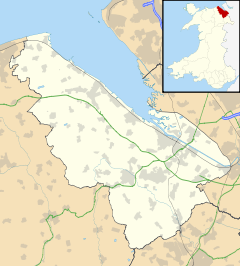
 Northop Hall
Northop Hall shown within FlintshirePopulation 1,665 (2001 Census)[1] OS grid reference SJ275677 Principal area Flintshire Ceremonial county Clwyd Country Wales Sovereign state United Kingdom Post town MOLD Postcode district CH7 6xx Dialling code 01244 Police North Wales Fire North Wales Ambulance Welsh EU Parliament Wales UK Parliament Alyn & Deeside Welsh Assembly Alyn & Deeside List of places: UK • Wales • Flintshire Northop Hall is a large village near Mold, in Flintshire, Wales. Located to the east of Northop, near the A55 North Wales Expressway, the village is largely residential in character. At the 2001 Census, the village of Northop Hall had a population of 1,665.[1] The village has two pubs, the Boar's Head and the Black Lion which are universally known locally as the 'Top Monkey' and 'Bottom Monkey'. There are active cricket and hockey clubs.
The hall that gives the village its name is a 13th century manor house which is located in close proximity to Smithy Lane and the Mold to Connah's Quay road. It was the most important house in Northop parish. It was occupied by local aristocracy including the Evans family, ancestors of author George Eliot. The original Northop Hall is now a private house and not to be confused with Northop Hall Country House Hotel which is Victorian and located elsewhere in the village.
References
- ^ a b 2001 Census: Northop Hall, Office for National Statistics, http://neighbourhood.statistics.gov.uk/dissemination/LeadTableView.do?a=3&b=800996&c=northop+hall&d=16&e=15&g=414728&i=1001x1003x1004&m=0&r=1&s=1214865201211&enc=1&dsFamilyId=779, retrieved 2008-06-30
External links
- Profile of village prepared by Flintshire County Council (PDF format)
- Northop Hall Hockey Club
- Northop Hall Cricket Club
- Photos of Northop Hall and surrounding area on geograph.org.uk
Categories:- Villages in Flintshire
- Clwyd geography stubs

Wikimedia Foundation. 2010.