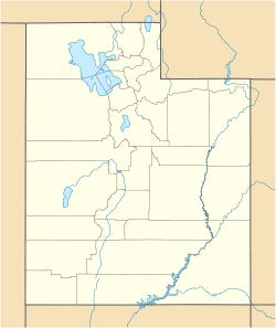
- Corinne, Utah
-
Corinne, Utah — City — Corinne Methodist Episcopal Church
 Corinne, Utah
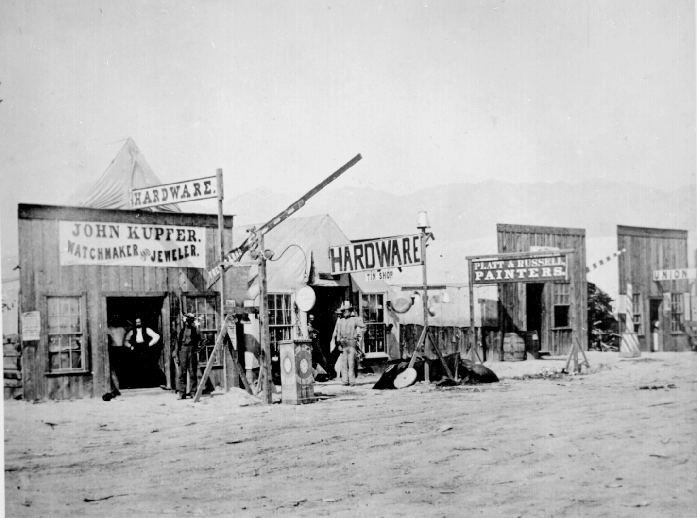
Coordinates: 41°32′55″N 112°6′50″W / 41.54861°N 112.11389°WCoordinates: 41°32′55″N 112°6′50″W / 41.54861°N 112.11389°W Country United States State Utah County Box Elder Founded 1869 Incorporated February 18, 1870 Founder Mark A. Gilmore Named for Corinne Williamson Area – Total 3.7 sq mi (9.5 km2) – Land 3.6 sq mi (9.3 km2) – Water 0.1 sq mi (0.2 km2) Elevation[1] 4,226 ft (1,288 m) Population (2010) – Total 685 – Density 173.4/sq mi (67.0/km2) Time zone MST (UTC-7) – Summer (DST) MDT (UTC-6) ZIP code 84307 Area code(s) 435 FIPS code 49-15830[2] GNIS feature ID 1439951[1]  Street view in Corinne, Box Elder County, Utah. Close-up view of several shops, 1869.
Corinne is a city in Box Elder County, Utah, United States. The population was 685 at the 2010 census.
Contents
Geography
Corinne is located at 41°32′55″N 112°6′50″W / 41.54861°N 112.11389°W (41.548575, -112.113752).[3]
According to the United States Census Bureau, the city has a total area of 3.7 square miles (9.5 km²), of which, 3.6 square miles (9.3 km²) of it is land and 0.1 square miles (0.2 km²) of it (2.19%) is water.
History
For almost ten years from its founding on 25 March 1869, the town of Corinne reigned as the unofficial "Gentile Capital of Utah." As the Union Pacific and Central Pacific Railroads approached their historic meeting place at Promontory Summit early in 1869, a group of former Union Army officers and some determined non-Mormon merchants from Salt Lake City decided to locate a Gentile town on the Union Pacific line, believing that the town could compete economically and politically with the Saints of Utah. They chose a location about six miles west of Brigham City on the west bank of the Bear River where the railroad crossed that stream. Named by one of the founders (General J.A. Williamson) for his fourteen-year-old daughter, Corinne was designed to be the freight-transfer point for the shipment of goods and supplies to the mining towns of western Montana along the Montana Trail.
In its heyday Corinne had some 1,000 permanent residents, not one of whom was a Mormon, according to the boast of the local newspaper. As an end-of-the-trail town, Corinne reflected a very different atmosphere and culture from the staid and quiet Mormon settlements of Utah, nurturing not only a number of commission and supply houses but also fifteen saloons and sixteen liquor stores, with a gun-fighting town marshal to keep order in this "Dodge City" of Utah. The permanent residents of Corinne did their best to promote a sense of community pride and peaceful, cultural pursuits but had a raucous and independent clientele of freighters and stagecoachers to control.
With some support from political leaders in the nation's capital and from eastern newspapers, the town fathers attempted to use their position as a Gentile city to break the political and economic monopoly held by the Mormons in Utah Territory. They sought to have J. A. Williamson named territorial governor; tried to have the northern one degree of latitude of Utah added to Idaho so as to dismember the territory; and attempted to have Corinne named as the capital of Utah. The citizens of Corinne failed in each case to achieve their wishes, although their leaders and newspapers bombarded Washington, D.C. for help in their fight with Brigham Young and the Mormon hierarchy. The Saints had no difficulty in this unequal fight, even awarding the ballot to Utah women to ensure maintenance of political control of the territory.
Brigham Young assured the demise of Corinne when he and the Mormon people built the narrow-gauge Utah Northern Railroad from Ogden to Franklin, Idaho. Although construction of the line beyond that point ceased for four years as a result of the Panic of 1873, in the autumn of 1877 the Union Pacific bought the spur line and began pushing it northward through Idaho. The tracks reached Marsh Valley and cut the Montana Trail at that place, thereby supplanting wagon traffic from Corinne with rail transport from Ogden. The Gentile merchants soon abandoned Corinne in favor of Ogden or the terminus of the rail line, while Mormon farmers moved in to buy the land around Corinne and make it into another Mormon settlement.
In 1877 an LDS ward was organized, but was dissolved when the town suffered a decline in population. As farmers again settled the region, a Corinne Ward was again organized; during the interim it was part of the Bear River Ward. A meetinghouse was built in 1914 and the Corinne Ward was reorganized that year with Alma Jenson as Bishop.[4]
Demographics
Historical populations Census Pop. %± 1900 323 — 1910 231 −28.5% 1920 394 70.6% 1930 352 −10.7% 1940 411 16.8% 1950 427 3.9% 1960 510 19.4% 1970 471 −7.6% 1980 512 8.7% 1990 639 24.8% 2000 621 −2.8% 2010 685 10.3% As of the census[2] of 2000, there were 621 people, 190 households, and 159 families residing in the city. The population density was 173.4 people per square mile (67.0/km²). There were 208 housing units at an average density of 58.1 per square mile (22.4/km²). The racial makeup of the city was 89.86% White, 0.48% Native American, 2.42% Asian, 0.32% Pacific Islander, 5.96% from other races, and 0.97% from two or more races. Hispanic or Latino of any race were 8.21% of the population.
There were 190 households of which 46.3% had children under the age of 18 living with them, 72.6% were married couples living together, 6.3% had a female householder with no husband present, and 16.3% were non-families. 15.8% of all households were made up of individuals and 7.4% had someone living alone who was 65 years of age or older. The average household size was 3.27 and the average family size was 3.64.
The 2000 population distribution was 34.3% under the age of 18, 10.3% from 18 to 24, 26.2% from 25 to 44, 19.8% from 45 to 64, and 9.3% of 65 or more years of age. The median age was 31 years. For every 100 females there were 101.6 males. For every 100 females age 18 and over, there were 104.0 males.
The median income for a household in the city was $42,125, and the median income for a family was $45,208. Males had a median income of $32,344 versus $19,205 for females. The per capita income for the city was $16,053. About 6.2% of families and 8.5% of the population were below the poverty line, including 10.9% of those under age 18 and 12.9% of those age 65 or over.
Schools
For several years an elementary school operated in Corinne, but it was closed and its students merged with Century Elementary School in Bear River City.
References
- ^ a b U.S. Geological Survey Geographic Names Information System: Corinne
- ^ a b "American FactFinder". United States Census Bureau. http://factfinder.census.gov. Retrieved 2008-01-31.
- ^ "US Gazetteer files: 2010, 2000, and 1990". United States Census Bureau. 2011-02-12. http://www.census.gov/geo/www/gazetteer/gazette.html. Retrieved 2011-04-23.
- ^ Jenson, Andrew. Encyclopediac History of the Church of Jesus Christ of Latter-day Saints (Salt Lake City: Deseret News Press, 1941) p. 159
External links
 Media related to Corinne, Utah at Wikimedia Commons
Municipalities and communities of Box Elder County, Utah Cities Bear River City | Brigham City | Corinne | Garland | Honeyville | Perry | Tremonton | Willard

Towns CDPs Riverside | South Willard | Thatcher
Unincorporated
areasBothwell | Collinston | Etna | Grouse Creek | Park Valley | Penrose | Promontory | Rosette | Standrod | Yost
Ghost towns Categories:- Buildings and structures in Box Elder County, Utah
- Cities in Utah
- Populated places established in 1869
- Populated places in Box Elder County, Utah
- Railway stations in Utah
- Transportation in Box Elder County, Utah


Wikimedia Foundation. 2010.