- Teterboro, New Jersey
Infobox Settlement
official_name = Teterboro, New Jersey
settlement_type = Borough
nickname =
motto =
imagesize =
image_caption =
image_
imagesize =
image_caption =
image_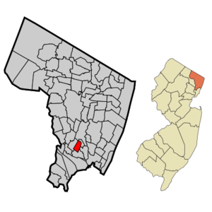
mapsize = 250x200px
map_caption = Map highlighting Teterboro's location within Bergen County. Inset: Bergen County's location within New Jersey.
mapsize1 = 250x200px
map_caption1 = Census Bureau map of Teterboro, New Jerseysubdivision_type = Country
subdivision_name =United States
subdivision_type1 = State
subdivision_name1 =New Jersey
subdivision_type2 = County
subdivision_name2 = Bergen
government_footnotes =
government_type =1923 Municipal Manager Law
leader_title =Mayor
leader_name = John P. Watt
leader_title1 = Administrator
leader_name1 = Paul F. Busch
established_title = Incorporated
established_date =March 26 ,1917 unit_pref = Imperial
area_footnotes =
area_magnitude =
area_total_km2 = 2.9
area_land_km2 = 2.9
area_water_km2 = 0.0
area_total_sq_mi = 1.1
area_land_sq_mi = 1.1
area_water_sq_mi = 0.0population_as_of = 2007
population_footnotes =
population_total = 18
population_density_km2 = 6.2
population_density_sq_mi = 16.2timezone = Eastern (EST)
utc_offset = -5
timezone_DST = EDT
utc_offset_DST = -4
elevation_footnotes = [Gnis|885418|Borough of Teterboro,Geographic Names Information System , accessedDecember 25 ,2007 .]
elevation_m = 2
elevation_ft = 7
latd = 40 |latm = 51 |lats = 13 |latNS = N
longd = 74 |longm = 3 |longs = 38 |longEW = Wpostal_code_type =
ZIP code
postal_code = 07608
area_code = 201
blank_name = FIPS code
blank_info = 34-72480GR|2 [ [http://mcdc2.missouri.edu/webrepts/commoncodes/ccc_nj.html A Cure for the Common Codes: New Jersey] , Missouri Census Data Center. AccessedJuly 14 ,2008 .]
blank1_name = GNIS feature ID
blank1_info = 0885418GR|3
website =
footnotes =Teterboro is a borough in Bergen County,
New Jersey , U.S. As of theUnited States 2000 census , the borough population was 18, making it the smallest municipality in New Jersey by population at the time of the census, ahead of Pine Valley (population 20) and Tavistock (with 24 residents). [ [http://factfinder.census.gov/servlet/GCTTable?_bm=y&-geo_id=04000US34&-_box_head_nbr=GCT-PH1-R&-ds_name=DEC_2000_SF1_U&-_lang=en&-format=ST-7S&-_sse=on New Jersey -- Place and County Subdivision - GCT-PH1-R. Population, Housing Units, Area, and Density (geographies ranked by total population): 2000] ,United States Census Bureau . AccessedJune 25 ,2008 .]The 2000 census failed to count any of the residents of the Vincent Place housing units who had moved into the newly built homes in 1999. The uncounted residents, including the Mayor and all four Council members, would help make up a projected tripling of the population enumerated by the census. [ [http://query.nytimes.com/gst/fullpage.html?res=9907E6D71639F934A25750C0A960958260 At Three Times the Population, This Town Will Still Be Tiny] , "
The New York Times "March 17 ,1996 .] Previously, the Mayor and Council, as well as several other Vincent Place residents, had all been residents of Huyler Street, the only other street zoned as a residential area in the borough.Teterboro was incorporated on
March 26 ,1917 , from land taken from the boroughs of Moonachie and Little Ferry and from Lodi Township. The borough was enlarged onJuly 5 ,1918 , by the addition of area annexed from Hasbrouck Heights. The name Teterboro was changed onApril 14 ,1937 , to Bendix Borough, and changed back to Teterboro Borough onJune 1 ,1943 ."The Story of New Jersey's Civil Boundaries: 1606-1968", John P. Snyder, Bureau of Geology and Topography; Trenton, New Jersey; 1969. p. 87 re Teterboro, p. 75 re Bendix.] The town was named for Walter C. Teter, a New York investment banker, who had purchased land to build a racetrack. [ [http://www.thearticlewriter.com/teterboro.htm Teterboro: A General Aviation Town] The Article Writer, October 11, 2005. Retrieved September 30, 2008.]In the past, neighboring municipalities, such as Hasbrouck Heights and South Hackensack, have attempted to absorb Teterboro, hoping to reap the financial benefits (and lower property taxes) of doing so. Others have reasoned that the population is too small for the borough to justify its own existence. However, all such attempts have met with failure, due to resistance from residents and municipal officials.
Teterboro is best known as the home of
Teterboro Airport (operated by thePort Authority of New York and New Jersey ) which takes up most of the borough, along with portions of Hasbrouck Heights and Moonachie. [ [http://www.panynj.gov/commutingtravel/airports/html/teb_location.html Directions to and from the Airport] ,Port Authority of New York & New Jersey . AccessedJuly 7 ,2008 . "Teterboro Airport is located in the Boroughs of Teterboro, Moonachie, and Hasbrouck Heights in Bergen County, New Jersey."]Geography
Teterboro is located at coor dms|40|51|13|N|74|3|36|W|city (40.853723, -74.059872)GR|1.
According to the
United States Census Bureau , the borough has a total area of 1.1square mile s (2.9km² ), all of it land.Demographics
USCensusPop
1900=7
1910=20
1920=24
1930=26
1940=40
1950=28
1960=22
1970=19
1980=19
1990=22
2000=18
estimate=18
estyear=2007
estref=cite web
url=http://factfinder.census.gov/servlet/SAFFPopulation?_event=Search&geo_id=16000US3421480&_geoContext=01000US%7C04000US34%7C16000US3421480&_street=&_county=Teterboro%2C+New+Jersey&_cityTown=Teterboro%2C+New+Jersey&_state=&_zip=&_lang=en&_sse=on&ActiveGeoDiv=geoSelect&_useEV=&pctxt=fph&pgsl=160&_submenuId=population_0&ds_name=null&_ci_nbr=null&qr_name=null®=null%3Anull&_keyword=&_industry=
publisher=U.S. Census Bureau
quote=The 2007 population estimate for Teterboro borough, New Jersey is 18.
title=Population Finder: Teterboro borough, New Jersey
accessdate=2008-09-04]
footnote=historical data sources: [ cite web
url=http://www.wnjpin.net/OneStopCareerCenter/LaborMarketInformation/lmi01/poptrd6.htm
title=New Jersey Resident Population by Municipality: 1930 - 1990
accessdate=2007-03-03] [ [http://www.co.bergen.nj.us/planning/data/HistoricalPop.pdf Bergen County Census Data] ,Bergen County, New Jersey . AccessedJanuary 2 ,2008 .] As of thecensus GR|2 of 2000, there were 18 people, 7 households, and 4 families residing in the borough. Thepopulation density was 16.2 people per square mile (6.3/km²). There were 8 housing units at an average density of 7.2/sq mi (2.8/km²). The racial makeup of the borough was 83.33% White, and 16.67% from two or more races.There were 7 households out of which 42.9% had children under the age of 18 living with them, 42.9% were married couples living together, 28.6% had a female householder with no husband present, and 28.6% were non-families. 14.3% of all households were made up of individuals and 14.3% had someone living alone who was 65 years of age or older. The average household size was 2.57 and the average family size was 3.00.
In the borough the population was spread out with 33.3% under the age of 18, 5.6% from 18 to 24, 50.0% from 25 to 44, 5.6% from 45 to 64, and 5.6% who were 65 years of age or older. The median age was 33 years. For every 100 females there were 100.0 males. For every 100 females age 18 and over, there were 100.0 males.
The median income for a household in the borough was $44,167, and the median income for a family was $43,750. Males had a median income of $18,750 versus $38,750 for females. The
per capita income for the borough was $72,613. None of the population or families were below thepoverty line .Government
Local government
Teterboro is governed under the
1923 Municipal Manager Law form of New Jersey municipal government. The government consists of a Borough Council comprising five council members, with all positions elected at large in partisan elections to four-year terms on a concurrent basis."2005 New Jersey Legislative District Data Book",Rutgers University Edward J. Bloustein School of Planning and Public Policy , April 2005, p. 160.] The Council selects one of its members to serve as mayor.With only 12 residents over the age of eighteen at the time of the 2000 Census, Teterboro has one of the smallest electorates of any municipality in the United States. The four councilpersons and mayor make up nearly half of the voting population by themselves.
Teterboro's Borough Council consists of
Mayor John P. Watt, James O'Dwyer, Juan Ramirez, Gregory Stein and John B. Watt. Terms for all current members end onDecember 31 ,2010 ."County of Bergen: 2007 County and Municipal Directory",Bergen County, New Jersey , p. 64.]Federal, state and county representation
Teterboro is in the Ninth Congressional District and is part of New Jersey's 38th Legislative District. [ [http://www.lwvnj.org/pubs/CG06.pdf 2006 New Jersey Citizen's Guide to Government] , New Jersey
League of Women Voters , p. 65. AccessedAugust 30 ,2006 .]Politics
As of
April 1 ,2006 , out of a 2004 Census estimated population of 18 in Teterboro, there were 39 registered voters (216.7% of the population, vs. 55.4% in all of Bergen County). Of registered voters, 7 (17.9% vs. 20.7% countywide) were registered as Democrats, 6 (15.4% vs. 19.2% countywide) were registered as Republicans and 26 (66.7% vs. 60.1% countywide) were registered as Undeclared. There were no voters registered to other parties. ["County of Bergen: Voter Statistics by Municipality, Ward & District,"Bergen county, New Jersey , datedApril 1 ,2006 .]On the national level, Teterboro tilts strongly toward the Democratic Party. In the 2004 presidential election, Democrat
John Kerry received 56% of the vote here, defeating RepublicanGeorge W. Bush , who received around 43%. [ [http://www.nj.gov/lps/elections/2004results/04_Municipality_pdf%27s/presidential_bergen_co_2004.pdf 2004 Presidential Election results: Bergen County] ,New Jersey Department of Law and Public Safety : Division of Elections, datedDecember 13 ,2004 .]Education
Public school students in grades K - 8, attend Memorial School in South Hackensack, as part of a
sending/receiving relationship with theSouth Hackensack School District . [Staff. [http://www.highbeam.com/doc/1P1-43297376.html "GUIDE TO SCHOOL ELECTIONS " "GUIDE TO SCHOOL ELECTIONS -- TETERBORO "] , "The Record (Bergen County) ", April 4, 2001. Accessed September 4, 2008. "Teterboro sends its studentsto South Hackensack schools and has a three-member board that preparesits annual school budget."]High school students have an option to attend
Hackensack High School (which is the receiving district for South Hackensack students) of theHackensack Public Schools , orHasbrouck Heights High School of theHasbrouck Heights School District . Other options include the various locations of theBergen County Academies andBergen County Technical Schools .Teterboro is the home to the Teterboro campus of the
Bergen County Technical Schools .Transportation
Teterboro is served by
New Jersey Transit on thePascack Valley Line at the Williams Avenue train station. The station is located on Williams Avenue near Route 17.This line runs north-south to
Hoboken Terminal with connections via theSecaucus Junction transfer station to New Jersey Transit one-stop service to New York Penn Station and to other NJ Transit rail service. Connections are available at theHoboken Terminal to other New Jersey Transit rail lines, the PATH train at the Hoboken PATH station,New York Waterways ferry service to theWorld Financial Center and other destinations andHudson-Bergen Light Rail service.The Pascack Valley Line is a single-track line providing service towards Hoboken during the morning rush hour and service from Hoboken in the evening rush hour.
U.S. Route 46 travels through Teterboro, while Route 17 travels parallel to the Hasbrouck Heights - Teterboro town line on the Hasbrouck Heights side.References
External links
* [http://hhschools.org Hasbrouck Heights School District]
* [http://www.hashgts.k12.nj.us/hs/index.htm Hasbrouck Heights High School]
* [http://www.hackensackhigh.org/ Hackensack High School]
* [http://www.teterboro-online.com/ Teterboro-Online unofficial website]
Wikimedia Foundation. 2010.