- Geography of Jersey
-
Jersey Native name: Jèrri 
Map of islands of Bailiwick of Jersey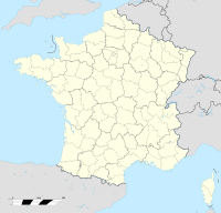
 Jersey (off the coast of France)
Geography Location English Channel Coordinates 49°11′24.06″N 2°6′36″W / 49.1900167°N 2.11°WCoordinates: 49°11′24.06″N 2°6′36″W / 49.1900167°N 2.11°W Archipelago Channel Islands Area 116 km2 (44.8 sq mi) Coastline 70 km (43 mi) Highest elevation 143 m (469 ft) Highest point Les Platons Country United KingdomCrown dependency  Jersey
Largest city Saint Helier (pop. 28,310) Demographics Population 90,800 (as of 2007) Density 782.76 /km2 (2,027.34 /sq mi) Ethnic groups English and Norman-French descent. Portuguese and Polish minorities This article describes the geography of Jersey, an island territory in the English Channel. The island of Jersey has an area of 116 square kilometres, with 70 kilometres of coastline. Jersey claims a territorial sea of 3 nmi (5.6 km; 3.5 mi) and an exclusive fishing zone of 12 nmi (22.2 km; 13.8 mi).
Jersey is the largest and southernmost of the Channel Islands. It is located north of Brittany and west of the Cotentin Peninsula in Normandy. About 30% of the population of the island is concentrated in Saint Helier.
Contents
Physical geography
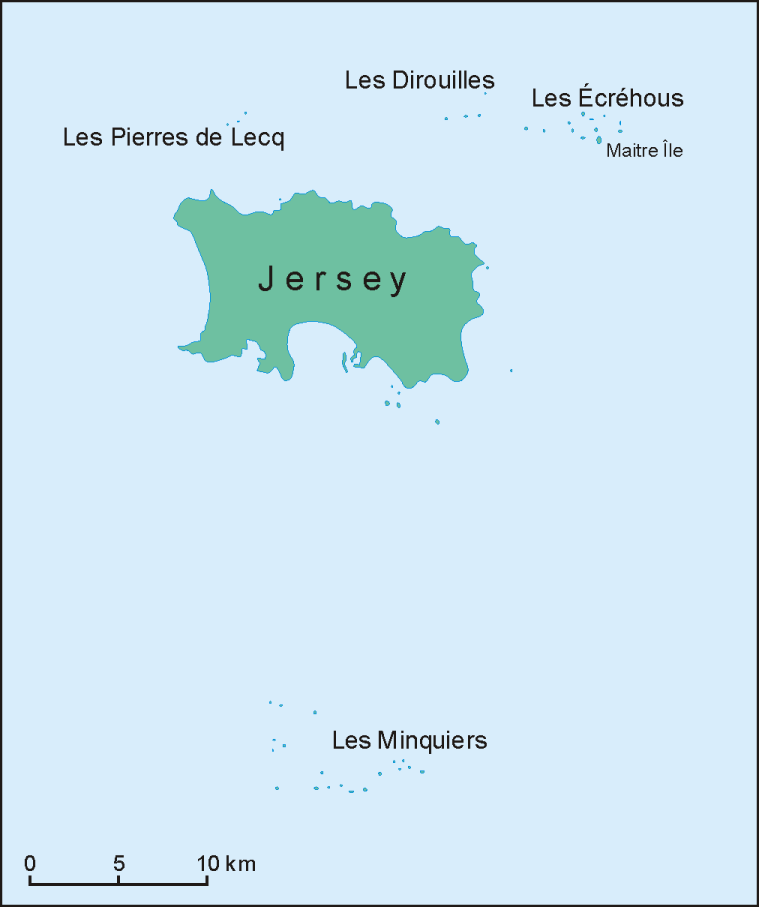
Besides the main island, the bailiwick includes other islets and reefs with no permanent population: Les Écréhous, Les Minquiers, Les Pierres de Lecq, Les Dirouilles.
The lowest point in the island is the Atlantic Ocean, and the highest is Les Platons, at 143 metres (469 ft). The terrain is generally low-lying on the south coast, with some rocky headlands, rising gradually to rugged cliffs along the north coast. On the west coast there are sand dunes. Small valleys run north to south across the island. Very large tidal variation exposes large expanses of sand and rock to the southeast at low tide.
Climate
The climate in the island is temperate, with mild winters and cool summers.
Natural resources
The main natural resource on ths island is arable land. 66% of the island's land is used as such, and the remaining 34% is used for other purposes.
Environment
Current environmental issues for Jersey include waste disposal, air pollution and traffic.
External links
- Jersey Tourism: Island Maps: all roads and features, and when magnified includes Parish borders
- Jersey Meteorological Department
- Jersey Tourism Coastal Microsite
- Prehistoric Jersey
 This exaggerated-colour image of Jersey was taken on September 23, 2000, by NASA's Terra satellite.
 topographic relief image
Geography of Europe Sovereign
states- Albania
- Andorra
- Armenia
- Austria
- Azerbaijan
- Belarus
- Belgium
- Bosnia and Herzegovina
- Bulgaria
- Croatia
- Cyprus
- Czech Republic
- Denmark
- Estonia
- Finland
- France
- Georgia
- Germany
- Greece
- Hungary
- Iceland
- Ireland
- Italy
- Kazakhstan
- Latvia
- Liechtenstein
- Lithuania
- Luxembourg
- Macedonia
- Malta
- Moldova
- Monaco
- Montenegro
- Netherlands
- Norway
- Poland
- Portugal
- Romania
- Russia
- San Marino
- Serbia
- Slovakia
- Slovenia
- Spain
- Sweden
- Switzerland
- Turkey
- Ukraine
- United Kingdom
- (England
- Northern Ireland
- Scotland
- Wales)
- Vatican City
States with limited
recognitionDependencies
and other territories- Åland
- Faroe Islands
- Gibraltar
- Guernsey
- Jan Mayen
- Jersey
- Isle of Man
- Svalbard
Other entities Climate of Europe Sovereign
states- Albania
- Andorra
- Armenia
- Austria
- Azerbaijan
- Belarus
- Belgium
- Bosnia and Herzegovina
- Bulgaria
- Croatia
- Cyprus
- Czech Republic
- Denmark
- Estonia
- Finland
- France
- Georgia
- Germany
- Greece
- Hungary
- Iceland
- Ireland
- Italy
- Kazakhstan
- Latvia
- Liechtenstein
- Lithuania
- Luxembourg
- Macedonia
- Malta
- Moldova
- Monaco
- Montenegro
- Netherlands
- Norway
- Poland
- Portugal
- Romania
- Russia
- San Marino
- Serbia
- Slovakia
- Slovenia
- Spain
- Sweden
- Switzerland
- Turkey
- Ukraine
- United Kingdom
- (England
- Northern Ireland
- Scotland
- Wales)
- Vatican City
States with limited
recognition- Abkhazia
- Kosovo
- Nagorno-Karabakh
- Northern Cyprus
- South Ossetia
- Transnistria
Dependencies
and other territoriesOther entities - European Union
- Sovereign Military Order of Malta
Categories:- Geography of Jersey
- Geography of the Channel Islands


Wikimedia Foundation. 2010.