- Plain City, Utah
Infobox Settlement
official_name = Plain City, Utah
other_name =
native_name =
nickname =
settlement_type =City
motto =
imagesize =
image_caption =
flag_size =
image_
seal_size =
image_shield =
shield_size =
image_blank_emblem =
blank_emblem_size =
mapsize = 250px
map_caption = Location of Plain City, Utah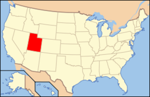
mapsize1 =
map_caption1 = Location of Utah in the United States
image_dot_
dot_mapsize =
dot_map_caption =
dot_x =
dot_y =
pushpin_
pushpin_label_position =
pushpin_map_caption =
pushpin_mapsize =
subdivision_type = Country
subdivision_name =United States
subdivision_type1 = State
subdivision_name1 =Utah
subdivision_type2 = County
subdivision_name2 = Weber
subdivision_type3 =
subdivision_name3 =
subdivision_type4 =
subdivision_name4 =
government_footnotes =
government_type = Council-Mayor
leader_title = Mayor
leader_name = "Jay Jenkins"
leader_title1 = Mayor Pro Temp
leader_name1 = "Brent White"
leader_title2 = Arts Council
leader_name2 = "LaFray Kelley"
leader_title3 = Risk Management
leader_name3 = "Bruce Higley"
leader_title4 = Public Safety
leader_name4 = "Beth Koford"
leader_title5 = City Recorder
leader_name5 = "Diane Hirschi"
established_title =
established_date =
established_title2 =
established_date2 =
established_title3 =
established_date3 =
area_magnitude =
unit_pref = Imperial
area_footnotes =
area_total_km2 = 9.7
area_land_km2 = 9.7
area_water_km2 = 0.0
area_total_sq_mi = 3.7
area_land_sq_mi = 3.7
area_water_sq_mi = 0.0
area_water_percent =
area_urban_km2 =
area_urban_sq_mi =
area_metro_km2 =
area_metro_sq_mi =
population_as_of = 2000
population_footnotes =
population_note =
population_total = 3,489
population_density_km2 = 361.2
population_density_sq_mi = 935.3
population_metro =
population_density_metro_km2 =
population_density_metro_sq_mi =
population_urban =
population_density_urban_km2 =
population_density_urban_sq_mi =
population_blank1_title =
population_blank1 =
population_density_blank1_km2 =
population_density_blank1_sq_mi =
timezone = MST
utc_offset = -7
timezone_DST = MDT
utc_offset_DST = -6
latd = 41 |latm = 17 |lats = 58 |latNS = N
longd = 112 |longm = 4 |longs = 49 |longEW = W
elevation_footnotes =
elevation_m = 1293
elevation_ft = 4242
postal_code_type = ZIP code
postal_code = 84404
area_code = 801
blank_name = FIPS code
blank_info = 49-60710GR|2
blank1_name = GNIS feature ID
blank1_info = 1444471GR|3
website = http://plaincityutah.org
footnotes = Plain City is a city in Weber County,Utah ,United States . The population was 3,489 at the 2000 census. It is part of the Ogden–Clearfield, Utah Metropolitan Statistical Area.History
Church of Jesus Christ of Latter Day Saints members and farmers, from Lehi and Kay's Creek, looking for a new place to homestead came to where the city is now in the late Fall of 1858 and founded the town in the late Winter and early Spring of 1859. [ [http://www.plaincityutah.org/bodily/utah_pioneers.htm Plain City History] . - Daughters of Utah Pioneers. - (c/o Plain City Website)]Trucking
Plain City was the incubator for four American nationwide trucking companies. Maude Knight married Chester Rodney England in 1916. Chester R. England founded
C. R. England Trucking in 1920 to haul local produce for nearby farmers. Carl Moyes was a driver for C.R. England in the 1940s, and his two sons, Jerry and Ronald, were childhood friends with Jeff England, son of Gene and grandson of Chester. Carl would leave England to found his own company with his wife, Betty, B & C Truck Leasing. Carl and Betty would latter employ the Knight cousins to drive for them. Carl and his two sons would move toPhoenix, Arizona in 1966, and found Common Market, the company would becomeSwift Transportation in 1969. Jeff England would found Pride Transport in 1979 in Salt Lake City. Brothers Kevin and Keith Knight and their cousins Randy and Gary Knight, who would also move to Phoenix and work for Swift, then the four cousins would foundKnight Transportation in 1990.Demoss, Jeff. - "Four major trucking firms have roots in Plain City". - "Ogden Standard-Examiner ". - January 30, 2005. - Retrieved: 2008-07-30]Geography
Plain City is located at coor dms|41|17|58|N|112|4|49|W|city (41.299492, -112.080200)GR|1.
According to the
United States Census Bureau , the city has a total area of 3.7square mile s (9.7km² ), of which, 3.7 square miles (9.7 km²) of it is land and 0.27% is water.Demographics
As of the
census GR|2 of 2000, there were 3,489 people, 979 households, and 868 families residing in the city. Thepopulation density was 935.3 people per square mile (361.2/km²). There were 1,001 housing units at an average density of 268.3/sq mi (103.6/km²). The racial makeup of the city was 97.39% White, 0.03% African American, 0.32% Native American, 0.49% Asian, 0.03% Pacific Islander, 0.63% from other races, and 1.12% from two or more races. Hispanic or Latino of any race were 2.03% of the population.There were 979 households out of which 52.9% had children under the age of 18 living with them, 80.3% were married couples living together, 6.3% had a female householder with no husband present, and 11.3% were non-families. 10.1% of all households were made up of individuals and 4.5% had someone living alone who was 65 years of age or older. The average household size was 3.56 and the average family size was 3.84.
In the city the population was spread out with 36.4% under the age of 18, 11.6% from 18 to 24, 26.9% from 25 to 44, 18.8% from 45 to 64, and 6.4% who were 65 years of age or older. The median age was 27 years. For every 100 females there were 103.0 males. For every 100 females age 18 and over, there were 99.1 males.
The median income for a household in the city was $57,601, and the median income for a family was $60,000. Males had a median income of $41,477 versus $26,532 for females. The
per capita income for the city was $17,688. About 1.3% of families and 2.0% of the population were below thepoverty line , including 2.4% of those under age 18 and none of those age 65 or over.Education
Fremont High School, built in 1994, is located in Plain City.
References
External links

Wikimedia Foundation. 2010.