- Church Hanborough
-
Coordinates: 51°48′00″N 1°22′59″W / 51.800°N 1.383°W
Church Hanborough 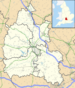
 Church Hanborough
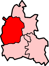
Church Hanborough shown within OxfordshireOS grid reference SP4212 Parish Hanborough District West Oxfordshire Shire county Oxfordshire Region South East Country England Sovereign state United Kingdom Postcode district OX29 Dialling code 01993 Police Thames Valley Fire Oxfordshire Ambulance South Central EU Parliament South East England UK Parliament Witney Website Hanborough Online List of places: UK • England • Oxfordshire Church Hanborough is a village in Hanborough civil parish about 5 miles (8.0 km) northeast of Witney in Oxfordshire.
The Domesday Book of 1086 records the village as Haneberge.
The Church of England parish church is dedicated to Saints Peter and Paul.[1]
Church Hanborough has a public house, the Hand and Shears.[2]
References
- 'Hanborough: Introduction', A History of the County of Oxford: Volume 12: Wootton Hundred (South) including Woodstock (1990), pp. 158-164. Date accessed: 30 March 2008
External links
Towns Burford (Signet, Upton) • Carterton • Charlbury • Chipping Norton (Southcombe) • Witney (Cogges, Madley Park) • Woodstock (Hensington, Old Woodstock)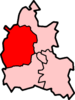
Large Villages Aston, Cote, Shifford and Chimney (Aston, Cote, Shifford, Chimney) • Bampton (Lower Haddon, Weald) • Brize Norton • Ducklington • Enstone (Church Enstone, Neat Enstone, Chalford, Cleveley, Fulwell, Gagingwell, Lidstone, Radford) • Eynsham (Barnard Gate) • Freeland • Hailey (New Yatt) • Hanborough (Church Hanborough, Long Hanborough) • Milton-under-Wychwood • Minster Lovell • North Leigh (East End, Wilcote) • Shipton-under-Wychwood • Standlake (Brighthampton) • Steeple Barton (Middle Barton) • StonesfieldOther Civil
Parishes
(Component
Villages
and Hamlets)Alvescot • Ascott-under-Wychwood (Ascott d'Oyley, Ascott Earl) • Asthall (Asthall Leigh, Worsham) • Black Bourton • Bladon • Blenheim • Broadwell • Bruern • Cassington (Worton) • Chadlington • Chastleton • Chilson (Shorthampton) • Churchill • Clanfield • Combe • Cornbury and Wychwood (Cornbury, Wychwood) • Cornwell • Crawley • Curbridge • Fawler • Fifield • Filkins and Broughton Poggs (Filkins, Broughton Poggs) • Finstock • Fulbrook • Glympton • Grafton and Radcot (Grafton, Radcot) • Great Tew • Hardwick-with-Yelford (Hardwick, Yelford) • Heythrop (Dunthrop) • Holwell • Idbury (Bould, Foscot) • Kelmscott • Kencot • Kiddington with Asterleigh (Asterleigh, Kiddington, Over Kiddington) • Kingham • Langford • Leafield • Lew • Little Faringdon • Little Tew • Lyneham • Northmoor • Over Norton • Ramsden (Mount Skippett) • Rollright (Great Rollright, Little Rollright) • Rousham • Salford • Sandford St. Martin (Ledwell) • Sarsden • Shilton • South Leigh • Spelsbury (Dean, Taston) • Stanton Harcourt • Swerford • Swinbrook and Widford (Swinbrook, Widford) • Tackley • Taynton • Westcott Barton • Westwell • Wootton (Dornford, Hordley) • Worton (Nether Worton, Over Worton)Former Districts
and BoroughsChipping Norton Rural District • Municipal Borough of Chipping Norton • Witney Urban District • Witney Rural District • Municipal Borough of Woodstock • Woodstock Rural DistrictFormer
ConstituenciesCategories:- Villages in Oxfordshire
- West Oxfordshire
- Oxfordshire geography stubs

Wikimedia Foundation. 2010.