- Culpeper, Virginia
-
Culpeper, Virginia — Town — 
SealLocation in Virginia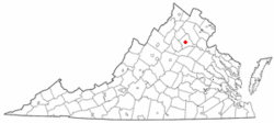
Coordinates: 38°28′19″N 77°59′57″W / 38.47194°N 77.99917°WCoordinates: 38°28′19″N 77°59′57″W / 38.47194°N 77.99917°W Country United States State Virginia County Culpeper Founded 1759 Government - Mayor Calvin L. "Chip" Coleman Area - Total 6.8 sq mi (17.5 km2) - Land 6.7 sq mi (17.4 km2) - Water 0.0 sq mi (0.1 km2) Elevation 413 ft (126 m) Population (2000) - Total 9,664 - Density 1,442.4/sq mi (555.4/km2) Time zone Eastern (EST) (UTC-5) - Summer (DST) EDT (UTC-4) ZIP codes 22701, 22735 Area code(s) 540 FIPS code 51-20752[1] GNIS feature ID 1498471[2] Website http://www.culpeper.to/ Culpeper is an incorporated town in Culpeper County, Virginia, United States. The population was 9,664 at the 2000 census. It is the county seat of Culpeper County[3]. Culpeper is part of the Culpeper Micropolitan Statistical Area, which includes all of Culpeper County. Both the Town of Culpeper and Culpeper County are part of the greater Baltimore-Washington Metropolitan Area. As of 2010, Culpeper County was included among those considered part of Northern Virginia.
Contents
Geography
Culpeper is located at 38°28′19″N 77°59′57″W / 38.47194°N 77.99917°W (38.471915, -77.999168)[4].
According to the United States Census Bureau, the town has a total area of 6.8 square miles (17.5 km²), of which, 6.7 square miles (17.4 km²) of it is land and 0.04 square miles (0.1 km²) of it (0.44%) is water.
History
After forming Culpeper County, Virginia, in 1748, the Virginia House of Burgesses voted to establish the Town of Fairfax on February 22, 1759. The name honored Thomas Fairfax, 6th Lord Fairfax of Cameron, who was proprietor of the Northern Neck, a vast domain north of the Rappahannock River; his territory was then defined as stretching from Chesapeake Bay to what is now Hampshire County, West Virginia.
The original plan of the town called for ten blocks, which form the core of Culpeper's downtown area today. The original town was surveyed by a young George Washington. In 1795, the town received a post office under the name Culpeper Court House, although most maps continued to show the Fairfax name. The confusion resulting from the difference in official and postal names, coupled with the existence of Fairfax Court House and Fairfax Station post offices in Fairfax County, was finally resolved when the Virginia Assembly formally renamed the town Culpeper in 1869 (Acts, 1869–1870, chapter 118, page 154).
During the American Revolutionary War, the Culpeper Minutemen, a pro-Independence militia, formed in the town of Culpeper. They organized in what was then known as "Clayton's Old Field," near today's Yowell Meadow Park.
During the Civil War, Culpeper was a crossroads for a number of armies marching through central Virginia, with both Union and Confederate forces occupying the town by turn. In the heart of downtown, the childhood home of Confederate General A.P. Hill stands at the corner of Main and Davis streets. One block north on Main St. (present location of Piedmont Realty) was the frame house where "The Gallant Major" John Pelham died after sustaining a wound at the battle of Kelley's Ford.
Culpeper began to grow dramatically in the 1980s, becoming a "bedroom community" of more densely populated Northern Virginia and Washington, DC suburbs. A growing number of residents of the town and county of Culpeper once lived and continue to work in those areas.
Downtown Culpeper was one of the communities most affected by the August 23, 2011 Virginia Earthquake. Several buildings along Main Street and East Davis Street suffered structural damage, and some have been condemned.[5] The earthquake led to the temporary evacuation of the Packard Campus for Audio-Visual Conservation, which at the time was hosting a town hall event for Senator Mark Warner.[6]
Demographics
As of the census[1] of 2000, there were 9,664 people, 3,933 households, and 2,442 families residing in the town. The population density was 1,436.2 inhabitants per square mile (554.4/km²). There were 4,139 housing units at an average density of 615.1 per square mile (237.5/km²). The racial makeup of the town was 78.27% White, 18.15% Black, 0.21% Native American, 1.32% Asian, 0.01% Pacific Islander, 1.98% from other races, and 1.92% from two or more races. Hispanic or Latino of any race were 4.55% of the population.
There were 3,933 households out of which 32.3% had children under the age of 18 living with them, 40.8% were married couples living together, 16.2% had a female householder with no husband present, and 37.9% were non-families. 31.3% of all households were made up of individuals and 12.2% had someone living alone who was 65 years of age or older. The average household size was 2.39 and the average family size was 2.97.
The town's population included 25.7% under the age of 18, 10.0% from 18 to 24, 30.3% from 25 to 44, 19.0% from 45 to 64, and 15.0% who were 65 years of age or older. The median age was 35 years. For every 100 females there were 87.9 males. For every 100 females age 18 and over, there were 82.9 males.
The median income for a household in the town was at a time $35,438, and the median income for a family was $41,894 but due to the economic downturn this has changed. Males had a median income of $28,658 versus $25,252 for females. The per capita income for the town was $16,842. About 23.0% of families and 26.9% of the population were below the poverty line, including 40.8% of those under age 18 and 22.1% of those age 65 or over.
According to the 2007 census estimates, Culpeper's population has grown to 13,497.[7]
Climate
Climate data for Culpeper, VA Month Jan Feb Mar Apr May Jun Jul Aug Sep Oct Nov Dec Year Record high °F (°C) 80
(27)84
(29)91
(33)95
(35)100
(38)103
(39)107
(42)102
(39)102
(39)99
(37)86
(30)79
(26)107
(42)Average high °F (°C) 45
(7)49
(9)60
(16)70
(21)79
(26)86
(30)90
(32)87
(31)81
(27)70
(21)59
(15)48
(9)68.7
(20.4)Average low °F (°C) 25
(−4)28
(−2)34
(1)43
(6)52
(11)61
(16)66
(19)64
(18)58
(14)45
(7)37
(3)29
(−2)45.2
(7.3)Record low °F (°C) −14
(−26)−9
(−23)5
(−15)18
(−8)28
(−2)37
(3)48
(9)44
(7)31
(−1)18
(−8)6
(−14)−6
(−21)−14
(−26)Precipitation inches (mm) 3.26
(82.8)2.96
(75.2)3.55
(90.2)3.32
(84.3)4.34
(110.2)4.39
(111.5)4.23
(107.4)4.13
(104.9)4.36
(110.7)3.81
(96.8)3.71
(94.2)3.13
(79.5)45.19
(1,147.8)Source: [8] Transportation
Culpeper is served by U.S. Route 29, U.S. Route 15, and U.S. Route 522 as well as state primary routes 229, 299, and 3. Interstate 95 is accessible via 3 east to Fredericksburg, Interstate 64 is accessible via U.S. Route 29 south to Charlottesville and U.S. Route 15 south in Zion Crossroads, Interstate 66 is accessible via U.S. Route 29 north, Interstate 81 is accessible via U.S. Route 522 north in Winchester.
Amtrak operates a station in Culpeper, station code CLP. This station is served by the Cardinal, Northeast Regional and Crescent trains daily.
The town of Culpeper is also serviced by Virginia Regional Transit. Virginia Regional Transit operates three buses in town—one on a northern loop, one on a southern loop, and one for disabled individuals.
Notable residents
- Kenny Alphin, of the country music group Big & Rich.
- John S. Barbour, Jr., U.S. Congressman, 1881–1887 and U.S. Senator, 1889-1892.
- Cary Travers Grayson, highly decorated U.S. Navy surgeon, onetime chairman of the American Red Cross, and personal aide to U.S. President Woodrow Wilson.
- General A. P. Hill, Confederate general during the American Civil War, commander of "Hill's Light Division," under Stonewall Jackson.
- John Preston "Pete" Hill, Negro league baseball player and member of the Baseball Hall of Fame, was born in nearby Buena, Virginia.
- Alexis "Mo Mo" Brown, back-up dancer in Michael Jackson's This Is It
- Keith Jennings, former NBA point guard, Golden State Warriors.
- William Morgan, whose 1826 disappearance in New York state sparked a powerful anti-Freemasonry movement.
- Waller T. Patton, Confederate colonel during the American Civil War, great-uncle of World War II General, George S. Patton.
- John Pendleton, American diplomat.
- Eppa Rixey, major league pitcher and member of the Baseball Hall of Fame
- J. Loren Wince, lead singer/songwriter for the band HURT
- Shannon Davis, back-up singer for R&B Diva Patti LaBelle
- Jeannette Walls, author of The Glass Castle
Notable events
- In 1967, it was the site of a one-day standoff between members of the American Nazi Party and police and military personnel over the group's attempt to bury their leader George Lincoln Rockwell in the local National Cemetery.
- The site of the riding accident that paralyzed actor Christopher Reeve in 1995.
Public schools
- A.G. Richardson Elementary (18370 Simms Dr., Culpeper Va. 22701)
- Emerald Hill Elementary (11245 Rixeyville Road, Culpeper VA 22701)
- Farmington Elementary (500 Sunset Lane Culpeper VA 22701)
- Pearl Sample Elementary (18480 Simms Drive, Culpeper VA 22701)
- Sycamore Park Elementary (451 Radio Lane, Culpeper, Virginia 22701)
- Yowell Elementary (701 Yowell Drive, Culpeper, VA 22701)
- Culpeper Middle School (14300 Achievement Drive, Culpeper VA 22701)
- Floyd T. Binns Middle School (205 E. Grandview Ave. Culpeper, VA 22701)
- Culpeper County High School (14240 Achievement Drive, Culpeper Va. 22701)
- Eastern View High School (16332 Cyclone Way, Culpeper, VA 22701)
Link Culpeper County Public Schools * Culpeper County Public Schools
References
- ^ a b "American FactFinder". United States Census Bureau. http://factfinder.census.gov. Retrieved 2008-01-31.
- ^ "US Board on Geographic Names". United States Geological Survey. 2007-10-25. http://geonames.usgs.gov. Retrieved 2008-01-31.
- ^ "Find a County". National Association of Counties. http://www.naco.org/Counties/Pages/FindACounty.aspx. Retrieved 2011-06-07.
- ^ "US Gazetteer files: 2010, 2000, and 1990". United States Census Bureau. 2011-02-12. http://www.census.gov/geo/www/gazetteer/gazette.html. Retrieved 2011-04-23.
- ^ "EARTHQUAKE IN CULPEPER: The damage done". Star-Exponent; Culpeper, Virginia. August 24, 2011. http://www2.starexponent.com/news/2011/aug/24/earthquake-culpeper-damage-done-ar-1258754/. Retrieved 24 August 2011.
- ^ Johnston, Donnie (August 24, 2011). "Earthquake forces Warner outside for public forum". The Free Lance-Star; Fredericksburg, Virginia. http://fredericksburg.com/News/FLS/2011/082011/08242011/647382. Retrieved 24 August 2011.
- ^ Culpeper town, Virginia - Population Finder - American FactFinder
- ^ "Average Weather for Culpeper, VA - Temperature and Precipitation". Weather.com. August 2011. http://www.weather.com/outlook/health/fitness/wxclimatology/monthly/22701. Retrieved February 11, 2011.
External links
- Visitor Information
- Culpeper Community and Real Estate Information
- [Town of Culpeper]
- Culpeper Regional Hospital
- Culpeper Chamber of Commerce
Municipalities and communities of Culpeper County, Virginia County seat: Culpeper Town Culpeper

Unincorporated
communitiesBoston | Brandy Station | Rapidan | Reva | Richardsville | Somerset | Stevensburg
 Commonwealth of Virginia
Richmond (capital) Topics Climate · Colleges and universities · Colony · Congressional Districts · Culture · Delegations · Demographics · Economy · Education · Environment · Furniture · Geography · Government · Governors · History · Historic Landmarks · Magisterial Districts · Homes · Music · People · Police · Politics · Rights · Rivers · School divisions · Scouting · Slogan · Sports teams · State Fair · State parks · Symbols · Towns · Transportation · Tribes · Visitor Attractions
Regions Allegheny Mountains · Atlantic Coastal Plain · Blue Ridge · Chesapeake Bay · Cumberland Mountains · Delmarva Peninsula · Eastern Shore · Hampton Roads · Middle Peninsula · Northern Neck · Northern Virginia · Piedmont · Ridge-and-Valley Appalachians · Shenandoah Valley · South Hampton Roads · Southside · Southwest Virginia · Tennessee Valley · Tidewater · Tri-Cities · Virginia Peninsula
Metro areas Blacksburg-Christiansburg-Radford · Bluefield · Bristol · Charlottesville · Culpeper · Danville · Fredericksburg · Harrisonburg · Lynchburg · Martinsville · Richmond · Roanoke · Staunton · Hampton Roads · Washington-Arlington-Alexandria · Waynesboro · Winchester
Counties Accomack · Albemarle · Alleghany · Amelia · Amherst · Appomattox · Arlington · Augusta · Bath · Bedford · Bland · Botetourt · Brunswick · Buchanan · Buckingham · Campbell · Caroline · Carroll · Charles City · Charlotte · Chesterfield · Clarke · Craig · Culpeper · Cumberland · Dickenson · Dinwiddie · Essex · Fairfax · Fauquier · Floyd · Fluvanna · Franklin · Frederick · Giles · Gloucester · Goochland · Grayson · Greene · Greensville · Halifax · Hanover · Henrico · Henry · Highland · Isle of Wight · James City · King and Queen · King George · King William · Lancaster · Lee · Loudoun · Louisa · Lunenburg · Madison · Mathews · Mecklenburg · Middlesex · Montgomery · Nelson · New Kent · Northampton · Northumberland · Nottoway · Orange · Page · Patrick · Pittsylvania · Powhatan · Prince Edward · Prince George · Prince William · Pulaski · Rappahannock · Richmond · Roanoke · Rockbridge · Rockingham · Russell · Scott · Shenandoah · Smyth · Southampton · Spotsylvania · Stafford · Surry · Sussex · Tazewell · Warren · Washington · Westmoreland · Wise · Wythe · York
Independent
citiesAlexandria · Bedford · Bristol · Buena Vista · Charlottesville · Chesapeake · Colonial Heights · Covington · Danville · Emporia · Fairfax · Falls Church · Franklin · Fredericksburg · Galax · Hampton · Harrisonburg · Hopewell · Lexington · Lynchburg · Manassas · Manassas Park · Martinsville · Newport News · Norfolk · Norton · Petersburg · Poquoson · Portsmouth · Radford · Richmond · Roanoke · Salem · Staunton · Suffolk · Virginia Beach · Waynesboro · Williamsburg · Winchester
Categories:- Populated places in Culpeper County, Virginia
- Micropolitan areas of Virginia
- Towns in Virginia
- County seats in Virginia
- Populated places established in 1759


Wikimedia Foundation. 2010.