- North Bend, Washington
-
North Bend — City — Downtown North Bend. Twede's Cafe from Twin Peaks is on the right.
Motto: Excellence in Government - Pride in Service Location of North Bend, Washington
Coordinates: 47°29′38″N 121°47′10″W / 47.49389°N 121.78611°WCoordinates: 47°29′38″N 121°47′10″W / 47.49389°N 121.78611°W Country United States State Washington County King Government – Type Incorporated – Mayor Kenneth G. Hearing – City Council David Cook, Alan Gothelf, Ross Loudenback, Jonathan Rosen, Dee Williamson. Area – Total 2.9 sq mi (7.6 km2) – Land 2.97 sq mi (7.6 km2) – Water 0.0 sq mi (0.0 km2) Elevation 440 ft (134 m) Population (2010) – Total 5,731 – Density 1,611.6/sq mi (622.2/km2) Time zone PDT (UTC-7) – Summer (DST) PST (UTC-8) Zip code 98045 Area code(s) Area code 425 FIPS code 53-49485[1] GNIS feature ID 1523724[2] Website http://ci.north-bend.wa.us/ North Bend is a city in King County, Washington, United States. The town was made famous by David Lynch's television series Twin Peaks (also filmed in nearby Snoqualmie.) Since the Weyerhaeuser sawmill closed, North Bend has become an upscale bedroom community for the Eastside of Seattle, Washington, with property values more than doubling from 1997 to 2006. The population as of 5,731 at the 2010 census.
North Bend is home to Nintendo North Bend, the main North American production facility and distribution center for the video game console manufacturer Nintendo. Based on per capita income, one of the more reliable measures of affluence, North Bend ranks 52nd of 522 areas in the state of Washington to be ranked. The city's ZIP code is 98045.
Contents
History
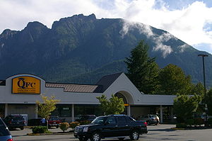 Mt. Si and Little Si behind food store.
The Native Americans who inhabited the Snoqualmie Valley, led by Chief Patkanim, sided with settlers in the wars of the 1850s and, with the Treaty of Point Elliott, lost such title as settlers acknowledged. Some of the soldiers in those wars, such as the brothers and sisters Kellogg, established cabins near their blockhouses; however the first permanent settler in the valley was Jeremiah Borst, in 1858.[3]
In 1865, Matts Peterson homesteaded the site that ultimately became North Bend.[4] Deeply in debt, he sold the property to Borst and moved east of the mountains. Borst wrote to Will Taylor, who had left the area to go mining in California, and offered him the Peterson place in exchange for labor. Taylor returned and prospered as a farmer and operator of a trading post. He platted North Bend as Snoqualmie[1] but because another nearby town had the same name, renamed it Mountain View.[2] However, the Post Office Department objected to the name Mountain View, so it was renamed North Bend after its location near the north bend of the South Fork of the Snoqualmie River.[4] North Bend was officially incorporated on March 12, 1909.
Geography
 Scott's Dairy Freeze, North Bend Way, North Bend, Washington. This fast food restaurant dates from the 1950s
North Bend is located at 47°29′38″N 121°47′10″W / 47.49389°N 121.78611°W (47.493831, -121.786247).[5] According to the United States Census Bureau, the city has a total area of 2.9 square miles (7.6 km²), all of it land.
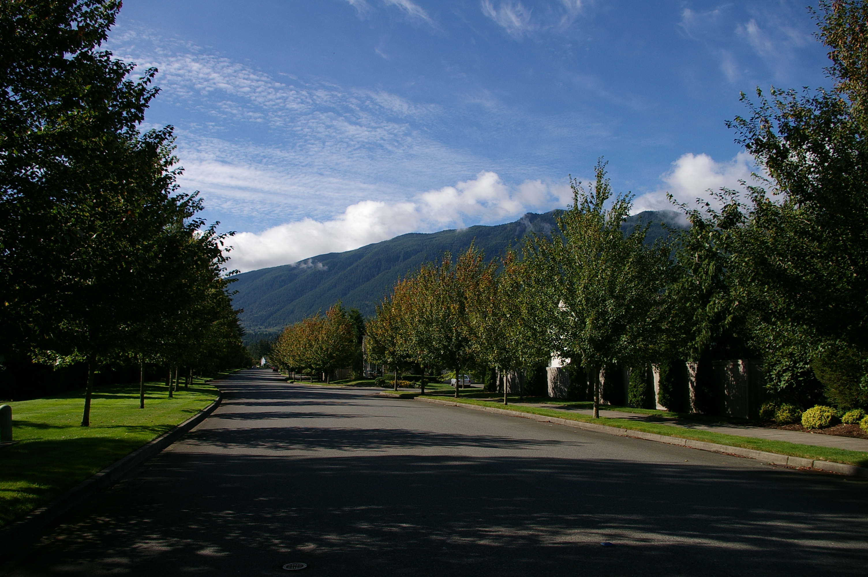
North Bend is located in the foothills of the Cascade Range just 31 miles (50 km) east of Seattle in the upper valley of the Snoqualmie River. Nearby Mount Si looms over the town. To the south is Rattlesnake Ridge. The nearest town, Snoqualmie, Washington, is located about 3 miles (4.8 km) to the northwest. Mount Si is the most prominent geological feature arising on the outskirts of North Bend. It stands at 4,167 feet (1,270 m) and towers above the town, itself at around 440 ft (130 m). A 4-mile (6.4 km) trail zig zags up to the summit with a vertical climb of 3,500 feet (1,100 m).
North Bend annexed Tanner, Washington and the Stilson area July 6, 2009.[6]
Surrounding Cities and Communities

Snoqualmie Preston 
 North Bend

Hobart Snoqualmie Pass North Bend Climate
North Bend's climate is warm and generally dry during the summer when high temperatures tend to be in the 70s and 80s and cool during the winter when high temperatures tend to be in the 40s. The all-time record high temperature is 105 °F (41 °C) set in 2009. The warmest month of the year is July with an average maximum temperature of 77 °F (25 °C), while the coldest month of the year is January with an average minimum temperature of 33 °F (1 °C). The annual average precipitation in North Bend is 59.1 inches (1,500 mm) with 12.8 inches (330 mm) of snowfall. Winter months tend to be wetter than summer months.[7]
Climate data for North Bend, Washington Month Jan Feb Mar Apr May Jun Jul Aug Sep Oct Nov Dec Year Record high °F (°C) 67
(19)75
(24)79
(26)90
(32)97
(36)99
(37)105
(41)102
(39)98
(37)95
(35)75
(24)67
(19)105
(41)Average high °F (°C) 44
(7)48
(9)53
(12)59
(15)66
(19)71
(22)77
(25)76
(24)70
(21)60
(16)51
(11)45
(7)60 Average low °F (°C) 33
(1)34
(1)35
(2)39
(4)44
(7)49
(9)51
(11)51
(11)47
(8)42
(6)37
(3)34
(1)41 Record low °F (°C) −1
(−18)−3
(−19)8
(−13)24
(−4)26
(−3)31
(−1)36
(2)35
(2)30
(−1)23
(−5)2
(−17)3
(−16)−3
(−19)Precipitation inches (mm) 8.25
(209.6)5.88
(149.4)5.88
(149.4)4.41
(112)3.49
(88.6)2.84
(72.1)1.31
(33.3)1.49
(37.8)2.97
(75.4)5.46
(138.7)8.49
(215.6)8.61
(218.7)59.1
(1,501)Source: http://www.wrcc.dri.edu/cgi-bin/cliMAIN.pl?wa7773 Demographics
Historical populations Census Pop. %± 1910 299 — 1920 387 29.4% 1930 548 41.6% 1940 646 17.9% 1950 787 21.8% 1960 945 20.1% 1970 1,625 72.0% 1980 1,701 4.7% 1990 2,578 51.6% 2000 4,746 84.1% 2010 5,731 20.8%  Historic McGrath Hotel
As of the census[1] of 2000, there were 4,746 people, 1,841 households, and 1,286 families residing in the city. The population density was 1,611.6 people per square mile (623.3/km²). There were 1,889 housing units at an average density of 641.4 per square mile (248.1/km²). The racial makeup of the city was 92.01% White, 0.70% African American, 1.03% Native American, 2.23% Asian, 0.17% Pacific Islander, 1.45% from other races, and 2.40% from two or more races. Hispanic or Latino of any race were 3.79% of the population.
There were 1,841 households out of which 37.8% had children under the age of 18 living with them, 57.1% were married couples living together, 8.8% had a female householder with no husband present, and 30.1% were non-families. 23.7% of all households were made up of individuals and 10.8% had someone living alone who was 65 years of age or older. The average household size was 2.53 and the average family size was 3.01.
In the city the population was 27.3% under the age of 18, 6.7% from 18 to 24, 37.1% from 25 to 44, 18.4% from 45 to 64, and 10.6% who were 65 years of age or older. The median age was 34 years. For every 100 females there were 97.5 males. For every 100 females age 18 and over, there were 94.0 males. The median income for a household in the city was $61,534, and the median income for a family was $69,402. Males had a median income of $57,333 versus $38,401 for females. The per capita income for the city was $28,229. About 2.1% of families and 4.7% of the population were below the poverty line, including 5.1% of those under age 18 and 3.0% of those age 65 or over.
Culture
 North Bend Theater
North Bend Theatre
On April 9, 1941 the North Bend Theatre opened its doors. It has continued operating as an independent movie theater since that day. In 1999, the theatre underwent a major renovation to make it more modern. During this renovation every part of the building was improved without sacrificing the distinctive character of this 1941 Art Deco theatre.
Valley Center Stage
Valley Center Stage is a community theater that promotes the performing arts in all its aspects. The theater has regular shows featuring classics and comedy. In addition, the theater offers opportunities to valley residents to participate in the theater productions.[8]
Snoqualmie Valley Historical Museum
The Snoqualmie Valley Historical Museum, operated by the Snoqualmie Valley Historical Society, has been sharing the history of the Snoqualmie Valley for over 50 years.[9]
Transportation
North Bend is located 30 miles (48 km) east of Seattle on Interstate 90 freeway, which runs from Seattle to Boston. There is regular bus service provided by King County Metro Transit on routes MT 209 to Issaquah [10] and MT 215 to downtown Seattle.[11] Metro buses are outfitted with bike racks. There are a number of van pools to Redmond, Bellevue, Seattle, and Renton.[12] Snoqualmie Valley Transportation provides door-to-door transportation for the public in North Bend, Snoqualmie, Preston, Fall City, Carnation, Duvall and Monroe.[13]
North Bend has a fairly modest trail system.[14] The Snoqualmie Valley Regional Trail stretches from Duvall, WA through Carnation, WA, Fall City, WA, Snoqualmie, WA, through North Bend, WA to Rattlesnake Lake.[15] This 31.5-mile (50.7 km) trail connects to the John Wayne Pioneer Trail (which goes clear across Washington to the Idaho border) and to the City of Snoqualmie's extensive trail network. North Bend also has its own city trail system in downtown, the Si View neighborhood and along the South Fork of the Snoqualmie River in several places.
Economy
North Bend is for the largest part a bedroom community to Bellevue and Seattle. In addition, it does have a growing tourism economy centered around the Factory Outlet Shops and the Northwest Train Museum's train activities. North Bend also has about 400 employees working for Nintendo North Bend.
Landmarks
King County and the City of North Bend have designated the following landmarks:
Landmark Built Listed Address Photo Camp North Bend (Camp Waskowitz) [16] 1935 1992 45509 SE 150th Street, North Bend 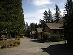
Si View Pool and Activity Center (WPA Park Building) 1938-40 [16] 1984 400 SE Orchard Dr., North Bend 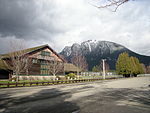
North Bend Historic Commercial District[16] 1889–1960 2000 Bendigo Blvd. & No. Bend Way 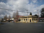
Tollgate Farmhouse[16] c.1890 2002 SR 202 (near Boalch Avenue) 
See also
- Tanner, Washington
- Riverbend, Washington
- Cascade Range
- Alpine Lakes Wilderness
- Franklin Falls
- Interstate 90 in Washington
- Iron Horse State Park
- Little Si
- Mount Washington (Cascades)
- Mount Si
- Olallie State Park
- Rattlesnake Lake
- Rattlesnake Ridge
- Snoqualmie Falls
- Snoqualmie Pass
- Snoqualmie River
- Twin Falls (Washington)
- Weeks Falls
References
 Si View neighborhood, Rattlesnake Ridge in background
- ^ a b "American FactFinder". United States Census Bureau. http://factfinder.census.gov. Retrieved 2008-01-31.
- ^ "US Board on Geographic Names". United States Geological Survey. 2007-10-25. http://geonames.usgs.gov. Retrieved 2008-01-31.
- ^ *Evans, Jack R. (1990). A Little History of North Bend - Snoqualmie. SCW Publications. ISBN 1-877882-03-8.
- ^ a b Majors, Harry M. (1975). Exploring Washington. Van Winkle Publishing Co. p. 86. ISBN 9780918664006. http://books.google.com/books?id=CoWrPQAACAAJ.
- ^ "US Gazetteer files: 2010, 2000, and 1990". United States Census Bureau. 2011-02-12. http://www.census.gov/geo/www/gazetteer/gazette.html. Retrieved 2011-04-23.
- ^ Michael Rowe (2009-08-20). "North Bend gets official number on annexation". SnoValley Star. http://snovalleystar.com/2009/08/20/north-bend-gets-official-number-on-annexation. Retrieved 2011-09-19.
- ^ "North Bend, WA Weather". idcide.com. http://www.wrcc.dri.edu/cgi-bin/cliMAIN.pl?wa7773. Retrieved 2009-05-17.
- ^ Valley Center Stage
- ^ Snoqualmie Valley Historical Museum
- ^ King County Metro 209 Schedule
- ^ King County Metro 215 Schedule
- ^ Springer, Natalie Metro Transit van-pooling reaches an all-time high Seattle Times, March 5, 2004
- ^ Snoqualmie Valley Transportation
- ^ City of North Bend Plan Trail Map
- ^ Snoqualmie Valley Trail Map
- ^ a b c d King County and Local Landmarks List, King County (undated, last modified 2003-02-26). Accessed online 2009-05-09
External links
- City of North Bend
- Snoqualmie School District
- Snoqualmie Valley Chamber of Commerce
- North Bend Library
- Snoqualmie Valley Historical Museum
- North Bend Theater - (Art Deco) built 1941, renovated 1999
 State of Washington
Topics State government | Cities | Towns | Congressional delegation | City governments | Governors | History | Geography | People | Legislative initiatives | Popular initiatives | Legislature | Music | Parks | Highways | Symbols | Visitor attractions
Society Demographics · Economy · Education · Politics
Regions Larger cities and
metropolitan areasSeattle | Seattle metropolitan area | Spokane | Tacoma | Tri-Cities | Vancouver | Bellevue | Everett | Yakima
Smaller cities Aberdeen | Anacortes | Arlington | Auburn | Bainbridge Island | Battle Ground | Bellingham | Bonney Lake | Bothell | Bremerton | Burien | Camas | Centralia | Cheney | Cle Elum | Coupeville | Covington | Des Moines | East Wenatchee | Edmonds | Ellensburg | Enumclaw | Federal Way | Fort Lewis | Grandview | Hoquiam | Issaquah | Kelso | Kenmore | Kennewick | Kent | Kirkland | Lacey | Lake Forest Park | Lake Stevens | Lakewood | Langley | Longview | Lynden | Lynnwood | Mabton | Maple Valley | Marysville | Mercer Island | Mill Creek | Monroe | Moses Lake | Mountlake Terrace | Mount Vernon | Mukilteo | Naches | Oak Harbor | Olympia | Pasco | Port Angeles | Port Orchard | Port Townsend | Prosser | Pullman | Puyallup | Redmond | Renton | Richland | Sammamish | SeaTac | Sedro-Woolley | Selah | Shelton | Shoreline | Silverdale | Spokane Valley | Sunnyside | Toppenish | Tukwila | Tumwater | University Place | Walla Walla | Wapato | Washougal | Wenatchee | West Richland | Woodinville | Zillah
Counties Adams | Asotin | Benton | Chelan | Clallam | Clark | Columbia | Cowlitz | Douglas | Ferry | Franklin | Garfield | Grant | Grays Harbor | Island | Jefferson | King | Kitsap | Kittitas | Klickitat | Lewis | Lincoln | Mason | Okanogan | Pacific | Pend Oreille | Pierce | San Juan | Skagit | Skamania | Snohomish | Spokane | Stevens | Thurston | Wahkiakum | Walla Walla | Whatcom | Whitman | Yakima
Categories:- Cities in King County, Washington
- Cities in the Seattle metropolitan area


Wikimedia Foundation. 2010.