- Chiemgau Alps
-
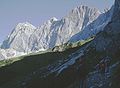
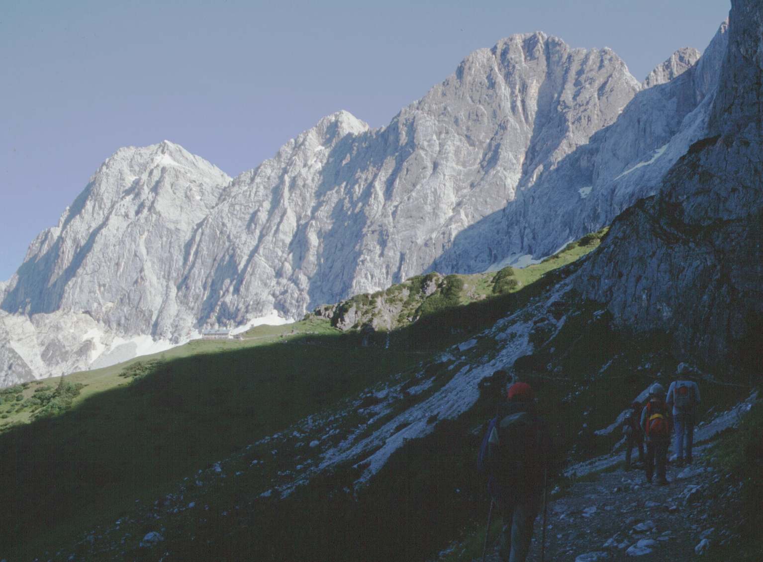
Chiemgau Alps Range  Geigelstein (1813 m) seen from the southern peak Breitenstein
Country Germany, Austria States Bavaria, Salzburg, Tirol Part of Northern Limestone Alps Highest point Sonntagshorn - elevation 1,961 m (6,434 ft) Geology sedimentary rocks Orogeny Alpine orogeny Period Mesozoic and Cenozoic 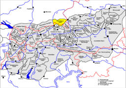
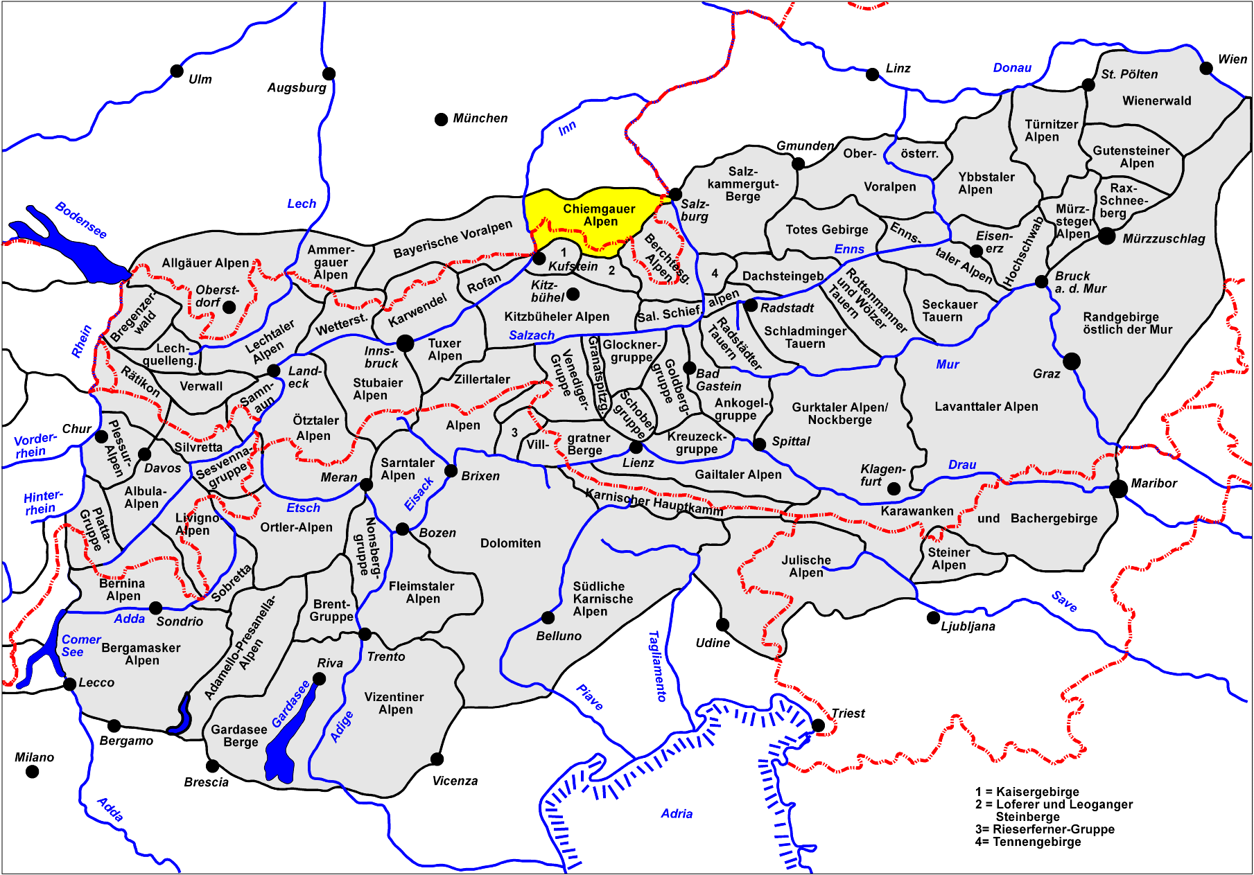
The Chiemgau Alps (German: Chiemgauer Alpen) are a mountain range in the Northern Limestone Alps and therefore belong to the Eastern Alps. Their major part is situated in Bavaria, Germany and only a small section crosses the Austrian border into the states of Salzburg and Tirol. They reach their highest elevation (1961 m) in the Sonntagshorn, a peak straddling the German-Austrian border.
Geography
The Chiemgau Alps stretch from the Inn River in the West to the Salzach River in the East and cover a distance of 60 km in strike direction; their maximum width in North-South direction amounts to about 25-30 km. They are surrounded by the following mountain ranges:
- Bavarian Prealps in the West
- Kaisergebirge in the Southwest
- Leoganger Steinberge in the South
- Loferer Steinberge in the Southeast
- Berchtesgaden Alps in the Southeast and East
Their northern edge often drops off quite drastically to the foothills.
Major Peaks
- Sonntagshorn 1961 m
- Steinplatte 1869 m
- Geigelstein 1813 m
- Zwiesel 1781 m
- Dürrnbachhorn 1776 m
- Hochstaufen 1771 m
- Fellhorn/Österreich 1764 m
- Hochgern 1744 m
Peaks for rock climbing:
- Hörndlwand 1684 m
- Kampenwand 1664 m
References
- This article incorporates information from the German Wikipedia.
Coordinates: 47°43′N 12°33′E / 47.717°N 12.55°E
Allgäu Alps | Ammergau Alps | Bavarian Prealps | Berchtesgaden Alps | Brandenberg Alps | Bregenzerwaldgebirge | Chiemgau Alps | Dachstein | Ennstal Alps | Gutenstein Alps | Hochschwab | Kaisergebirge | Karwendel | Lechquellengebirge | Lechtal Alps | Leoganger Steinberge | Loferer Steinberge | Mieminger Chain | Mürzsteg Alps | Upper Austrian Prealps | Rax-Schneeberg Group | Rofangebirge | Salzburg Slate Alps | Salzkammergut Mountains | Tennengebirge | Totes Gebirge | Türnitz Alps | Wetterstein | Vienna Woods | Ybbstal Alps
 Categories:
- Northern Limestone Alps
- Mountain ranges of the Alps
- Mountain ranges of Tyrol
- Mountain ranges of Germany
- Geography of Bavaria
- Geography of Salzburgerland
- Geography of Tyrol
- Chiemgau Alps
Wikimedia Foundation. 2010.