- White Salmon, Washington
Infobox Settlement
official_name = White Salmon
settlement_type =City
nickname =
motto =
imagesize =
image_caption =
image_
imagesize =
image_caption =
image_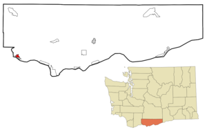
mapsize = 250px
map_caption =
mapsize1 =
map_caption1 =
subdivision_type = Country
subdivision_name =United States
subdivision_type1 = State
subdivision_name1 =Washington
subdivision_type2 = County
subdivision_name2 = Klickitat
government_type =
leader_title =
leader_name =
established_title =
established_date =
area_magnitude =
area_total_km2 = 3.2
area_total_sq_mi = 1.2
area_land_km2 = 3.2
area_land_sq_mi = 1.2
area_water_km2 = 0.0
area_water_sq_mi = 0.0
area_water_percent =
area_urban_km2 =
area_urban_sq_mi =
area_metro_km2 =
area_metro_sq_mi =
population_as_of = 2000
population_note =
population_total = 2193
population_metro =
population_urban =
population_density_km2 = 677.4
population_density_sq_mi = 1759.2
timezone = Pacific (PST)
utc_offset = -8
timezone_DST = PDT
utc_offset_DST = -7
latd = 45 |latm = 43 |lats = 44 |latNS = N
longd = 121 |longm = 29 |longs = 1 |longEW = W
elevation_m = 190
elevation_ft = 623
website = [http://www.ci.white-salmon.wa.us/ http://www.ci.white-salmon.wa.us/]
postal_code_type =ZIP code
postal_code = 98672
area_code = 509
blank_name = FIPS code
blank_info = 53-78330GR|2
blank1_name = GNIS feature ID
blank1_info = 1512803GR|3
footnotes = White Salmon is a city in Klickitat County,Washington ,United States . The population was 2,193 at the 2000 census.History
White Salmon was officially incorporated on
June 3 ,1907 .Geography
White Salmon is located at coor dms|45|43|44|N|121|29|1|W|city (45.728792, -121.483557)GR|1.
According to the
United States Census Bureau , the city has a total area of 1.2square mile s (3.2km² ), all of it land.Demographics
As of the
census GR|2 of 2000, there were 2,193 people, 887 households, and 590 families residing in the city. Thepopulation density was 1,759.2 people per square mile (677.4/km²). There were 948 housing units at an average density of 760.5/sq mi (292.8/km²). The racial makeup of the city was 83.08% White, 0.23% African American, 1.14% Native American, 0.73% Asian, 0.09% Pacific Islander, 12.04% from other races, and 2.69% from two or more races. Hispanic or Latino of any race were 16.83% of the population.There were 887 households out of which 34.4% had children under the age of 18 living with them, 50.1% were married couples living together, 12.3% had a female householder with no husband present, and 33.4% were non-families. 29.7% of all households were made up of individuals and 14.2% had someone living alone who was 65 years of age or older. The average household size was 2.46 and the average family size was 3.03.
In the city the population was spread out with 28.7% under the age of 18, 7.0% from 18 to 24, 28.2% from 25 to 44, 20.4% from 45 to 64, and 15.7% who were 65 years of age or older. The median age was 37 years. For every 100 females there were 93.0 males. For every 100 females age 18 and over, there were 84.7 males.
The median income for a household in the city was $34,787, and the median income for a family was $39,653. Males had a median income of $33,021 versus $20,417 for females. The
per capita income for the city was $17,995. About 13.0% of families and 16.7% of the population were below thepoverty line , including 23.6% of those under age 18 and 12.8% of those age 65 or over.References
External links
*Mapit-US-cityscale|45.728792|-121.483557
* [http://www.ci.white-salmon.wa.us/ City website]
* [http://www.whitesalmonenterprise.com "The Enterprise"] , local newspaper
Wikimedia Foundation. 2010.