- Carnelian Bay, California
-
Carnelian Bay — census-designated place — Position in California.
 Carnelian Bay
Coordinates: 39°13′58″N 120°04′54″W / 39.23278°N 120.08167°WCoordinates: 39°13′58″N 120°04′54″W / 39.23278°N 120.08167°W Country  United States
State  California
County Placer Area[1] – Total 1.303 sq mi (3.376 km2) – Land 1.301 sq mi (3.370 km2) – Water 0.002 sq mi (0.006 km2) 0.18% Elevation[2] 6,325 ft (1,928 m) Population (2010) – Total 524 – Density 402/sq mi (155.2/km2) Time zone Pacific (PST) (UTC-8) – Summer (DST) PDT (UTC-7) ZIP Code 96140 Area code(s) 530 GNIS feature ID 2628716 U.S. Geological Survey Geographic Names Information System: Carnelian Bay, California Carnelian Bay (formerly, Cornelian Bay)[3] is a census-designated place located on the shore of Lake Tahoe in Placer County, California, in the United States. The elevation is 6,325 feet (1,928 m). The population was 524 at the 2010 census.
Nearby cities and towns include: Tahoe Vista, Brockway, Kings Beach, Crystal Bay, Incline Village, Truckee, Tahoma, Homewood, and Tahoe City. Its ZIP code is 96140 and its area code 530.
The Cornelian Bay post office operated from 1883 to 1887 and from 1891 to 1893.[3] The Carnelian Bay post office opened in 1908.[3]
Geography
According to the United States Census Bureau, the CDP covers an area of 1.3 square miles (3.4 km²), 99.82% of it land, and 0.18% of it water.
Demographics
The 2010 United States Census[4] reported that Carnelian Bay had a population of 524. The population density was 402.0 people per square mile (155.2/km²). The racial makeup of Carnelian Bay was 493 (94.1%) White, 1 (0.2%) African American, 4 (0.8%) Native American, 14 (2.7%) Asian, 0 (0.0%) Pacific Islander, 1 (0.2%) from other races, and 11 (2.1%) from two or more races. Hispanic or Latino of any race were 13 persons (2.5%).
The Census reported that 524 people (100% of the population) lived in households, 0 (0%) lived in non-institutionalized group quarters, and 0 (0%) were institutionalized.
There were 256 households, out of which 38 (14.8%) had children under the age of 18 living in them, 113 (44.1%) were opposite-sex married couples living together, 14 (5.5%) had a female householder with no husband present, 11 (4.3%) had a male householder with no wife present. There were 19 (7.4%) unmarried opposite-sex partnerships, and 3 (1.2%) same-sex married couples or partnerships. 78 households (30.5%) were made up of individuals and 26 (10.2%) had someone living alone who was 65 years of age or older. The average household size was 2.05. There were 138 families (53.9% of all households); the average family size was 2.45.
The population was spread out with 60 people (11.5%) under the age of 18, 39 people (7.4%) aged 18 to 24, 127 people (24.2%) aged 25 to 44, 184 people (35.1%) aged 45 to 64, and 114 people (21.8%) who were 65 years of age or older. The median age was 49.3 years. For every 100 females there were 126.8 males. For every 100 females age 18 and over, there were 126.3 males.
There were 947 housing units at an average density of 726.5 per square mile (280.5/km²), of which 171 (66.8%) were owner-occupied, and 85 (33.2%) were occupied by renters. The homeowner vacancy rate was 10.0%; the rental vacancy rate was 7.9%. 345 people (65.8% of the population) lived in owner-occupied housing units and 179 people (34.2%) lived in rental housing units.
References
- ^ U.S. Census
- ^ U.S. Geological Survey Geographic Names Information System: Carnelian Bay, California
- ^ a b c Durham, David L. (1998). California's Geographic Names: A Gazetteer of Historic and Modern Names of the State. Quill Driver Books. p. 461. ISBN 9781884995149.
- ^ All data are derived from the United States Census Bureau reports from the 2010 United States Census, and are accessible on-line here. The data on unmarried partnerships and same-sex married couples are from the Census report DEC_10_SF1_PCT15. All other housing and population data are from Census report DEC_10_DP_DPDP1. Both reports are viewable online or downloadable in a zip file containing a comma-delimited data file. The area data, from which densities are calculated, are available on-line here. Percentage totals may not add to 100% due to rounding. The Census Bureau defines families as a household containing one or more people related to the householder by birth, opposite-sex marriage, or adoption. People living in group quarters are tabulated by the Census Bureau as neither owners nor renters. For further details, see the text files accompanying the data files containing the Census reports mentioned above.
Municipalities and communities of Placer County, California Cities and towns 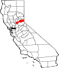
CDPs Alta | Carnelian Bay | Dollar Point | Dutch Flat | Foresthill | Granite Bay | Kings Beach | Kingvale‡ | Meadow Vista | Newcastle | North Auburn | Penryn | Sheridan | Sunnyside-Tahoe City | Tahoe Vista | Tahoma‡
Unincorporated
communitiesAlpine Meadows | Applegate | Baxter | Big Bend | Blue Canyon | Brockway | Cape Horn | Casa Loma | Chambers Lodge | Cisco | Cisco Grove | Clayton | Clipper Gap | Donner | Eder | Elders Corner | Emigrant Gap | Forebay | Four Acres | Gold Hill | Greekstore | Heather Glen | Hidden Valley | Homewood | Hughes Mill | Idlewild | Iowa Hill | Kilaga Springs | Lake Forest | Lander Crossing | Last Chance | Magra | McCulloh | Michigan Bluff | Midas | Monte Vista | Nielsburg | Ophir | Pinecroft | Rainbow | Rampart | Ramsey Crossing | Rawhide | Secret Town | Soda Springs | Squaw Valley | Sunnyside | Tahoe City | Tahoe Pines | The Cedars | Todd Valley | Towle | Troy | Virginiatown | Westville | Weimar | Whitney | Yankee Jims | Zuver
Ghost
townsAckerman | Andover | Arctic | Baltimore | Bath | Blue Bluffs | Bullion | Cairns | Ceres Flat | Chicago Park | Coon Creek | Deadwood | Drum | East Auburn | Flat Ravine | Florence Spring | Fort Trojan | Frytown | Fulda | Gilsons Station | Goggins | Gold Run | Indiana Hill | Knapp | Kulkumish | Leta | Little Rattlesnake Bar | Lone Star | Lost Camp | Mayflower | Millertown | Mineral Bar | Molma | Moss Hills | Oilville | Pine Grove | Pitsokut | Ralston | Red Point | Secret Canyon | Secret Ravine | Smiths | Spruce | Stanford | Stewarts Flat | Stonehill | Tamarack | Union Shed | Vantrent | Webster | Yorkville
Footnotes ‡This CDP also has portions in an adjacent county or counties
Categories:- Census-designated places in Placer County, California
- Unincorporated communities in California


Wikimedia Foundation. 2010.