- Tekoa, Washington
Infobox Settlement
official_name = Tekoa, Washington
settlement_type =City
nickname =
motto =
imagesize =
image_caption =
image_
imagesize =
image_caption =
image_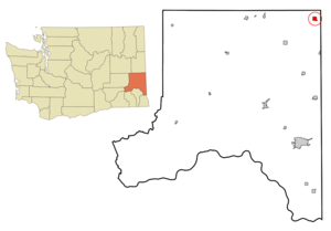
mapsize = 250px
map_caption = Location of Tekoa, Washington
mapsize1 =
map_caption1 =subdivision_type = Country
subdivision_name =United States
subdivision_type1 = State
subdivision_name1 =Washington
subdivision_type2 = County
subdivision_name2 = Whitmangovernment_footnotes =
government_type =
leader_title =
leader_name =
leader_title1 =
leader_name1 =
established_title =
established_date =unit_pref = Imperial
area_footnotes =area_magnitude =
area_total_km2 = 2.9
area_land_km2 = 2.9
area_water_km2 = 0.0
area_total_sq_mi = 1.1
area_land_sq_mi = 1.1
area_water_sq_mi = 0.0population_as_of = 2000
population_footnotes =
population_total = 826
population_density_km2 = 280.8
population_density_sq_mi = 727.2timezone = Pacific (PST)
utc_offset = -8
timezone_DST = PDT
utc_offset_DST = -7
elevation_footnotes =
elevation_m = 772
elevation_ft = 2533
latd = 47 |latm = 13 |lats = 29 |latNS = N
longd = 117 |longm = 4 |longs = 25 |longEW = Wpostal_code_type =
ZIP code
postal_code = 99033
area_code = 509
blank_name = FIPS code
blank_info = 53-70560GR|2
blank1_name = GNIS feature ID
blank1_info = 1508933GR|3
website =
footnotes =Tekoa is a city in Whitman County,
Washington ,United States . The population was 826 at the 2000 census and 840 at the 2008 Washington State Office of Financial Management estimate.History
Tekoa was incorporated in 1889 with just under 300 souls. By 1910 the population had swelled to 1,694. Over the next 60 years, Tekoa began a long decline as mechanicalized farming and the automobile age came into being. By 1990 the town had fewer than 750 residents. During the 1990's the town increased in popularity and once again, the population has started to increase. Today, over 840 residents call Tekoa home.
Geography
Tekoa is located at coor dms|47|13|29|N|117|4|25|W|city (47.224704, -117.073607)GR|1.
According to the
United States Census Bureau , the city has a total area of 1.1square mile s (3.0km² ), all of it land.Demographics
As of the
census GR|2 of 2000, there were 826 people, 318 households, and 220 families residing in the city. Thepopulation density was 727.2 people per square mile (279.8/km²). There were 363 housing units at an average density of 319.6/sq mi (122.9/km²). The racial makeup of the city was 93.46% White, 0.36% African American, 2.18% Native American, 0.85% Asian, 0.12% Pacific Islander, 0.12% from other races, and 2.91% from two or more races. Hispanic or Latino of any race were 1.57% of the population.There were 318 households out of which 30.5% had children under the age of 18 living with them, 56.3% were married couples living together, 10.7% had a female householder with no husband present, and 30.8% were non-families. 29.2% of all households were made up of individuals and 15.1% had someone living alone who was 65 years of age or older. The average household size was 2.43 and the average family size was 2.98.
In the city the population was spread out with 27.7% under the age of 18, 4.4% from 18 to 24, 20.5% from 25 to 44, 24.7% from 45 to 64, and 22.8% who were 65 years of age or older. The median age was 42 years. For every 100 females there were 84.8 males. For every 100 females age 18 and over, there were 86.6 males.
The median income for a household in the city was $30,833, and the median income for a family was $36,771. Males had a median income of $32,014 versus $19,307 for females. The
per capita income for the city was $14,344. About 13.2% of families and 14.5% of the population were below thepoverty line , including 20.5% of those under age 18 and 10.1% of those age 65 or over.References
External links
* [http://www.tekoawa.com/ Official website of Tekoa, WA]
* [http://www.the-boomerang.com/ The Boomerang! - Local newspaper]
Wikimedia Foundation. 2010.