- Chesapeake, West Virginia
-
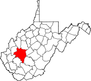
Chesapeake, West Virginia — Town — Location of Chesapeake, West Virginia
Coordinates: 38°13′21″N 81°32′10″W / 38.2225°N 81.53611°WCoordinates: 38°13′21″N 81°32′10″W / 38.2225°N 81.53611°W Country United States State West Virginia County Kanawha Area – Total 0.7 sq mi (1.7 km2) – Land 0.5 sq mi (1.2 km2) – Water 0.2 sq mi (0.5 km2) Elevation 607 ft (185 m) Population (2000) – Total 1,643 – Density 3,487.3/sq mi (1,346.5/km2) Time zone Eastern (EST) (UTC-5) – Summer (DST) EDT (UTC-4) Area code(s) 304 FIPS code 54-15028[1] GNIS feature ID 1554120[2] Chesapeake is a town in Kanawha County, West Virginia, United States. The population was 1,643 at the 2000 census. The town is situated on the Kanawha River. Chesapeake was incorporated in 1949 and named for the Chesapeake and Ohio Railway, which has served the community since 1873. It is also the hometown of NFL player Chris Massey, long snapper for the St. Louis Rams.[3] The current mayor of Chesapeake is Damon Bradshaw.[4]
Geography
Chesapeake is located at 38°13′21″N 81°32′10″W / 38.2225°N 81.53611°W (38.222541, -81.536042)[5].
According to the United States Census Bureau, the town has a total area of 0.6 square miles (1.7 km²). 0.5 square miles (1.2 km²) of it is land and 0.2 square miles (0.5 km²) of it (27.69%) is water.
Demographics
As of the census[1] of 2000, there were 1,643 people, 750 households, and 480 families residing in the town. The population density was 3,487.3 inhabitants per square mile (1,349.7/km²). There were 851 housing units at an average density of 1,806.3 per square mile (699.1/km²). The racial makeup of the town was 88.19% White, 10.04% African American, 0.06% Native American, 0.12% Asian, 0.06% Pacific Islander, 0.37% from other races, and 1.16% from two or more races. Hispanic or Latino of any race were 0.37% of the population.
There were 750 households out of which 22.8% had children under the age of 18 living with them, 42.3% were married couples living together, 16.9% had a female householder with no husband present, and 35.9% were non-families. 31.5% of all households were made up of individuals and 15.6% had someone living alone who was 65 years of age or older. The average household size was 2.19 and the average family size was 2.71.
In the town the population was spread out with 19.7% under the age of 18, 6.9% from 18 to 24, 25.9% from 25 to 44, 27.1% from 45 to 64, and 20.3% who were 65 years of age or older. The median age was 43 years. For every 100 females there were 83.2 males. For every 100 females age 18 and over, there were 80.2 males.
The median income for a household in the town was $29,526, and the median income for a family was $35,703. Males had a median income of $30,588 versus $21,458 for females. The per capita income for the town was $16,307. About 14.3% of families and 19.1% of the population were below the poverty line, including 38.9% of those under age 18 and 10.9% of those age 65 or over.
References
- ^ a b "American FactFinder". United States Census Bureau. http://factfinder.census.gov. Retrieved 2008-01-31.
- ^ "US Board on Geographic Names". United States Geological Survey. 2007-10-25. http://geonames.usgs.gov. Retrieved 2008-01-31.
- ^ DatabaseFootball
- ^ West Virginia Byways and Backways Program
- ^ "US Gazetteer files: 2010, 2000, and 1990". United States Census Bureau. 2011-02-12. http://www.census.gov/geo/www/gazetteer/gazette.html. Retrieved 2011-04-23.
Municipalities and communities of Kanawha County, West Virginia Cities Charleston | Dunbar | Marmet | Montgomery‡ | Nitro‡ | St. Albans | Smithers‡ | South Charleston
Towns CDPs Alum Creek‡ | Big Chimney | Chelyan | Coal Fork | Cross Lanes | Elkview | Jefferson | Pinch | Rand | Shrewsbury | Sissonville | Upper Falls
Other
localitiesAarons | Acme | Acup | Amandaville | Amelia | Annfred | Barren Creek | Blackhawk | Blakeley | Blount | Blue Creek | Blundon | Bream | Brounland | Burnwell | Cabin Creek | Carbon | Cinco | Coalburg | Coalridge | Coco | Corton | Crede | Crown Hill | Davis Creek | Dawes | Decota | Dial | Diamond | Dickinson | Donwood | Dry Branch | Dungriff | Dupont City | East Nitro | East Side | Edgewood | Elk | Elk Forest | Elk Hills | Emmons‡ | Eskdale | Etowah | Falling Rock | Ferrell | Fivemile | Forest Hills | Forks of Coal | Fort Hill | Frame | Gallagher | Giles | Green Valley | Greencastle | Grippe | Guthrie | Hansford | Hernshaw | Hicumbottom | Highlawn | Hillsdale | Hitop | Holly | Hollygrove | Hollyhurst | Hugheston | Institute | Island Branch | Ivydale | Jarrett | Jarretts Ford | Joplin | Kanawha Estates | Kayford | Kelly Hill | Kendalia | Laing | Leewood | London | Lower Falls | Malden | Mammoth | Meadowbrook | Miami | Mink Shoals | Ohley | Pocatalico | Pond Gap | Port Amherst | Quick | River Bend | Riverside | Ruth | Ruthdale | Sharon | Snow Hill | Standard | Tad | Tornado | Victor | Wallace | Whittaker | Winifrede
Footnotes ‡This populated place also has portions in an adjacent county or counties
Categories:- Populated places in Kanawha County, West Virginia
- Towns in West Virginia
- Kanawha River
- Charleston, West Virginia metropolitan area


Wikimedia Foundation. 2010.