- Cross Lanes, West Virginia
-
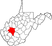
Cross Lanes, West Virginia — CDP — Location of Cross Lanes, West Virginia
Coordinates: 38°25′45″N 81°46′33″W / 38.42917°N 81.77583°WCoordinates: 38°25′45″N 81°46′33″W / 38.42917°N 81.77583°W Country United States State West Virginia County Kanawha Area[1] – Total 6.4 sq mi (16.6 km2) – Land 6.4 sq mi (16.5 km2) – Water 0.0 sq mi (0.1 km2) Elevation 709 ft (216 m) Population (2010)[2] – Total 9,995 – Density 1,561.7/sq mi (602.1/km2) Time zone Eastern (EST) (UTC-5) – Summer (DST) EDT (UTC-4) ZIP codes 25313, 25356 Area code(s) 304 FIPS code 54-19108[3] GNIS feature ID 1554227[4] Cross Lanes is an unincorporated census-designated place and suburb of Charleston in Kanawha County, West Virginia, United States. As of the 2010 census, its population was 9,995.[2]
Contents
Geography
Cross Lanes is an unincorporated city in the suburbs of Charleston, West Virginia. It is located at 38°25′45″N 81°46′33″W / 38.42917°N 81.77583°W (38.429096, -81.775854)[1].
According to the United States Census Bureau, the Cross Lanes CDP has a total area of 6.4 square miles (16.6 km²), of which, 6.4 square miles (16.5 km²) of it is land and 0.04 square miles (0.1 km²) of it (0.65%) is water.
Demographics
As of the census[3] of 2000, there were 10,353 people, 4,231 households, and 2,991 families residing in Cross Lanes. The population density was 1,594.4 people per square mile (615.9/km²). There were 4,481 housing units at an average density of 690.1/sq mi (266.6/km²). The racial makeup of the CDP was 93.63% White, 3.84% Black or African American, 0.21% Native American, 1.24% Asian, 0.02% Pacific Islander, 0.10% from other races, and 0.96% from two or more races. Hispanic or Latino of any race were 0.57% of the population.
There were 4,231 households out of which 33.0% had children under the age of 18 living with them, 56.5% were married couples living together, 11.0% had a female householder with no husband present, and 29.3% were non-families. 25.2% of all households were made up of individuals and 6.3% had someone living alone who was 65 years of age or older. The average household size was 2.44 and the average family size was 2.92.
The age distribution of the CDP is: 24.1% under the age of 18, 8.5% from 18 to 24, 31.4% from 25 to 44, 24.9% from 45 to 64, and 11.2% who were 65 years of age or older. The median age was 37 years. For every 100 females there were 93.2 males. For every 100 females age 18 and over, there were 90.8 males.
The median income for a Cross Lanes household is $45,334, and the median income for a family was $54,649. Males had a median income of $40,758 versus $27,250 for females. The per capita income is $22,719. About 4.1% of families and 5.9% of the population were below the poverty line, including 8.1% of those under age 18 and 6.5% of those age 65 or over.
Education
There are six schools in Cross Lanes.
- Andrew Jackson - public middle school
- Cross Lanes Elementary - public elementary school
- Point Harmony - public elementary school
- Cross Lanes Christian - private elementary, junior, and senior high school
- Everest Institute
There is no public high school in Cross Lanes so students must bus to Nitro High School in Nitro, West Virginia. As Cross Lanes is within Kanawha County, the public schools are part of the Kanawha County School District.
Notable residents
- Steve Harrison - member of West Virginia State Senate (2003–2006) and West Virginia House of Delegates (1993–2002).
- Pentecostal pastor and televangelist T. D. Jakes headed a church, the Greater Emmanuel Temple of Faith, in Cross Lanes, before moving to Dallas in 1996.
- Patrick Lane - member of West Virginia House of Delegates (2005–present).
- Country singer/songwriter Kathy Mattea grew up in Cross Lanes before moving to Nashville, Tennessee to begin her professional career
- William "Jay" Nesbitt - member of West Virginia House of Delegates (1993–1996).
- Ron Walters - member of West Virginia House of Delegates (1993–1998, 2001–present).
- Charles "Rusty" Webb - member of West Virginia House of Delegates (1997–2004).
References
- ^ a b "US Gazetteer files: 2010, 2000, and 1990". United States Census Bureau. 2011-02-12. http://www.census.gov/geo/www/gazetteer/gazette.html. Retrieved 2011-04-23.
- ^ a b "American FactFinder". United States Census Bureau. http://factfinder2.census.gov. Retrieved 2011-05-14.
- ^ a b "American FactFinder". United States Census Bureau. http://factfinder.census.gov. Retrieved 2008-01-31.
- ^ "US Board on Geographic Names". United States Geological Survey. 2007-10-25. http://geonames.usgs.gov. Retrieved 2008-01-31.
Municipalities and communities of Kanawha County, West Virginia Cities Charleston | Dunbar | Marmet | Montgomery‡ | Nitro‡ | St. Albans | Smithers‡ | South Charleston
Towns Belle | Cedar Grove | Chesapeake | Clendenin | East Bank | Glasgow | Handley | Pratt
CDPs Alum Creek‡ | Big Chimney | Chelyan | Coal Fork | Cross Lanes | Elkview | Jefferson | Pinch | Rand | Shrewsbury | Sissonville | Upper Falls
Other
localitiesAarons | Acme | Acup | Amandaville | Amelia | Annfred | Barren Creek | Blackhawk | Blakeley | Blount | Blue Creek | Blundon | Bream | Brounland | Burnwell | Cabin Creek | Carbon | Cinco | Coalburg | Coalridge | Coco | Corton | Crede | Crown Hill | Davis Creek | Dawes | Decota | Dial | Diamond | Dickinson | Donwood | Dry Branch | Dungriff | Dupont City | East Nitro | East Side | Edgewood | Elk | Elk Forest | Elk Hills | Emmons‡ | Eskdale | Etowah | Falling Rock | Ferrell | Fivemile | Forest Hills | Forks of Coal | Fort Hill | Frame | Gallagher | Giles | Green Valley | Greencastle | Grippe | Guthrie | Hansford | Hernshaw | Hicumbottom | Highlawn | Hillsdale | Hitop | Holly | Hollygrove | Hollyhurst | Hugheston | Institute | Island Branch | Ivydale | Jarrett | Jarretts Ford | Joplin | Kanawha Estates | Kayford | Kelly Hill | Kendalia | Laing | Leewood | London | Lower Falls | Malden | Mammoth | Meadowbrook | Miami | Mink Shoals | Ohley | Pocatalico | Pond Gap | Port Amherst | Quick | River Bend | Riverside | Ruth | Ruthdale | Sharon | Snow Hill | Standard | Tad | Tornado | Victor | Wallace | Whittaker | Winifrede
Footnotes ‡This populated place also has portions in an adjacent county or counties
Categories:- Populated places in Kanawha County, West Virginia
- Unincorporated communities in West Virginia
- Census-designated places in West Virginia
- Charleston, West Virginia metropolitan area


Wikimedia Foundation. 2010.