- Charlottetown
-
For other uses, see Charlottetown (disambiguation).
City of Charlottetown — City — The skyline of Charlottetown seen from Port-la-Joye–Fort Amherst.

Flag
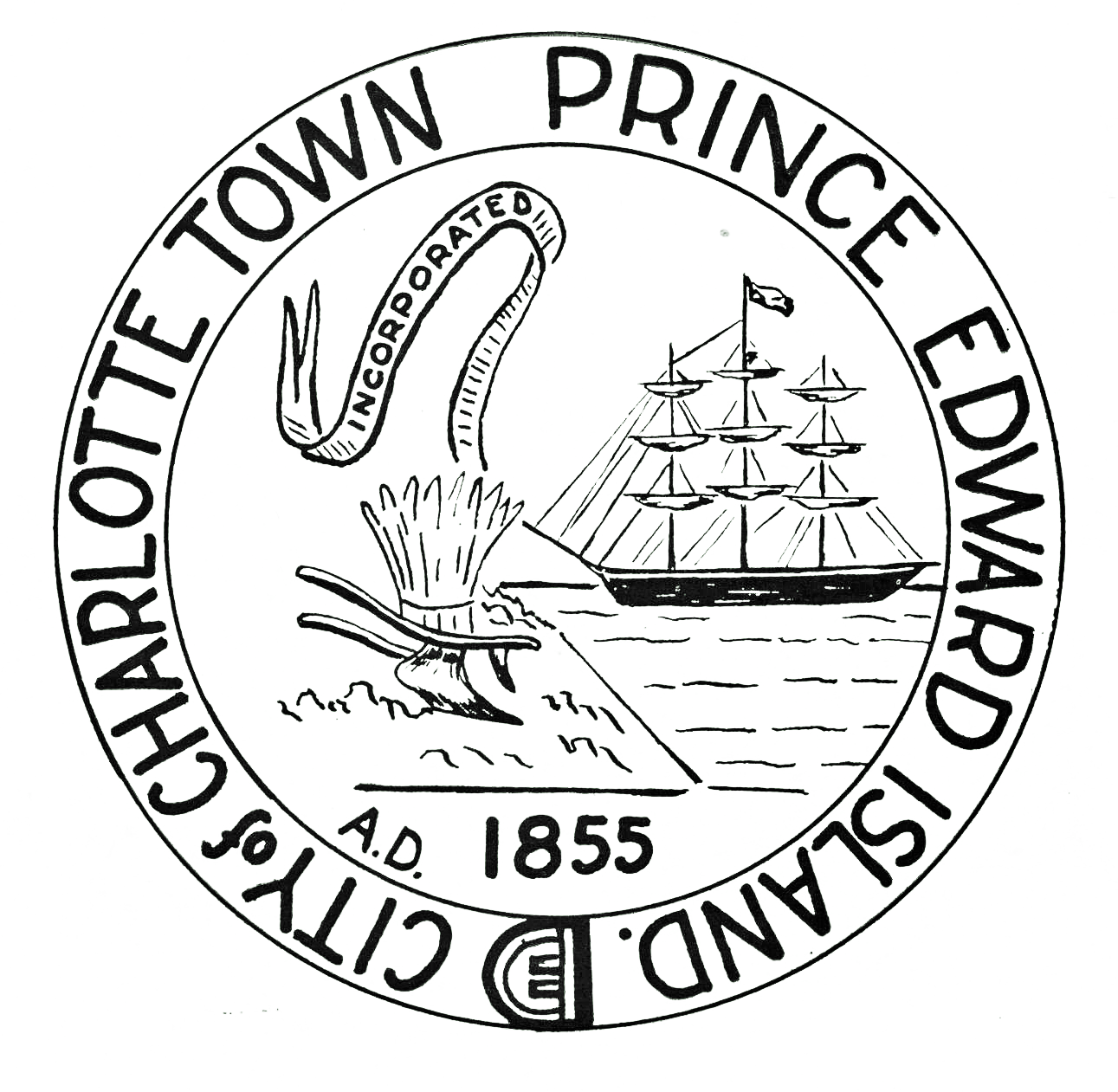
Seal
Coat of arms
LogoMotto: "Cunabula Foederis" (Latin)
"Birthplace of Confederation"Location of Charlottetown in Prince Edward Island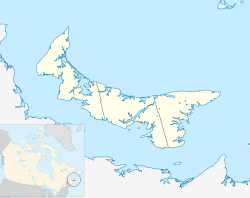
 City of Charlottetown
Coordinates: 46°14′00″N 63°09′00″W / 46.2333333°N 63.15°W Country  Canada
Province  Prince Edward Island
County Queens County Founded 1764 City April 17, 1855 Government - City Mayor Clifford J. Lee - Governing body Charlottetown City Council - MPs Sean Casey - MLAs Robert Mitchell
Douglas W. Currie
Richard Brown
Robert Ghiz
Kathleen Casey
Forrest Dumville
Francis WattsArea - City 44.33 km2 (17.1 sq mi) - Metro 823.39 km2 (317.9 sq mi) Elevation Sea Level to 49 m (0 to 161 ft) Population (2006)[1] - City 32,174 - Density 725.8/km2 (1,879.8/sq mi) - Metro 58,625 - Metro density 80.5/km2 (208.5/sq mi) Demonym Charlottetonian Time zone Atlantic (AST) (UTC-4) - Summer (DST) ADT (UTC-3) Postal code C1A — E Area code(s) 902 NTS Map 011L03 GNBC Code BAARG Website www.city.charlottetown.pe.ca Charlottetown (
 /ˈʃɑːrləttaʊn/; 2006 population: 32,174[2]) is a Canadian city. It is both the largest city on and the provincial capital of Prince Edward Island, and the county seat of Queens County. Named after Queen Charlotte, the wife of George III, Charlottetown was first incorporated as a town in 1855 and designated as a city in 1885. It was most famously the site of the Charlottetown Conference in 1864, the first gathering of Canadian statesmen to debate the proposed Canadian Confederation. From this, the city adopted as its motto "Cunabula Foederis" -- "Birthplace of Confederation".
The population of the Charlottetown census agglomeration in the 2006 census was 58,625,[1] slightly less than half of the province's population (135,851[1]).
Contents
History
Main article: History of Charlottetown1720 - 1758
 Fort Amherst is situated south of the city on the western side of the approaches to Charlottetown Harbour.
The first European settlers in the area were French; personnel from Fortress Louisbourg founded a settlement in 1720 named Port La Joye on the southwestern part of the harbour opposite the present-day city. This settlement was led by Michel Haché-Gallant, who used his sloop to ferry Acadian settlers from Louisbourg.
During King Georges War, the British had taken over the Island. French officer Ramezay sent 500 men to attack the British troops in the Battle at Port-la-Joye. The French were successful in killing or taken prisoner forty British troops.[3]
In August 1758, at the height of the French and Indian War, a British fleet took control of the settlement and the rest of the island, promptly deporting those French settlers that they could find in the Ile Saint-Jean Campaign (this being fully three years after the original Acadian Expulsion in Nova Scotia). British forces built Fort Amherst near the site of the abandoned Port La Joye settlement to protect the entrance to the harbour.
1759 - 1855
Charlottetown was selected as the site for the county seat of Queens County in the colonial survey of 1764 by Captain Samuel Holland of the Royal Engineers. A year later, Charlottetown was made the colonial capital of St. John's Island. Further surveys conducted between 1768–1771 established the street grid and public squares which can be seen in the city's historic district. The town was named in honour of Queen Charlotte, consort of King George III.

On November 17, 1775, the colony's new capital was ransacked by Massachusetts-based privateers, participants in the American Revolutionary War. During the attack, the colonial seal was stolen and several prisoners, including Phillips Callbeck and Thomas Wright, were taken to Cambridge, Massachusetts and later released.
In 1793, land had been set aside by Governor Fanning on the western limits of the community for use by the "Administrator of Government" (the Governor), and as such it became known informally as "Fanning's Bank" or just "Fanning Bank".
On November 29, 1798, St. John's Island was renamed to Prince Edward Island in honour of Prince Edward, Duke of Kent and Strathearn who was the Commander-in-Chief, North America.
In 1805, the local British garrison constructed a harbour defence called "Fort Edward" to the west of the capital's waterfront and the "Prince Edward Battery" manned this facility.
In 1835, "Government House" was constructed at Fanning Bank as a residence for the colony's Governor. Today, it serves as the official residence for the Lieutenant Governor.
Between 1843 and 1847, a new legislative building was constructed in the community. Named the Colonial Building originally, following Confederation with Canada it gradually became known as "Province House". The completion of this structure with Isaac Smith as builder/architect was an important milestone in the history of the capital and it is still in use today as the provincial legislature as well as a National Historic Site, and is currently the second-oldest legislative seat in Canada.
On April 17, 1855, Charlottetown was incorporated as a city, holding its first council meeting on August 11 of that year. The community had 6,500 residents at the time of incorporation.
1856 - 1885
Between September 1–7, 1864, Charlottetown hosted what is now termed the Charlottetown Conference. Although many of the meetings and negotiations which would lead to Canadian Confederation were held in Province House, various social events spilled over into the surrounding community.
 Streetscape on Water Street.
On June 14, 1873 the "Government House Farm" at Fanning Bank was designated a municipal park, named Victoria Park in honour of Queen Victoria.
Prince Edward Island entered Confederation on July 1, 1873.
Aside from being the seat of colonial government, the community came to be noted during the early nineteenth century for shipbuilding and its lumber industry as well as being a fishing port. The shipbuilding industry declined in the latter part of the nineteenth century. In August 1874, the Prince Edward Island Railway opened its main line between Charlottetown and Summerside. The railway, along with the shipping industry, would continue to drive industrial development on the waterfront for several decades to come.
The province's first health care facility, the Charlottetown Hospital, was opened by the Diocese of Charlottetown in 1879, which was followed by the publicly operated Prince Edward Island Hospital in 1884.
In 1885 the municipality saw its status upgraded to become a city.
1886 - 1950
Religion played a central role in the development of Charlottetown's institutions with non-denominational (i.e. Protestant) and Roman Catholic public schools ( Catholic Queen Square, Notre Dame, and St Josephs. vs Protestant West Kent and Prince Street) (hospitals (Prince Edward Island Hospital vs. Charlottetown Hospital), and post-secondary institutions (Prince of Wales College vs. St. Dunstan's University) being instituted. St. Dunstan's was originally developed as a seminary for training priests, and the Maritime Christian College was founded in 1960 to train preachers for the Christian churches and churches of Christ in Prince Edward Island and the Maritime Provinces.
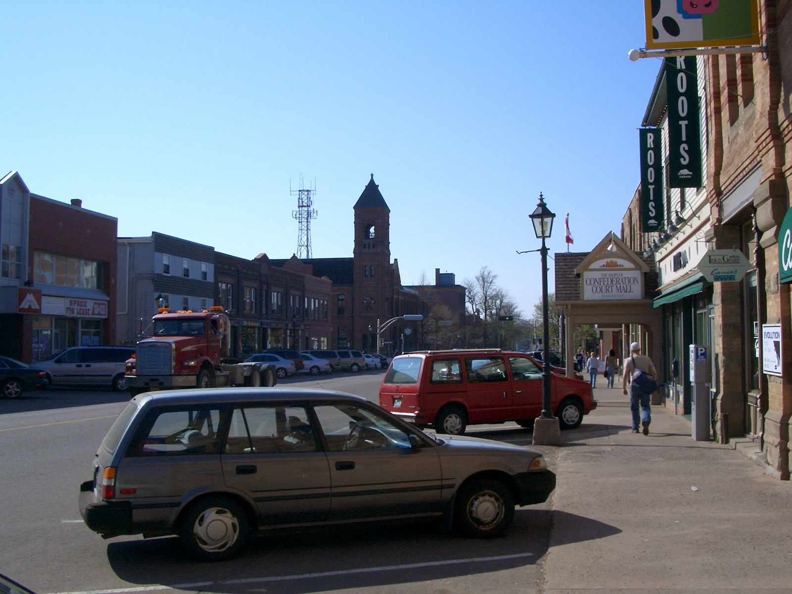
 Queen Street in the central business district
As with most communities in North America, the automobile shaped Charlottetown's development in the latter half of the twentieth century, when outlying farms in rural areas of Brighton, Spring Park, and Parkdale saw increased housing developments. The Charlottetown airfield in the nearby rural community of Sherwood was upgraded as part of the British Commonwealth Air Training Plan and operated for the duration of World War II as RCAF Station Charlottetown, in conjunction with RCAF Station Mount Pleasant and RCAF Station Summerside. After the war the airfield was designated Charlottetown Airport. Charlottetown's shipyards also saw extensive use during World War II, being used for refits and upgrades to numerous Royal Canadian Navy warships. Further post-war development saw residential properties continue to expand in adjacent outlying areas, particularly in the neighboring farming communities of Sherwood, West Royalty, and East Royalty.
1951 - present
In 1959, the suburban village of Spring Park was amalgamated into the city, extending the city's northern boundary from Kirkwood Drive to Hermitage Creek and included the campus of St. Dunstan's University.
To commemorate the centennial of the Charlottetown Conference, the ten provincial governments and the Government of Canada contributed to a national monument to the "Fathers of Confederation". The Confederation Centre of the Arts, which opened in 1964, is a gift to the residents of Prince Edward Island, and contains a public library, nationally renowned art gallery, and a mainstage theatre which has played to the Charlottetown Festival every summer since.
 Province House is Canada's second oldest legislature building and the home of the Prince Edward Island House of Assembly.
In the 1960s, new public schools were constructed in the community, and in 1969 the city became home to the amalgamated University of Prince Edward Island (UPEI), located on the campus of the former St. Dunstan's University. Together with the federal Department of Agriculture and Agri-Food's Charlottetown Experimental Farm (also known as Ravenwood Farm), these properties comprise a large green space surrounded by the city. The Prince of Wales College downtown campus became part of a new provincial community college system named Holland College, in honour of the island's famous surveyor. The P.E.I. Comprehensive Development Plan in the late 1960s greatly contributed to the expansion of the provincial government in Charlottetown for the next decade.
The Queen Elizabeth Hospital opened in 1982. In 1983, the national headquarters of the federal Department of Veterans Affairs was moved to Charlottetown as part of a nation-wide federal government decentralization programme. In 1986, UPEI saw further expansion with the opening of the Atlantic Veterinary College.
Throughout the 1970s and 1980s, Charlottetown witnessed increased commercial office and retail development. A waterfront hotel and convention centre was completed in 1982 and helped to encourage diversification and renewal in the area, leading to several residential complexes and downtown shopping facilities. The abandonment of rail service in the province by CN Rail in December 1989 led to the railway and industrial lands at the east end fo the waterfront being transformed into parks and cultural attractions.
The late 1990s and 2000s witnessed a change in the retail landscape with the opening of big box stores on the site of former traditional shopping centres and in new developments in the northern suburbs, particularly the neighbourhood of West Royalty, which is a key road junction.
In 1995 Charlottetown underwent municipal amalgamation. The present city was created by merging Charlottetown with Sherwood, Parkdale, Winsloe, West Royalty, and East Royalty. Since amalgamation, the city occupies most of Queens Royalty and part of the townships Lot 33 and Lot 34.
The central business district continues to undergo incremental expansion as government and private sector office space is constructed and new institutional space is built or retrofitted, however retail space in the CBD has suffered as a result of outlying big box retail construction in recent years.
Geography
Charlottetown is situated on its namesake harbour, which is formed by the confluence of three rivers in the central part of the island's south shore. The harbour itself opens onto the Northumberland Strait. The city is roughly V-shaped (pointed to the south) and constrained by the North (Yorke) and the Hillsborough (East) Rivers to the west and east.
Climate
Charlottetown has a humid continental climate (Koppen Dfb) moderated partially by Prince Edward Island's location in the Gulf of Saint Lawrence. Winters are milder than many inland cities at a similar latitude: the January average is −8 °C (17.6 °F), and lows reach −20 °C (−4 °F) or below on an average 8 days per season.[4] However, the coastal position means that winter precipitation, more often as snow, is frequent and at times heavy: the seasonal snow average is 312 centimetres (123 in).[4] Spring warming is gradual due to the ocean waters still being cold. Summers are mild, again due to the same maritime moderation: the July high is 23.2 °C (73.8 °F).[4] Precipitation averages 1,170 millimetres (46 in) per year,[4] with the greatest amounts falling in late fall and winter.
Climate data for Charlottetown Month Jan Feb Mar Apr May Jun Jul Aug Sep Oct Nov Dec Year Record high °C (°F) 15.1
(59.2)13.3
(55.9)16.3
(61.3)22.9
(73.2)31.2
(88.2)32.2
(90.0)33.9
(93.0)34.4
(93.9)31.5
(88.7)24.4
(75.9)21.3
(70.3)16.7
(62.1)34.4
(93.9)Average high °C (°F) −3.3
(26.1)−3.3
(26.1)0.9
(33.6)6.7
(44.1)14.1
(57.4)19.6
(67.3)23.2
(73.8)22.6
(72.7)18
(64)11.8
(53.2)5.7
(42.3)−0.1
(31.8)9.7 Average low °C (°F) −12.6
(9.3)−12.4
(9.7)−7.1
(19.2)−1.4
(29.5)4
(39)9.6
(49.3)13.8
(56.8)13.5
(56.3)9.1
(48.4)3.8
(38.8)−1.1
(30.0)−8.1
(17.4)0.9 Record low °C (°F) −30.5
(−22.9)−29.8
(−21.6)−23.9
(−11.0)−13.6
(7.5)−6.7
(19.9)−1.1
(30.0)4.4
(39.9)2
(36)−0.6
(30.9)−6.7
(19.9)−15
(5)−28.1
(−18.6)−30.5
(−22.9)Precipitation mm (inches) 106.4
(4.189)85.5
(3.366)91.8
(3.614)87.8
(3.457)97.7
(3.846)93.2
(3.669)85.8
(3.378)87.3
(3.437)95.4
(3.756)108.6
(4.276)110.8
(4.362)123.1
(4.846)1,173.3
(46.193)Rainfall mm (inches) 42.1
(1.657)30.1
(1.185)38.8
(1.528)59
(2.32)93.8
(3.693)93.2
(3.669)85.8
(3.378)87.3
(3.437)95.4
(3.756)105.2
(4.142)87.1
(3.429)62.6
(2.465)880.4
(34.661)Snowfall cm (inches) 71.1
(27.99)60.2
(23.7)53.4
(21.02)28.9
(11.38)3.8
(1.5)0
(0)0
(0)0
(0)0
(0)3.1
(1.22)23.0
(9.06)68.4
(26.93)311.9
(122.8)Avg. precipitation days 18.8 16.1 16 15.4 14.7 12.8 12.4 11.3 13.7 15 17.5 20.6 184.3 Avg. rainy days 6.8 5.1 7.4 11.1 14.5 12.8 12.4 11.3 13.7 14.4 12.8 8.5 130.8 Avg. snowy days 16.2 14.1 12.2 7.4 0.9 0 0 0 0 1.2 7.5 16.2 75.7 Sunshine hours 105.3 115.2 142.7 150.8 197.1 225.5 248.2 223.2 175.7 123.3 77.1 74.5 1,858.6 Source: Environment Canada [4] Cityscape and architecture
 The skyline of Charlottetown as seen from Port-la-Joye–Fort Amherst.
Downtown Charlottetown includes the city's historic five hundred lots, as surveyed by Captain Samuel Holland, as well as the waterfront facing the harbour and the Hillsborough River. Adjacent communities to the original downtown included Brighton, Spring Park, Sherwood and Parkdale. The areas to the west, north and east of downtown have been developed in recent decades with several residential and commercial/retail developments, although the outer regions of the city are still predominantly farmland, as is an area in the centre of the city where an Agriculture Canada experimental crop research station is located.
The Agriculture Canada research station farm is the last remnant of the Queens Royalty common pasture lands and creates a large greenspace in the centre of the city, north of downtown. The development of the township of Queens Royalty, with its 12-acre (49,000 m2) estates surveyed during the 18th and 19th centuries along a north-south axis forced early road networks into a grid.
 University Avenue as seen from the Atlantic Technology Centre roof deck.
 Charlottetown Marina.
The present-day Charlottetown landscape is dominated by urban development along the waterfront areas, suburban development to the west, north and east, as well as the airport to the north. Commercial development, aside from the central business district, is concentrated along several road corridors:
- University Avenue/Malpeque Road
- North River Road/Lower Malpeque Road
- St. Peter's Road
- Mount Edward Road
- Kensington Road
The downtown core is augmented by several feeder streets:
- Queen Street
- Water Street
- Grafton Street
Neighbourhoods
Main article: Neighbourhoods of Charlottetown Prince Street in the city's historic district.
Charlottetown comprises the following neighbourhoods which were one-time independent municipalities:
- Charlottetown (original municipality)
- Brighton
- Spring Park
- Parkdale
- Sherwood
- East Royalty (including Hillsborough Park)
- West Royalty
- Winsloe
The original municipal boundary between Charlottetown and the common area of the township of Queens Royalty was the northern edge of the original five hundred lots along present-day Euston Street. This boundary was extended north to Allen Street and Kirkwood Drive during the early twentieth century, taking in part of the rural community of Brighton west of the downtown. The village of Spring Park was amalgamated into the city in 1959, extending the city's boundary north to Hermitage Creek, which also formed the southern boundary of the village of West Royalty. Development filled in most vacant land in the Brighton and Spring Park neighbourhoods by the 1980s.
Municipal amalgamation in 1996 saw the outlying independent municipalities of Parkdale (town), Sherwood, East Royalty, West Royalty and Winsloe (villages) merged into a larger city of Charlottetown at the same time as rural communities east and west of the city were amalgamated to form the towns of Stratford and Cornwall respectively.
A green belt is in place around the northern fringe of the municipal boundary, although it is poorly enforced by the provincial government, leading to suburban sprawl.
Demography
 Typical houses in working-class neighbourhoods.
Ethnic Origin (2006)[5] Ethnic Origin Population Percent Scottish 24,345 42.2% Canadian 20,530 35.6% English 19,205 33.3% Irish 18,775 32.5% French 10,675 18.5% German 3,335 5.8% Dutch 2,000 3.5% First Nations 1,390 2.4% Welsh 1,310 2.3% Acadian 1,070 1.9% Lebanese 510 0.9% According to the 2006 census,[6] the City of Charlottetown had 32,174 residents of whom approximately 45.5% were male and 54.5% were female. Children under five accounted for approximately 4.3% of the resident population of Charlottetown. This compares with 4.9% in Prince Edward Island, and 5.3% for Canada overall. Charlottetown is mainly dominated by people of European ancestry, but there is a growing Black-Canadian and Chinese-Canadian population.
In 2006, 17.2% of the resident population in Charlottetown were of retirement age (65 and over for males and females) compared with 14.9% in Prince Edward Island and 13.7% in Canada; therefore, the median age is 41.3 years of age comparing to 40.8 years of age for Prince Edward Island and 39.5 years of age for all of Canada.
Census Population 1851 4,717 1861 6,706 1871 8,807 1881 11,485 1891 11,373 1901 12,080 1911 11,198 1921 12,347 1931 12,361 1941 14,460 1951 15,887 1961 18,318 1971 19,133 1981 15,282 1991 15,396 2001 32,245 2006 32,174 According to the 2001 census, the median income for a household in the city is $52,996, and the median income for a family is $77,008. Males have a median income of $42,519 versus $28,136 for females. The per capita income for the town is $29,710. 12.2% of the population and 8.0% of families are below the poverty line. Out of the total population, 9.6% of those under the age of 18 and 10.3% of those 65 and older are living below the poverty line.
Between the 2001 and 2006 census, the population of Charlottetown fell by 0.2%, compared with an increase of 0.4% for Prince Edward Island as a whole. Population density of Charlottetown averaged 725.8 people per square kilometre, compared with a provincial average of 23.9 people per square kilometre for Prince Edward Island.
The Charlottetown census agglomeration area (CA) comprises Charlottetown and the neighbouring towns of Stratford and Cornwall, as well as adjoining rural areas of central-eastern Queens County, namely Lots 31, 34, 35, 36, 48, 49 and 65. At the time of the 2006 census,[7] the resident population for the CA was 58,625 people over an area measuring 728.03 square kilometres, compared with a resident population in the province of Prince Edward Island of 135,851 people. The 2010 projected population is estimated to be 61,210.
According to the 2001 Statistics Canada census, more than nine out of ten inhabitants of the Charlottetown metropolitan self-identified as Christian. This breaks down to 91.7% Christian (46.0% Roman Catholic, 42.6% Protestant, and 3.0% other Christian mostly Orthodox), 7.3% stating no religion, and other religions that comprise less than 1.0% includes Muslim, Buddhist, and Jewish.
Government
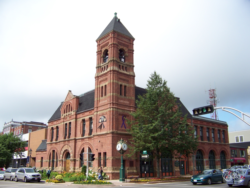
See also: Charlottetown City Council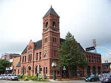 Charlottetown City Hall, a National Historic Site of Canada, constructed in the 1880s
The city's municipal government is structured around a council comprising a mayor and ten councillors elected using the ward system. The current mayor of the city is Clifford J. Lee.
Charlottetown also has 7 seats (50%) in the Legislative Assembly of Prince Edward Island, although it should be noted that some of these electoral districts occupy adjacent rural areas that are not within the city's boundaries.
The city has a single seat in the House of Commons.
Economy
 Founder's Hall museum on the Charlottetown waterfront.
Charlottetown's economy is dominated by the public sector. The provincial, federal, and municipal levels of government are significant employers in the central part of Queens County, as well as healthcare and secondary and post-secondary education. Technology companies have also been increasing their share of the city's workforce in the past decade, however the actual numbers are quite small once call-centres are excluded. Other significant economic activities include light manufacturing, such as chemicals, bio-technology, and machining.
Prince Edward Air, a charter airline, has its headquarters in Charlottetown.[8]
Transportation
Charlottetown's central location in the province makes it a natural transportation hub. Historically it was the centre of the province's railway network.
Highway development in the latter part of the 20th century has resulted in the city being the focal point of several important routes in the province. Route 1, the Trans-Canada Highway, partially bisects the northern suburbs, linking with Riverside Drive, the Hillsborough River Bridge and the North River Causeway/Bridge on a limited-access arterial highway linking the city with the Confederation Bridge in the west and the Northumberland Ferries terminal in the east. Route 2, the province's main east-west highway intersects with Route 1 in the city.
Charlottetown Airport is the province's only airport with scheduled passenger service, serving 280,000 passengers per year.[9]
Charlottetown Transit is the latest incarnation of several attempts since the 1970s to implement a public transit system. It has provided scheduled bus service throughout the municipality since 2005.[citation needed]
The absence of public transit for many decades in Charlottetown resulted in a dependence on personal use of automobiles, with municipal governments constructing three monolithic above-ground parking garages in the city's historic district to house vehicles of downtown workers. The city also had a statistically higher proportion of taxis than the Canadian average as taxi service became a last-resort for many residents without access to a vehicle. Taxis in Charlottetown use a zone-based fare system as opposed to meters, and do not have a protective partition between the driver and passenger.[citation needed]
The Charlottetown Harbour Authority operates the city's commercial port and is currently expanding a marine terminal which was formerly operated by the federal government.[citation needed] Importation of gravel for construction is the main port activity.
 Tugboat in Charlottetown during the winter
Tourism
Charlottetown[10] is a popular destination in eastern Canada for visitors from other Maritime provinces, central Canada and the northeastern United States, as the city has a central location in the province as well as various services.
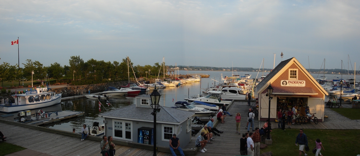
 Peakes Quay on the waterfront of Charlottetown Harbour
The city's streetscape with a centrally planned downtown core containing many Victorian-era houses and buildings is an attraction, as well as the waterfront redevelopment project in recent decades which has seen walking trails and parks developed on former industrial lands. A new cruise ship terminal was opened by the port authority in September 2007 which, proponents hope, will make the city a more attractive destination for the growing number of vessels operating in the Gulf of St. Lawrence.
Popular attractions within the city include the provincial legislature at Province House, which hosted the Charlottetown Conference, as well as Founders Hall, a recently redeveloped railway maintenance building which now houses an interactive trip through history tracing the development of Canada as a nation.
The Confederation Centre of the Arts provides live theatre, including the Charlottetown Festival during the summer months, as well as a nationally ranked art gallery. The Charlottetown Festival itself is headlined by Canada's most popular and longest-running musical, Anne of Green Gables - The Musical, which is an adaptation of Island author Lucy Maud Montgomery's novel. Several other small theaters and galleries can be found immediately surrounding the Confederation center including the Mac (MacKenzie theatre), the Arts Guild, and Pilar Shepard gallery.
 Lighthouse in Charlottetown during the Winter
There are 11 National Historic Sites of Canada located in Charlottetown, including Province House and the Confederation Centre of the Arts.[11]
Education
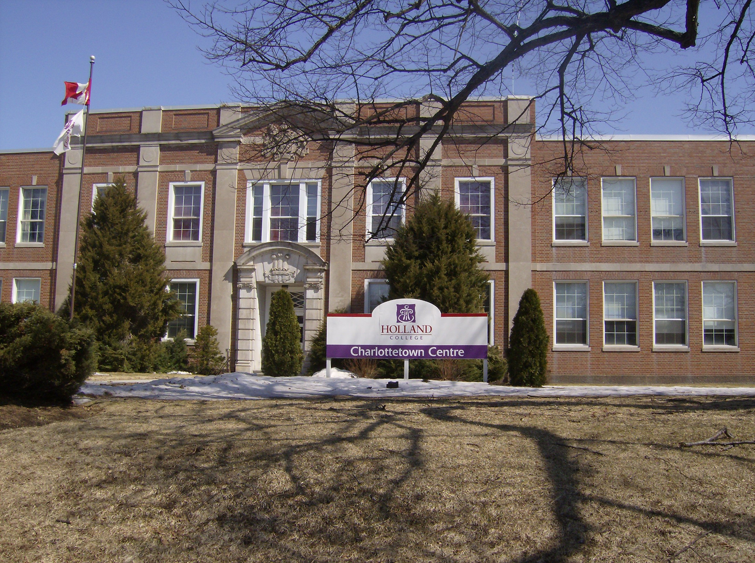
 Holland College is the province's community college.
English public schooling (gr. K-12) in Charlottetown is provided by the Eastern School District. French public schooling (gr. K-12) in the city is provided by the Commission scolaire de langue française.
The city has 4 private schools, mostly operated by religious denominations. These include Grace Christian School, Immanuel Christian School and Full Circle Co-operative School.
Charlottetown is home to the University of Prince Edward Island. UPEI has programs in Arts, Education, Science, Business, and Nursing. The provincial university also houses the Atlantic Veterinary College. UPEI has a number of sport teams that compete competitively in men's and women's hockey, soccer, rugby, basketball, and volleyball, and women's field hockey. These sports teams are called The Panthers.
Charlottetown is also home to several campuses of Holland College, the province's community college. In addition, there are various private training colleges in the city.
Sports
 The UPEI Panthers gear up for a hockey game.
Charlottetown has numerous parks and playing fields for soccer, baseball, softball, football, rugby, and field hockey. There are also many outdoor tennis courts, recreational trails, and running tracks. Most public schools in the city have gymnasiums available for public use outside of school hours and there are community-owned and operated hockey arenas and swimming pools, as well as several privately operated fitness centres.
Amateur varsity team sports are prevalent for males and females in the city's two senior high schools, Colonel Gray and Charlottetown Rural, as well as the University of Prince Edward Island's varsity teams (the UPEI Panthers) through the institution's affiliation with Canadian Interuniversity Sport. Holland College also has varsity teams, the Holland Hurricanes.
There is one junior hockey team in the community: the Quebec Major Junior Hockey League's P.E.I. Rocket franchise. There are currently no professional sports teams based in the city since the demise of the P.E.I. Senators.
Media
Main article: Media in CharlottetownNotable natives and residents
- Ahmed Nasry - The King Of Egypt
- Milton Acorn - Canadian poet
- Jared Connaughton - Canadian Olympic athlete
- Dorothy Corrigan - First and only female mayor of Charlottetown
- Lloyd Duffy - P.E.I. Sports Hall of Fame jockey
- Mike Duffy - Canadian Senator and television journalist
- Vern Handrahan - Former Major League Baseball player
- Haywire - Popular music group
- Safwan Javed - Member of Wide Mouth Mason[12]
- Lorie Kane - Professional LPGA golfer
- Joey Kitson - Lead singer of Juno nominated/seven time ECMA Award winning Celtic rock group, Rawlings Cross
- Troy Little - Comic book artist, graphic designer, co-creator of "Angora Napkin"
- Al MacAdam - former NHL player Minnesota North Stars
- Amber MacArthur - Canadian television personality
- David MacEachern - Olympic Gold Meadallist Canadian bobsledder
- Martha MacIsaac - Actress
- Tara MacLean - singer/songwriter
- Cynthia MacLeod - Fiddler ECMA Nominee/PEI Music Award winner
- Adam McQuaid - NHL player Boston Bruins
- Don Messer - Fiddler (originally born Fredericton, NB); Canadian radio then TV show, Don Messer's Jubilee
- Heather Moyse - Olympic Gold Medalist (Bobsledding)
- Chris Murphy - Member of Sloan
- Brad Richards - NHL hockey player
- Jackie Torrens - Two time Gemini Award winning (Made In Canada) comedian, actor, writer and journalist
- Jonathan Torrens - Gemini nominated actor, writer and producer
- Two Hours Traffic - Pop/Rock band
- Rick Vaive - former NHL player Toronto Maple Leafs
- Joel Ward - NHL hockey player Nashville Predators
References
- ^ a b c Statistics Canada. "2006 Census, PEI population and CA populations and dwelling counts". http://www12.statcan.ca/english/census06/data/profiles/community/Details/Page.cfm?Lang=E&Geo1=CMA&Code1=105__&Geo2=PR&Code2=11&Data=Count&SearchText=Charlottetown&SearchType=Begins&SearchPR=11&B1=All&Custom=. Retrieved 2007-03-13.
- ^ Statistics Canada. "2006 Census, population and dwelling counts". http://www12.statcan.ca/english/census06/data/profiles/community/Details/Page.cfm?Lang=E&Geo1=CSD&Code1=1102075&Geo2=PR&Code2=11&Data=Count&SearchText=Charlottetown&SearchType=Begins&SearchPR=11&B1=All&Custom=. Retrieved 2007-03-13.
- ^ Historical Biographies, Nova Scotia: Charles des Champs de BoishĂŠbert (1729-1797)
- ^ a b c d e "Canadian Climate Normals 1971-2000". Environment Canada. http://www.climate.weatheroffice.ec.gc.ca/climate_normals/results_e.html?Province=PEI%20&StationName=&SearchType=&LocateBy=Province&Proximity=25&ProximityFrom=City&StationNumber=&IDType=MSC&CityName=&ParkName=&LatitudeDegrees=&LatitudeMinutes=&LongitudeDegrees=&LongitudeMinutes=&NormalsClass=A&SelNormals=&StnId=6526&. Retrieved 2009-07-15.
- ^ Ethnocultural Portrait of Canada Highlight Tables: Charlottetown
- ^ 2006 Community Profiles - Census Subdivision
- ^ 2006 Community Profiles - Census Metropolitan Area/Census Agglomeration
- ^ "Offices." Prince Edward Air. Retrieved on May 29, 2009.
- ^ "Facts & Statistics". Charlottetown Airport. 2009. Archived from the original on 2008-06-20. http://web.archive.org/web/20080620075720/http://www.flypei.com/about_airport/ata_facts_stats.php. Retrieved 2009-05-23.
- ^ "Prince Edward Island Tourism Exit Survey"]. http://www.trc.upei.ca/exitsurvey.
- ^ "Charlottetown". Directory of Designations of National Historic Significance of Canada. Parks Canada. http://www.pc.gc.ca/apps/lhn-nhs/page3_E.asp?locateinp=charlottetown&nhsprov=Prince+Edward+Island&nhschoice=nhsdesig&list4=Generate+List. Retrieved 23 October 2011.
- ^ iii Official Website of Wide Mouth Mason iii
External links
Coordinates: 46°14′24″N 63°08′24″W / 46.24°N 63.1399°W
Neighbourhoods History and culture Government and politics Transportation Health and safety Education Media Sports and recreation Buildings and structures Province House · Government House · St. Dunstan's Basilica · All Souls' Chapel (Prince Edward Island) · St. Peter's Cathedral (Charlottetown) · Hotel Charlottetown · Jean Canfield Building Subdivisions of Prince Edward IslandSubdivisions Cities Charlottetown · SummersideTowns  Federal, provincial, and territorial capitals of CanadaOttawa, ON · Victoria, BC · Edmonton, AB · Regina, SK · Winnipeg, MB · Toronto, ON · Quebec City, QC · Fredericton, NB · Halifax, NS · Charlottetown, PE · St. John's, NL ·
Whitehorse, YT · Yellowknife, NT · Iqaluit, NUCategories:- Charlottetown
- Populated places established in 1764
- Populated coastal places in Canada


Wikimedia Foundation. 2010.