- Fairmont, West Virginia
-
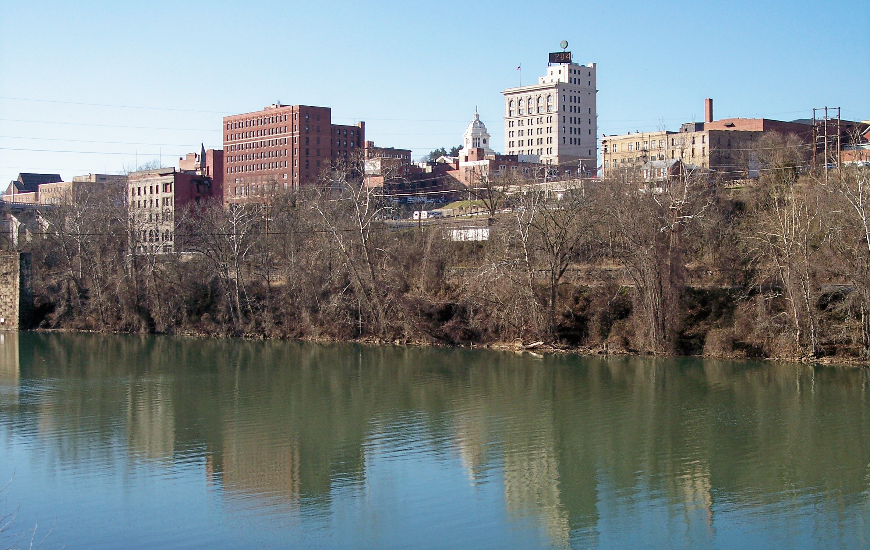
Fairmont, West Virginia — City — Downtown Fairmont and the Monongahela River in 2006
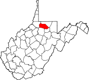
Nickname(s): "Friendly City" "Gymnastics Capital of West Virginia" Location of Fairmont, West Virginia
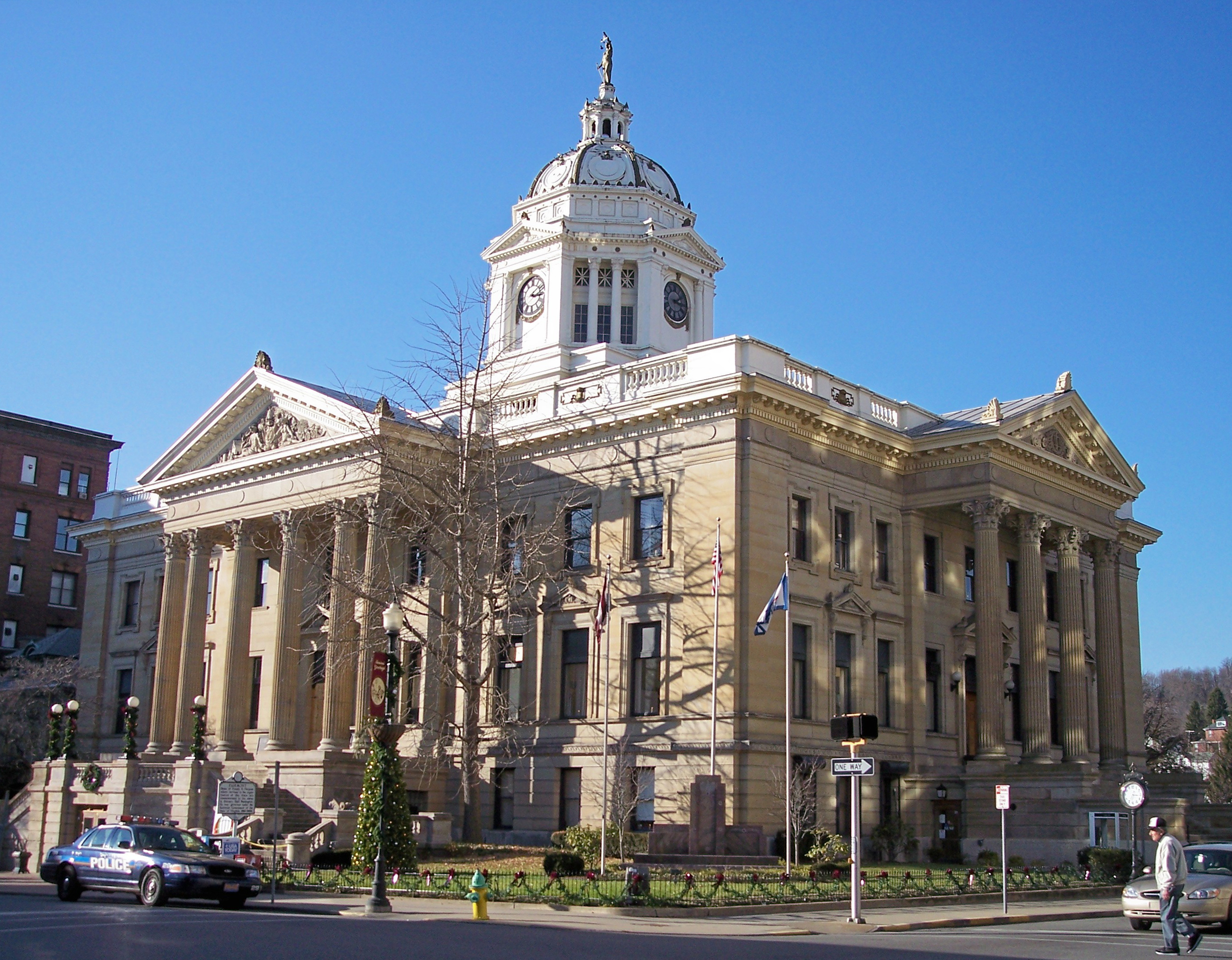
Coordinates: 39°28′53″N 80°8′36″W / 39.48139°N 80.14333°WCoordinates: 39°28′53″N 80°8′36″W / 39.48139°N 80.14333°W Country United States State West Virginia County Marion Government – Type Council-manager government – Mayor Bill Burdick – City Manager Jay Rogers – Deputy Mayor Bill Burdick Area – Total 8.2 sq mi (21.2 km2) – Land 7.8 sq mi (20.3 km2) – Water 0.4 sq mi (0.9 km2) Elevation 984 ft (300 m) Population (2008) – Total 19,024 – Density 2,438.5/sq mi (941.5/km2) Time zone Eastern (EST) (UTC-5) – Summer (DST) EDT (UTC-4) ZIP codes 26554-26555 Area code(s) 304 FIPS code 54-26452[1] GNIS feature ID 1560581[2] Website http://www.fairmontwv.gov/  The Marion County Courthouse in Fairmont.
Historical populations Census Pop. %± 1850 683 — 1860 704 3.1% 1870 621 −11.8% 1880 900 44.9% 1890 1,023 13.7% 1900 5,655 452.8% 1910 9,711 71.7% 1920 17,851 83.8% 1930 23,159 29.7% 1940 23,105 −0.2% 1950 29,346 27.0% 1960 27,477 −6.4% 1970 26,093 −5.0% 1980 23,863 −8.5% 1990 20,210 −15.3% 2000 19,097 −5.5% Est. 2008 19,024 −0.4% Fairmont is a city in Marion County, West Virginia, United States. Nicknamed "The Friendly City". The population was 19,097 at the 2000 census. It is the county seat of Marion County.[3]
Contents
History
- Established in 1820 as Middletown, then in Monongalia County, it was chartered by the Virginia General Assembly in 1843 as Fairmont, a contraction of "Fair Mountain".
- Country Club Bakery in Fairmont is "The Home of the Original Pepperoni Roll",[4] the first Father's Day service.[5]
- The former head of the art department at Fairmont State University, Luella Mundel, was the subject of a documentary called American Inquisition by Helen Whitney. Mundel was the victim of blacklisting during the McCarthy era, and the documentary showed how the negative effects of that era reached even smalltown West Virginia. This documentary was the subject of a very famous case about the First Amendment.[6]
- The site of the first Father's Day on July 5, 1908, originally celebrated in honor of the more than 200 fathers lost in the Monongah Mining disaster several months earlier. However, neither Fairmont nor the state of West Virginia chartered the holiday to make it official, so several other locales have erroneously taken credit for its inception over the years.[7]
- William S. Barnes born 1735, recognized patriot, militia man in the Revolutionary War, and progenitor of the Barnes family currently living in Fairmont and surrounding areas was the first person to live in what is currently Marion County and Fairmont, WV. He constructed a corn mill to process grain a short distance above where the Fairmont City Reservoir currently resides, and his pioneer house stood where the Fairmont Chemical Company is constructed.[8]
Geography
Fairmont is located at 39°28′53″N 80°8′36″W / 39.48139°N 80.14333°W (39.481253, -80.143453)[9]. The Tygart Valley River and the West Fork River join in Fairmont to form the Monongahela River. Buffalo Creek, a tributary of the Monongahela River, flows through the northern part of the city.[10]
According to the United States Census Bureau, the city has a total area of 8.2 square miles (21.2 km2), of which 7.8 square miles (20.3 km2) is land and 0.4 square miles (0.9 km2) (4.40%) is water.
Climate
Month Jan Feb Mar Apr May Jun Jul Aug Sep Oct Nov Dec Avg high (°F) 38 42 53 64 73 80 83 82 76 65 53 42 Avg low (°F) 20 22 30 38 49 57 61 60 53 41 33 25 Precipitation (in) 3.45 2.95 4.07 3.59 4.85 4.24 4.92 4.18 3.51 3.03 3.68 3.38 Source: weather.com
Transportation
Fairmont is located in the North-Central region of the state, along West Virginia's I-79 High Tech Corridor. Major highways include:
 Interstate 79
 U.S. Highway 19
 U.S. Highway 250
 West Virginia Route 310
Demographics
As of the census[1] of 2000, there were 19,097 people, 8,447 households, and 4,671 families residing in the city. The population density was 2,438.5 people per square mile (941.7/km2). There were 9,755 housing units at an average density of 1,245.6 per square mile (481.0/km2). The racial makeup of the city was 90.16% White, 7.26% African American, 0.26% Native American, 0.61% Asian, 0.02% Pacific Islander, 0.20% from other races, and 1.49% from two or more races. Hispanic or Latino of any race were 0.82% of the population.
There were 8,447 households out of which 21.4% had children under the age of 18 living with them, 40.2% were married couples living together, 11.7% had a female householder with no husband present, and 44.7% were non-families. 36.4% of all households were made up of individuals and 16.8% had someone living alone who was 65 years of age or older. The average household size was 2.16 and the average family size was 2.83.
In the city the population was spread out with 18.4% under the age of 18, 14.9% from 18 to 24, 24.1% from 25 to 44, 22.2% from 45 to 64, and 20.4% who were 65 years of age or older. The median age was 39 years. For every 100 females there were 87.0 males. For every 100 females age 18 and over, there were 83.3 males.
The median income for a household in the city was $25,628, and the median income for a family was $37,126. Males had a median income of $27,944 versus $20,401 for females. The per capita income for the city was $16,062. About 12.6% of families and 20.1% of the population were below the poverty line, including 22.0% of those under age 18 and 9.7% of those age 65 or over.
Local government
Fairmont has a Council-manager government, whereby the mayor serves as chairman of the city council and the city manager takes care of the day to day operations. The current mayor, Matt Delligatti, is Fairmont's youngest ever, at 22 years of age.[11]
Current City Council
- 1st District- Bob Gribben
- 2nd District- Bob Sapp
- 3rd District- Deborah Seifrit
- 4th District- Bill Burdick (Deputy Mayor)
- 5th District- Chuck Warner
- 6th District- Dan Weber
- 7th District- Rob Garcia
- 8th District- Robin Smith
- 9th District- Matt Delligatti (Mayor)
Past Mayor
Name Term Frank Pierpont Hall Matthew M. Neely 1908–1910 William Conaway A.C. West Fred T. Wilson 1935–1940 Fred T. Wilson 1944–1945 Albert F. Robertson 1947–1950 James H. Hanway 1951–1955 Wiliam G. Meyer 1959 Forrest L. Springer Albert F. Robinson J. Richard Davis William M. Hawkins Gregory T. Hinton Charles G. Manly II Nick L. Fantasia S. Scott Sears 2007–2009 Matt Delligatti 2009-? Landmarks
Fairmont Senior High School
Main article: Fairmont Senior High SchoolFairmont Senior High School (FSHS) is an historic secondary school, listed on the National Register of Historic Places on March 22, 2002.[12] Architect William B. Ittner, who is responsible for over three dozen entries in the National Register, designed the school in the late 1920s. The school's architectural classification is Colonial Revival, with a stone foundation, brick walls, and asphalt shingle roofing.
Fairmont State University
Main article: Fairmont State UniversityFairmont State University is a public university with an approximate enrollment of 7,700 students. The institution offers masters degrees in business, education, teaching, criminal justice and nursing in addition to 90 baccalaureate and 50 associate degrees.
Pricketts Fort State Park
Main article: Prickett's Fort State ParkPricketts Fort is a 22-acre (8.9 ha) West Virginia state park and site of an historic fort built to defend early European settlers from raids by hostile Native Americans. The feuds were generally over territory the settlers appropriated following the Treaty of Fort Stanwix (1768).
Other
- Valley Falls State Park is also located nearby to the east.
- The Johnnie Johnson (musician) Blues & Jazz Festival is held annually in Fairmont, WV.
- Fairmont's National White Collar Crime Center provides nationwide support to law enforcement agencies involved in prevention, investigation, and prosecution of economic and high-tech crime.
- NASA Independent Verification and Validation Facility, governed by the Goddard Space Flight Center, houses more than 150 full-time employees and more than 20 in-house partners and contractors.[13]
- The Jacobs-Hutchinson Block building, also known as Peoples' National Bank and Friendly Furniture Store
Notable natives
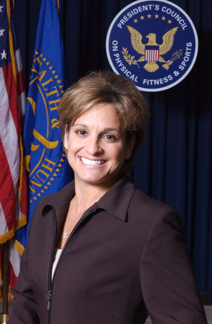
 Mary Lou Retton, the first female gymnast from outside Eastern Europe to win the Olympic all-around title.
 Nick Saban,head coach of the Alabama Crimson Tide college football team and winner of two National Championships
- Tony Adamle, played in the NFL for the Cleveland Browns (1947–1951, 1954).
- Frank J. Breth, United States Marine Corps brigadier general.
- Mike Caputo, Member of the West Virginia House of Delegates, representing the 43rd District.
- Joe Cerisano, musician, "Be All That You Can Be" "Hands Across America"
- Ann K. Covington, former chief justice of the Supreme Court of Missouri, the first woman to hold that position.
- Frank Kendall Everest, Jr., U.S. Air Force officer who is best remembered as an aeroengineer and test pilot during the 1950s. Once known as The Fastest Man Alive.
- Ron Everhart, Head basketball coach at Duquesne University. Previously, held the same position at Northeastern University and McNeese State University.
- Art Finley, North American television and radio personality, mostly in San Francisco and Vancouver, remembered by many as "Mayor Art," the host of a live children's show that aired on KRON-TV in San Francisco beginning in 1959 through 1966.
- Aretas B. Fleming, 8th Governor of West Virginia.
- Carrie Watson Fleming, First Lady of West Virginia, 1890–1893
- Frank Cruise Haymond, Judge of the West Virginia Supreme Court of Appeals, 1945-1972
- Thomas Haymond, a nineteenth century congressman and lawyer.
- Philip C. Jimeno Long-serving member of the Maryland State Legislature.
- Johnnie Johnson, Piano player and blues musician, member of the Rock and Roll Hall of Fame.
- Fuzzy Knight, film and television actor, appeared in over 180 films between 1929 and 1967, usually as a cowboy hero's sidekick.
- John Knowles, author
- Alan Mollohan, former member of United States House of Representatives, who represented West Virginia's 1st district.
- Luella Mundel, professor and McCarthyism victim
- Michael Oliverio II, member of the West Virginia Senate, representing the 13th District.
- Doris Piserchia, science fiction writer.
- Roman W. Prezioso, Jr., West Virginia state senator representing the 13th senatorial district.
- Francis H. Pierpont, Governor of the union controlled parts of Virginia during the American Civil War, known as the "father of West Virginia."
- Mary Lou Retton, American Olympic gold medal winner, member of the President's Council on Physical Fitness and Sports.[14]
- Nick Saban, Head coach of University of Alabama football team.
- Jeffrey Tinnell, Motion picture producer and publisher of graphic novels.
- Robert Tinnell, Motion picture screenwriter, director, and producer, the author of several comic books and graphic novels.
- Hershel W. Williams, awarded the Medal of Honor for his outstanding heroism in the Battle of Iwo Jima.
- Clarence Wayland Watson, Founded several companies that became Consolidation Coal and Mining Companies, United States Senator from West Virginia from 1911 to 1913.
See also
- Fairmont State University
- Fairmont Marion County Transit Authority
- Floyd Abrams and the McCarthy documentary case
- West Virginia
References
- ^ a b "American FactFinder". United States Census Bureau. http://factfinder.census.gov. Retrieved 2008-01-31.
- ^ "US Board on Geographic Names". United States Geological Survey. 2007-10-25. http://geonames.usgs.gov. Retrieved 2008-01-31.
- ^ "Find a County". National Association of Counties. http://www.naco.org/Counties/Pages/FindACounty.aspx. Retrieved 2011-06-07.
- ^ Pepperoni Roll History
- ^ WV Culture
- ^ Floyd Abrams, Speaking Freely, published by Viking Press (2005), Page 153-58
- ^ [1]
- ^ [2]
- ^ "US Gazetteer files: 2010, 2000, and 1990". United States Census Bureau. 2011-02-12. http://www.census.gov/geo/www/gazetteer/gazette.html. Retrieved 2011-04-23.
- ^ West Virginia Atlas & Gazetteer. Yarmouth, Me.: DeLorme. 1997. p. 25. ISBN 0-89933-246-3.
- ^ Times WV
- ^ "National Register Information System". National Register of Historic Places. National Park Service. 2008-04-15. http://nrhp.focus.nps.gov/natreg/docs/All_Data.html.
- ^ NASA IV&V Facility
- ^ Biography of Mary Lou Retton
External links
- City of Fairmont website
- Times West Virginian newspaper
- Main Street Fairmont
- Fairmont State University
- Fairmont Community Development Partnership
- Fairmont/Morgantown Housing Authority
- Pepperoni Roll History
- Marion County Historical Society
- Fairmont Connections
Municipalities and communities of Marion County, West Virginia County seat: FairmontCities Fairmont | Mannington | Pleasant Valley
Towns Barrackville | Fairview | Farmington | Grant Town | Monongah | Rivesville | White Hall | Worthington
CDPs Carolina | Idamay | Rachel
Unincorporated
communitiesBaxter | Beverly Hills | Big Run | Brink‡ | Colfax | Four States | Grays Flat | Hebron | Hopewell | Kingmont | Logansport | Metz | Montana | Pine Grove | Stringtown
Footnotes ‡This populated place also has portions in an adjacent county or counties
Categories:- Cities in West Virginia
- County seats in West Virginia
- Fairmont, West Virginia
- University towns in the United States
- Micropolitan areas of West Virginia
- Populated places in Marion County, West Virginia


Wikimedia Foundation. 2010.