- Colorado State Highway 7
-
"CO 7" redirects here. For the congressional district, see Colorado's 7th congressional district.
State Highway 7

Route information Maintained by CDOT Length: 81.64 mi[1] (131.39 km) Major junctions West end:  US 36 in Estes Park
East end:  I-76 in Brighton
Location Counties: Larimer, Boulder, Weld (south boundary), Broomfield, Adams Highway system ←  US 6
US 6SH 8  →
→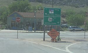 State Highway 7 meets U.S. Highway 36 at the small town of Lyons.
State Highway 7 in the U.S. state of Colorado is a state highway. Approximately 83 miles (134 km) long, it is located in the north-central portion of the state, traversing the mountains on the east of the continental divide south of Estes Park as well as portions of the Colorado Piedmont north of Denver. The northwestern segment of the highway is part of the Peak-to-Peak Scenic Byway and furnishes an access route to Estes Park, Colorado and Rocky Mountain National Park. In its southeast portion it skirts the northern end of the Denver Metropolitan Area, providing an access route connecting Boulder, Lafayette and Brighton with Interstate 25 and Interstate 76.
The western terminus is at the junction of U.S. Highway 36 at N. St. Vrain and S. St. Vrain avenues in Estes Park. The eastern terminus is at Interstate 76 exit 25 in Brighton. The portion between Lyons and Boulder, where it is concurrent with US 36, is unsigned. The highway is two lanes along the entire route except for portions in the cities and towns.
Contents
Route description
From Estes Park, Route 7 climbs into the mountains of southwest Larimer County and skirts the east side of Rocky Mountain National Park, providing the closest vehicle approach to the popular trailhead to the summit of Longs Peak. Near the community of Raymond it intersects State Highway 72, which takes the Peak-to-Peak Scenic Byway designation with it to the south, while Route 7 turns to the east and follows the St. Vrain River downstream onto the piedmont at Lyons, where it intersects U.S. Highway 36. South of Lyons it is concurrent with U.S. 36 along the base of the foothills to Boulder. (This section is signed only as U.S. 36.) It is also concurrent with State Highway 119 on 28th Street within Boulder. It runs straight east from Boulder as the extension of Arapahoe Avenue to U.S. Highway 287 north of Lafayette, jogging one mile (1.6 km) to the south while concurrent with U.S. 287, then going due east again, as Baseline Road, to Interstate 25. East of I-25 it jogs one mile (1.6 km) south, then due east as 160th Avenue (part of the Greater Denver street numbering system) through Brighton to Interstate 76 in the eastern part of Brighton.
History
The route was established in the 1920s. It began at Estes Park and traveled south to Lyons south to Boulder. It then continued to its terminus at U.S. Route 87 in Lafayette. The route was paved from Boulder to Lafayette in 1932 and from Estes Park to Lyons in 1936. In 1939, the route was extended southward to Brighton, where it met U.S. Route 6; this extension was paved by 1946. In 2006, the section on Broadway between US 36 and Canyon Boulevard in Boulder was turned back to the City of Boulder, and Route 7 was rerouted to be concurrent (unsigned) with US 36 on 28th Street through Boulder.[2]
Major intersections
County Location Mile Destination Notes Larimer Estes Park 0.000 US 36Start of route Boulder Alenspark 14.910  SH 7 Bus. Loop
16.080 SH 7 Bus. Loop19.24  SH 72
SH 72Lyons 32.99 US 36Begin US 36 concurrency Boulder 50.89  SH 119
Begin SH 119 concurrency 52.29 SH 119End SH 119 concurrency 52.48 US 36End US 36 concurrency 53.45  SH 157
Foothills Parkway Lafayette 59.29  SH 42
SH 4260.68  US 287
Begin US 287 concurrency 61.87 US 287End US 287 concurrency Broomfield 68.38 
 I-25 / US 87
Adams Brighton 76.98  US 85
US 8577.29  SH 2
SH 281.64 I-76 / US 6End of route 1.000 mi = 1.609 km; 1.000 km = 0.621 mi References
- ^ "Segment list for SH 7". http://www.dot.state.co.us/app_DTD_DataAccess/Highways/index.cfm?fuseaction=Description&route=007&begRefPt=0&endRefPt=500&Printable=true. Retrieved 2007-05-12.
- ^ Salek, Matthew E.. "Colorado Routes 1-19". http://www.mesalek.com/colo/r1-19.html#7. Retrieved 2010-05-17.
Categories:- State highways in Colorado
- Transportation in Larimer County, Colorado
- Transportation in Boulder County, Colorado
- Transportation in Weld County, Colorado
- Transportation in Broomfield County, Colorado
- Transportation in Adams County, Colorado


Wikimedia Foundation. 2010.