- Waunakee, Wisconsin
Infobox Settlement
official_name = Waunakee, Wisconsin
settlement_type = Village
nickname =
motto =
imagesize =
image_caption =
image_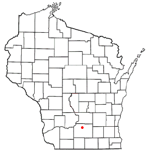
mapsize = 250px
map_caption = Location of Waunakee, Wisconsin
mapsize1 =
map_caption1 =subdivision_type = Country
subdivision_name =United States
subdivision_type1 = State
subdivision_name1 =Wisconsin
subdivision_type2 = County
subdivision_name2 = Danegovernment_footnotes =
government_type =
leader_title =
leader_name =
leader_title1 =
leader_name1 =
established_title =
established_date =unit_pref = Imperial
area_footnotes =area_magnitude =
area_total_km2 = 15.4
area_land_km2 = 15.4
area_water_km2 = 0.0
area_total_sq_mi = 6.0
area_land_sq_mi = 6.0
area_water_sq_mi = 0.0population_as_of = 2000
population_footnotes =
population_total = 8995
population_density_km2 = 583.0
population_density_sq_mi = 1509.9timezone = Central (CST)
utc_offset = -6
timezone_DST = CDT
utc_offset_DST = -5
elevation_footnotes = GR|3
elevation_m = 283
elevation_ft = 928
latd = 43 |latm = 11 |lats = 14 |latNS = N
longd = 89 |longm = 27 |longs = 8 |longEW = Wpostal_code_type =
postal_code =
area_code =
blank_name = FIPS code
blank_info = 55-84350GR|2
blank1_name = GNIS feature ID
blank1_info = 1576318GR|3
website =
footnotes =Waunakee is a village in Dane County,
Wisconsin ,United States . The population was 8,995 at the 2000 census. A 2004 estimate places the population at 10,002. Waunakee bills itself as "the only Waunakee in the World".Geography
Waunakee is located at coor dms|43|11|14|N|89|27|8|W|city (43.187253, -89.452244)GR|1.
According to the
United States Census Bureau , the village has a total area of 6.0square mile s (15.4km² ), all of it land.Demographics
As of the
census GR|2 of 2000, there were 8,995 people, 3,203 households, and 2,379 families residing in the village. Thepopulation density was 1,509.9 people per square mile (582.7/km²). There were 3,295 housing units at an average density of 553.1/sq mi (213.5/km²). The racial makeup of the village was 98.07% White, 0.36% African American, 0.08% Native American, 0.51% Asian, 0.01% Pacific Islander, 0.24% from other races, and 0.73% from two or more races. Hispanic or Latino of any race were 0.96% of the population.There are 3,203 households out of which 46.3% have children under the age of 18 living with them, 63.3% were married couples living together, 8.5% had a female householder with no husband present, and 25.7% were non-families. 20.2% of all households were made up of individuals and 8.9% had someone living alone who was 65 years of age or older. The average household size was 2.76 and the average family size was 3.23.
In the village the population was spread out with 32.1% under the age of 18, 6.3% from 18 to 24, 33.4% from 25 to 44, 18.6% from 45 to 64, and 9.5% who were 65 years of age or older. The median age was 35 years. For every 100 females there were 94.8 males. For every 100 females age 18 and over, there were 90.2 males.
The median income for a household in the village was $59,225, and the median income for a family was $67,894. Males had a median income of $45,053 versus $30,163 for females. The
per capita income for the village was $25,952. About 0.4% of families and 1.7% of the population were below thepoverty line , including 0.4% of those under age 18 and 2.0% of those age 65 or over.Established housing developments include Sixmile Creek, Southbridge, and Carriage Ridge among others. Waunakee also added a local Village Center in 2006 that acts as a central nucleus for the community by offering a fitness center, meeting rooms, and a gymnasium.
Education
Waunakee Community School District: [http://www.waunakee.k12.wi.us]
*Arboretum Elementary School
*Heritage Elementary School
*Prairie Elementary School
*Waunakee High School
*Waunakee Intermediate School
*Waunakee Middle SchoolSt. John the Baptist School, Waunakee's Roman Catholic elementary school [http://www.stjb.org/school/school.htm]Notable people
*
Robert Campbell Reeve , founder ofReeve Aleutian Airways
*Georgia Thompson
*J.B. Van Hollen ,Attorney General of WisconsinReferences
External links
* [http://www.vil.waunakee.wi.us/ Village of Waunakee]
* [http://www.waunakeetribune.com/ Waunakee Tribune newspaper]
Wikimedia Foundation. 2010.