- Northwich Community Woodlands
-
Coordinates: 53°15′50″N 2°33′18″W / 53.264°N 2.555°W
 Carden's Ferry Bridge over Witton Brook, connecting Anderton Nature Park to Carey Park.
Northwich Community Woodlands is an area of 374 hectares of publicly-accessible countryside to the north of Northwich in Cheshire, England. Much of the land was formerly industrial and used for mining salt and manufacturing chemicals. The extraction of salt caused subsidence leading to the formation of pools known as flashes. The land became derelict during the 20th century as the salt industry collapsed. Much of the area has now been reclaimed for the purposes of conservation and recreation and forms part of the Mersey Forest initiative.
Contents
Description
 Marbury Country Park
Northwich Community Woodlands is made up a number of different sites: Marbury Country Park, Anderton Nature Park, Dairy House and Witton Mill Meadows, Uplands and Hopyard's Woods, Neumann's and Ashton's Flashes, Furey Woods and Carey Park.
Marbury Country Park
-
Main article: Marbury Park
In the north of the area beside Budworth Mere is Marbury Country Park. It was formerly a country estate owned by the Smith-Barry family but it became derelict and Marbury Hall was demolished in 1968. The site was reclaimed in 1975 and is now run as a country park by Cheshire West and Chester Council. An arboretum, ice-house and avenues of lime trees remain from former times. An area of ancient woodland known as Big Wood is important for wildlife with a variety of woodland birds including lesser spotted woodpecker.
 Haydn's Pool in Anderton Nature Park
Anderton Nature Park
Anderton Nature Park stretches along the north side of the River Weaver and Witton Brook from Anderton Boat Lift in the west to Haydn's Pool (formerly Marbury No. 1 Sludge Bed) in the east. A number of paths lead through grassland and recently-planted woodland. Wildlife includes uncommon flowers such as pennyroyal. Haydn's Pool is important for waterbirds including regular green sandpiper.
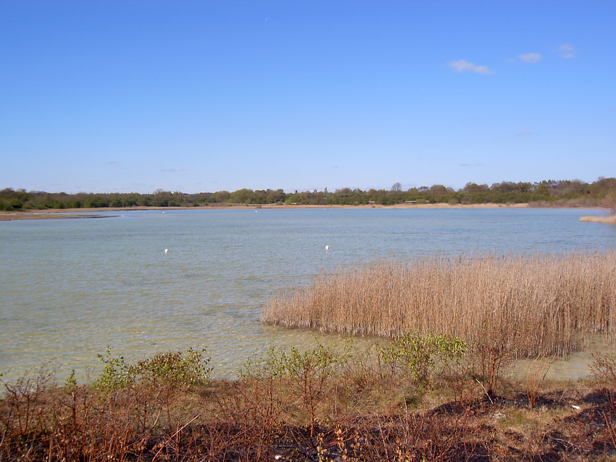
Neumann's and Ashton's Flashes
 Neumann's Flash
These flashes lie at the south-east of the site. From the 1940s they were used by ICI to store lime waste but by the 1970s they had become disused. Paths and bird hides have now been constructed around them.
A number of plants associated with alkaline soils grow on the site including fragrant orchid, marsh helleborine, ploughman's spikenard, and yellow-wort. It is a stronghold for the dingy skipper butterfly. A variety of ducks, waders, and other waterbirds occur and numerous rarities have been recorded such as broad-billed, stilt sandpipers, Caspian, and whiskered terns.
Witton Lime Beds SSSI
Immediately to the west of Neumann's and Ashton's Flashes, in a loop of Witton Brook, lies Witton Lime Beds, a Site of Special Scientific Interest.[1][2]
References
- Cheshire County Council (2005) Northwich Community Woodlands: Steps through time. Accessed 17/04/08.
- Guest, Jonathan & Hutcheson, Malcolm (1997) Where to watch birds in Cumbria, Lancashire & Cheshire, Christopher Helm, London.
- Northwich Community Woodlands website. Accessed 17/04/08.
- ^ Natural England: Witton Lime Beds (accessed 16 April 2010)
- ^ Natural England: Witton Lime Beds SSSI (accessed 16 April 2010)
External links
Categories:- Parks and open spaces in Cheshire
- Environment of Cheshire
- Northwich
-


Wikimedia Foundation. 2010.