- Archaeological plan
In an
archaeological excavation , an archaeological plan is a drawn record of features (and artifacts) in the horizontal plane. It can either take the form of a "multi context" plan, which is drawn with many contexts on it to show relationships between these features as part of some phase or alternatively a single context plan with a single feature is drawn . Excavated features are drawn in three dimensions with the help of drawing conventions such ashachures . Single context planning developed by theMuseum of London has become the professional norm. The basic advantage of single context planning is context plans draw on transparent perma-trace paper can be overlaid for re-interpretation at a later date. Multi-context Plans as opposed to single context plans can be made of complete sites, trenches or individual features. In theUnited Kingdom , thescale of the plans is usually 1:20. They are linked to the site recording system by the inclusion of knowngrid point s and height readings, taken with adumpy level or atotal station (seesurveying ). Excavation of a site by the removal of human made deposits in the reverse order they were created is the preferred method of excavation and is referred to as stratigraphic area excavation "in plan" as opposed to excavation "in section". Plan and section drawings [http://en.wikipedia.org/wiki/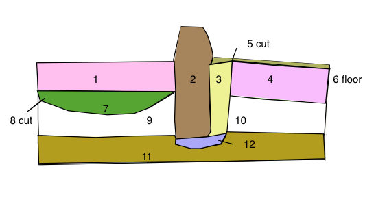
] have an interpretive function as well as being part of the recording system, because the draughts-person makes conscious decisions about what should be included or emphasised.The grid
It is common and good practice on excavations to lay out a grid of 5m squares so as to facilitate planning. This grid is marked out on-site with grid pegs that form the baselines for tapes and other planning tools to aid the drawing of plans. It is also common practice that planning is done for each context on a separate piece of perma-trace that conforms to these 5m grid squares. This is part of the
single context recording system "(see Fig 1.)" The site grid should be tied into a nationalgeomatic database such as theOrdnance survey Planning drawing conventions
Archaeological planners use various symbols to denote characteristics of features and contexts and while conventions vary depending on practitioner, the following are representative:
Pre-excavation and base plans
On sites with little stratigraphic depth, a pre-excavation multi-context plan is sometimes made of all visible features before any excavation is carried out. This helps in planning strategy since problems of stratigraphy on rural sites are minimal as features often cut into the natural minimizing issues of inter-cutting features. conversely planning a multi-context urban site is difficult to achieve on a multi context plan as the features and deposits when planned will obscure each other on the same planning sheet.
Critics of pre-excavation planning
Pre-excavation plans have been critiqued as being of limited use on urban or deeply stratified sites and have also been attacked in professional archeology where they have been described as a misused tool of the unscrupulous operators to give the impression the
archaeological record for a given site has been dealt with adequately.This critical point of view contends, that comparisons between pre and post-excavation plans can demonstrate that a site has not been comprehensively excavated on the basis of a pre-ex plan alone. In many cases there is a pronounced difference between the two phases of planning. Although many features may be visible at ground level following machining, it is often the case that the true limits of features are not so initially discernible until the area of the feature is fully cleaned and subsequently excavated revealing further features and relationships lower in the sequence.
See also
*
Archaeological illustration
*Single context recording
*Archaeological field survey
*Archaeological context
*Excavation
*Cut (archaeology)
*Archaeological section
*Feature (archaeology)
*Geomatics
*Harris matrix References
*The MoLAS archaeological site manual MoLAS, London 1994. ISBN 0-904818-40-3. Rb 128pp. bl/wh
Wikimedia Foundation. 2010.