- Columbia Plateau Trail
-
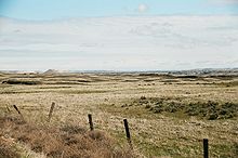
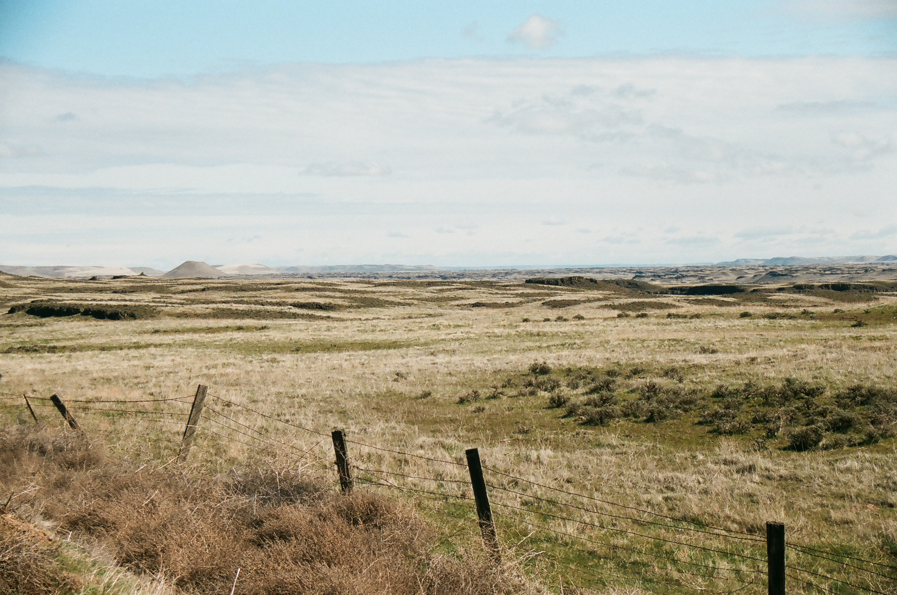
 View from a stretch of the trail between the Martin Road and Amber Lake trailheads.
The Columbia Plateau Trail is a 130-mile (210 km)-long 20-foot (6.1 m)-wide corridor in eastern Washington State along the abandoned right-of-way of the former Spokane, Portland and Seattle Railway. It runs between Cheney, Washington and Pasco at the confluence of the Snake River and Columbia River. It passes through parts of five counties in southeastern Washington. It is open to public for recreational use as part of the Washington State Park system. Uses include wildlife viewing, hiking, mountain bicycling, horseback riding and, in paved portions, in-line skating.[1][2]
Contents
Wildlife
 Scablands in the vicinity of Cow Creek
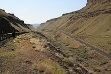
 The Trail runs along the lower Snake River ~ 10 miles (16 km) above its confluence with the Columbia River. The Trail lies over 100 feet (30 m) above the river at this location; the railroad trestle to the upper right is part of the trail.
The northern portion of the trail passes through the primarily ponderosa pine/grassland mixed with exposed basalt cliffs and areas of meadow and shrub-steppe. It bisects the Turnbull National Wildlife Refuge, which encompasses approximately 16,000 acres (65 km2) of the channeled scablands. The numerous erosion-created potholes have formed over 130 marshes, wetlands and lakes which attract a wide range of waterfowl; more than 200 different kinds of birds have been recorded in this area. The Turnbull National Wildlife Refuge was established in 1937 to provide productive breeding and nesting grounds for migratory birds. Other wildlife which inhabit the reserve include elk, mule deer, white-tailed deer, coyotes, badgers, porcupines, muskrats, and beavers.[3][4]
Geological features
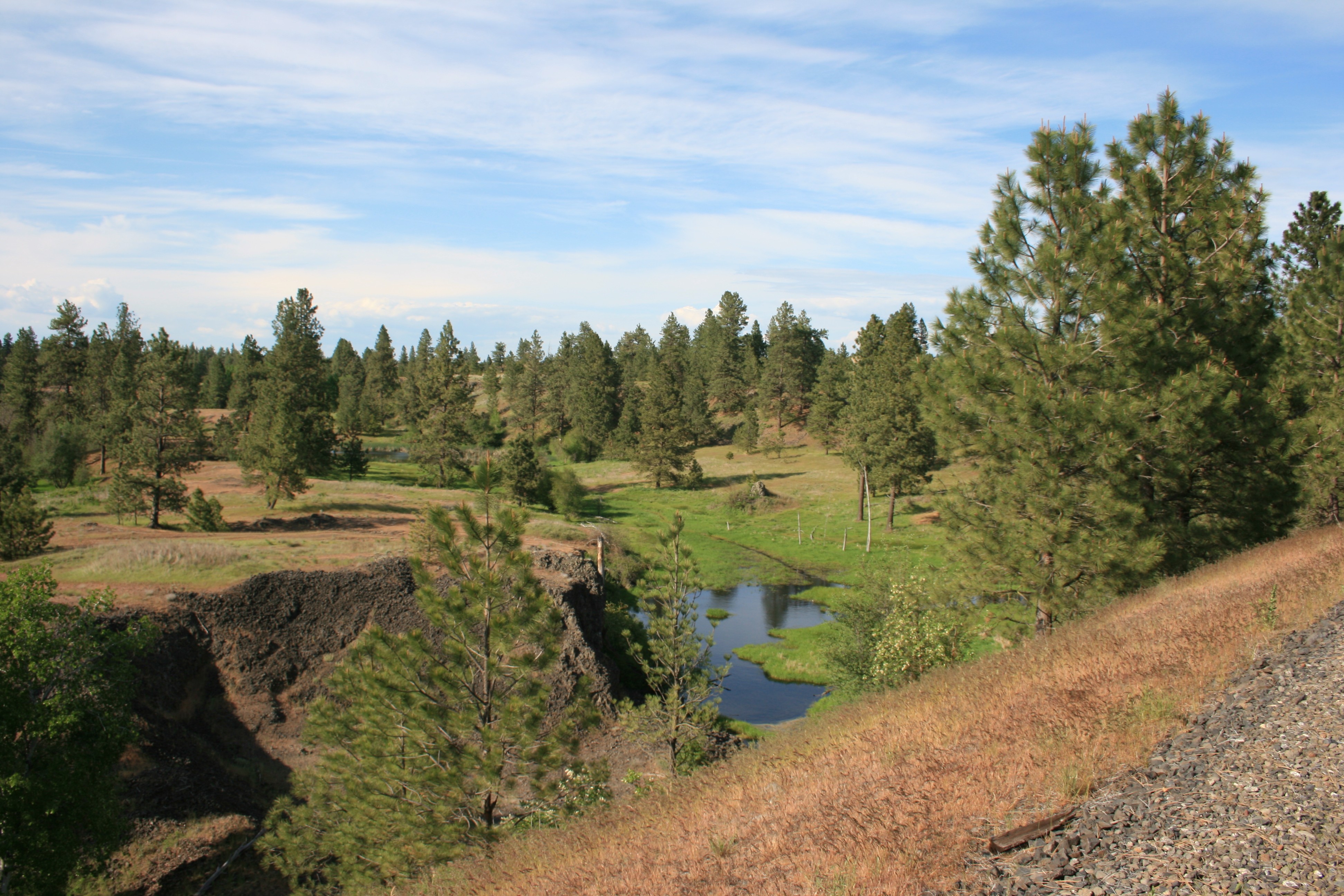
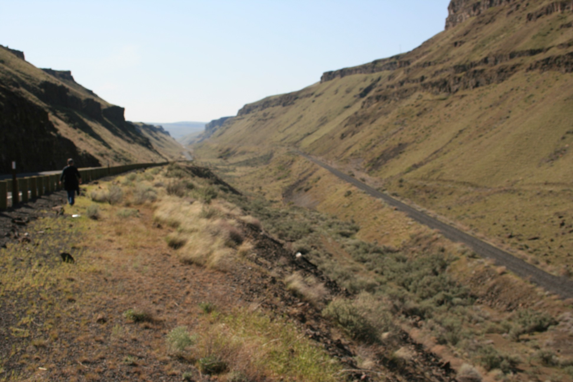
 The Columbia Plateau Trail, seen to the right, drops down 400 feet (120 m) in altitude as it descends through Devils Canyon to the Snake River.
As it crosses the Columbia River Plateau it passed through the unique geological erosion features of the channeled scablands created by the cataclysmic Missoula Floods that swept periodically across this portion of eastern Washington as well as other parts of the Columbia River Plateau during the Pleistocene epoch. The trail follows one of the many paths taken by the Missoula Floods as they cut through the Columbia River Basalt. Notable geologic features which the trail passes include the Cow Creek scabland, the point at which the Palouse River departs its former course (captured by ice-age flood erosion), Washtucna Coulee (the abandoned course of the Palouse River scoured wide by the floods), Devil’s Canyon (a dry straight 4-mile (6.4 km) long former flood channel which descends to the Snake River), giant current-created ripples formed by the flood currents in the low lands along the Snake River, and the Walker Bar, created by the outflow of the floods.[5]
Access points
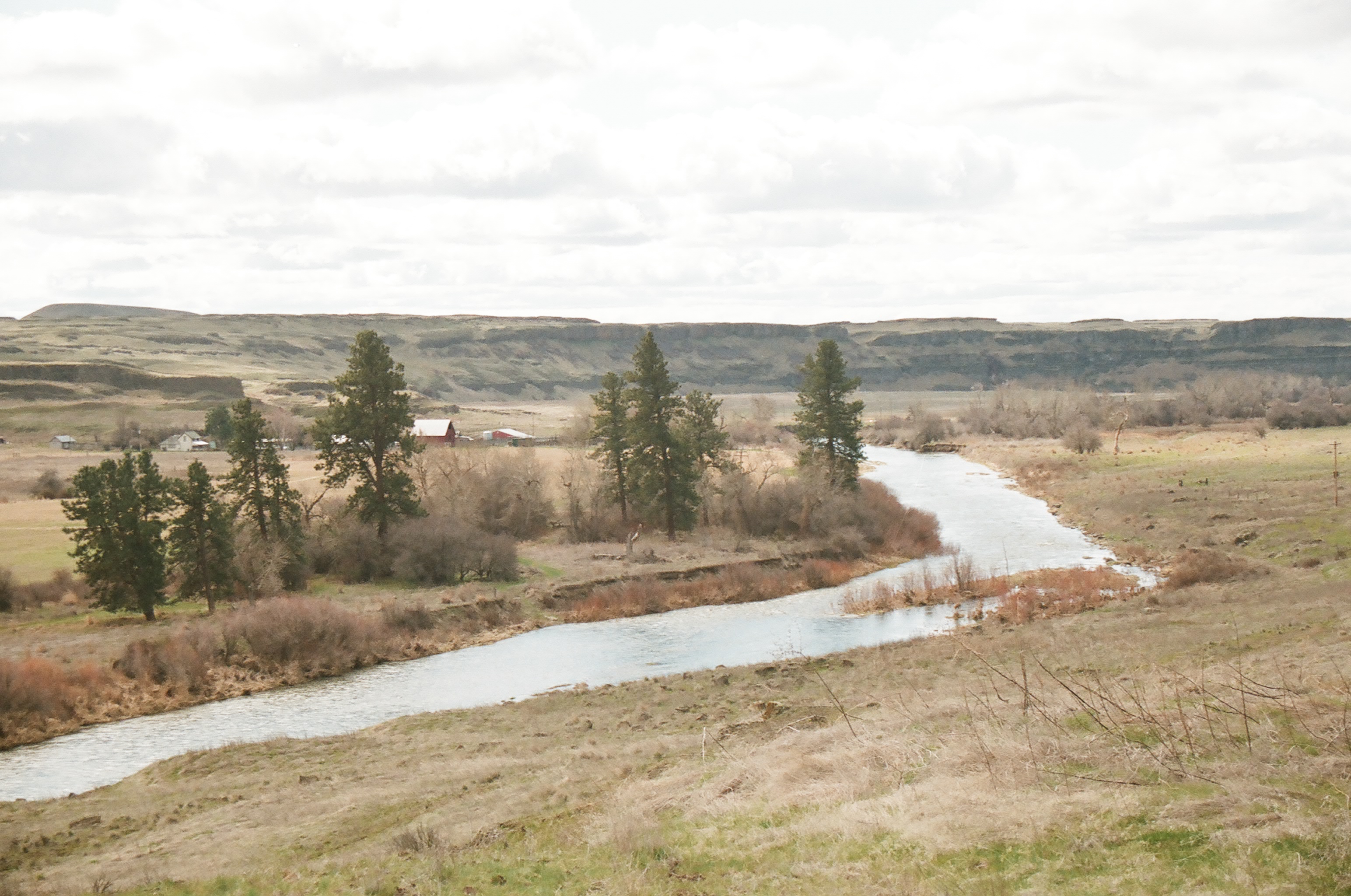
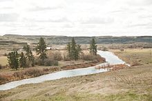 The trail follows the Palouse River for a portion of its course
Proceeding from the northeast toward the southwest, major access points include:
- Fishlake trailhead - Milepost 365
- Cheney Trailhead - Milepost 361.25
- Amber Lake Trailhead - Milestone 349.25
- Martin Road Trailhead - Milestone 342
- Lamont Trailhead
- John Wayne Pioneer Trail intersection (no trailhead)
- Benge Trailhead
- Washtucna Trailhead (Trail Administrative Area in downtown Washtucna)
- Kahlotus Trailhead & Visitor Center 46°38′41.77″N 118°33′17.67″W / 46.6449361°N 118.5549083°W
- Snake River Junction Trailhood
- Ice Harbor Dam Trailhead 46°14′58″N 118°52′46″W / 46.24944°N 118.87944°W
- Sacajawea State Park Pasco
References
- ^ Columbia Plateau Trail State Park
- ^ Edited (2006). Columbia Plateau Trail. Washington State Parks & Recreation Commission. ISBN.
- ^ Turnbull National Wildlife Refuge
- ^ Turnbull National Wildlife Refuge is located in an area of northeastern Washington on the eastern edge of the Columbia River Basin
- ^ Bjornstad, Bruce (2006). On the Trail of the Ice Age Floods: A Geological Guide to the Mid-Columbia Basin. Keokee Books; Sand Point, Idaho. ISBN 978-1-879628-27-4.
Categories:- Protected areas of Adams County, Washington
- Protected areas of Franklin County, Washington
- Hiking trails in Washington (state)
- Protected areas of Lincoln County, Washington
- Protected areas of Spokane County, Washington
- Washington (state) state parks
- Rail trails in Washington (state)
- Protected areas of Whitman County, Washington

Wikimedia Foundation. 2010.