- Menomonee Falls, Wisconsin
-
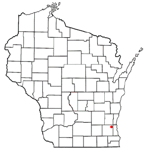
Menomonee Falls, Wisconsin — Village — Location of Menomonee Falls, Wisconsin
Coordinates: 43°10′44″N 88°7′2″W / 43.17889°N 88.11722°WCoordinates: 43°10′44″N 88°7′2″W / 43.17889°N 88.11722°W Country United States State Wisconsin County Waukesha Area – Total 33.3 sq mi (86.2 km2) – Land 33.3 sq mi (86.2 km2) – Water 0.0 sq mi (0.0 km2) Elevation[1] 856 ft (261 m) Population (2010) – Total 35,626 – Density 981.1/sq mi (378.8/km2) Time zone Central (CST) (UTC-6) – Summer (DST) CDT (UTC-5) FIPS code 55-51000[2] GNIS feature ID 1569346[3] Menomonee Falls is a village in Waukesha County, Wisconsin, United States, and is part of the Greater Milwaukee area. The population was 35,626 at the 2010 census, making it the most populous village in Wisconsin.[4] It is the fourth largest community in Waukesha County. The village's motto is "More than a village," referring to the excellence of its community and the fact that it is Wisconsin's largest village.
Contents
History
The village was incorporated in 1892. It was named after the Menomonee River, which flows through the village and subsequent waterfall which is showcased in the heart of the community.
Government
Menomonee Falls has a governing body consisting of a Board President and a six-member Board of Trustees. The current Village Board President is Randy Newman.The Trustees are: Sharon Ellis, Dennis M. Farrell, James A. Jeskewitz, Michael K. McDonald, Stephen C. Raymonds, Jeffrey R. Steliga.[5]
Geography
According to the United States Census Bureau, the village has a total area of 33.3 square miles (86 km2). 99.97% of it is land and 0.03% is water.
Neighborhoods
Fussville is a neighborhood of Menomonee Falls located at 43°09′06″N 88°04′40″W / 43.15167°N 88.07778°W.[6] Fussville was once a separate unincorporated community; it was annexed by Menomonee Falls sometime between 1950 and 1960.[7]
 Menomonee Falls Water Tower
Demographics
In the census[2] of 2010, there were 35,626 people, 12,844 households, and 9,299 families residing in the village. The population density was 981.1 people per square mile (378.8/km²). There were 13,140 housing units at an average density of 394.9 per square mile (152.4/km²). The racial makeup of the village was 96.50% White, 1.47% African American, 0.16% Native American, 0.88% Asian, 0.02% Pacific Islander, 0.24% from other races, and 0.73% from two or more races. Hispanic or Latino of any race were 1.15% of the population.
There were 12,844 households out of which 32.4% had children under the age of 18 living with them, 63.6% were married couples living together, 6.5% had a female householder with no husband present, and 27.6% were non-families. 23.7% of all households were made up of individuals and 11.2% had someone living alone who was 65 years of age or older. The average household size was 2.52 and the average family size was 3.01.
In the village the population was spread out with 25.0% under the age of 18, 5.4% from 18 to 24, 30.5% from 25 to 44, 23.4% from 45 to 64, and 15.7% who were 65 years of age or older. The median age was 39 years. For every 100 females there were 93.7 males. For every 100 females age 18 and over, there were 90.8 males.
Economy
Magnetek and Kohl's are based in Menomonee Falls.
Top employers
According to the Village's 2009 Comprehensive Annual Financial Report,[8] the top employers in the city are:
# Employer # of Employees 1 Kohl's (distribution center closed in January 2010) 4,300 (less 250 from distribution center) 2 Community Memorial Hospital 1,528 3 Menomonee Falls School District 945 4 Harley-Davidson 800 5 Arandell 750 6 Wells Fargo 648 7 Medical Associates 590 8 Actuant Corporation 400 9 Bradley Corporation 347 10 Alto-Shaam 330 Notable natives and residents
- Mark Borchardt, independent filmmaker
- Brett Hartmann, National Football League punter
- Andy Hurley, drummer (Fall Out Boy)
- Elmer Klumpp, Major League Baseball player
- Justus Henry Nelson, Methodist missionary in the Amazon
- Vic Perrin, actor
- Barry Schultz, professional disc golfer
- James Sensenbrenner, U.S. congressman
- Mike Solwold, NFL player
- Peter J. Somers, U.S. congressman
- Jessica Szohr, actress
- Bob Uecker, baseball radio broadcaster
- Joel Whitburn, music historian
- Mark Wilson, four-time winner on the PGA Tour
References
- ^ "US Board on Geographic Names". United States Geological Survey. 2007-10-25. http://geonames.usgs.gov. Retrieved 2008-01-31.
- ^ a b "American FactFinder". United States Census Bureau. http://factfinder.census.gov. Retrieved 2008-01-31.
- ^ U.S. Geological Survey Geographic Names Information System: Menomonee Falls, Wisconsin
- ^ http://www.legis.wisconsin.gov/lrb/bb/07bb/pdf/740-777.pdf
- ^ http://www.menomonee-falls.org/index.asp?nid=292
- ^ "Fussville". Geographic Names Information System, U.S. Geological Survey. http://geonames.usgs.gov/pls/gnispublic/f?p=gnispq:3:::NO::P3_FID:1577606.
- ^ Sussex-Lisbon Historic Society, Land Divisions Within Waukesha County
- ^ Village of Menomonee Falls 2009 Comprehensive Annual Financial Report
External links
Municipalities and communities of Waukesha County, Wisconsin Cities Brookfield | Delafield | Milwaukee‡ | Muskego | New Berlin | Oconomowoc | Pewaukee | Waukesha

Villages Towns CDP Unincorporated
communitiesColgate‡ | Genesee Depot | Goerke's Corners | Lake Five | Mapleton | Monches | Monterey | North Lake | Saylesville | Stone Bank | Summit Center | Summit Corners | Vernon
Ghost towns Footnotes ‡This populated place also has portions in an adjacent county or counties
Milwaukee Metropolitan Area Central City 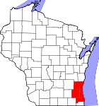
Largest Municipalities
(over 25,000 in 2000)BrookfieldC · FranklinC · GreenfieldC · Menomonee FallsV · New BerlinC · Oak CreekC · RacineC · WaukeshaC · WauwatosaC · West AllisC · West BendC
Municipalities
(over 10,000 in 2000)Brown DeerV · CaledoniaV · CedarburgC · CudahyC · GermantownV · GlendaleC · GraftonV · GreendaleV · MequonC · MuskegoC · OconomowocC · PewaukeeC · RichfieldT · ShorewoodV · South MilwaukeeC · Whitefish BayV
Smaller Municipalities
(under 10,000 in 2000)BaysideV · Big BendV · BrookfieldT · Elm GroveV · Fox PointV · HartlandV · Hales CornersV · MukwonagoV · PewaukeeV · River HillsV · SaukvilleV · Saint FrancisC · SussexV · ThiensvilleV · West MilwaukeeV
Counties Milwaukee · Ozaukee · Racine · Washington · Waukesha
Categories:- Villages in Wisconsin
- Populated places in Waukesha County, Wisconsin


Wikimedia Foundation. 2010.