Botanical Heights, St. Louis

Botanical Heights, St. Louis
Botanical Heights
Neighborhoods of St. Louis, Missouri
Government
Country United States
State Missouri
City St. Louis
Wards 17
Statistics
Total area 0.41 sq mi (1.1 km2)
Population (2010) 1,037[1]
Density 2,529 /sq mi (976 /km2)
Miscellaneous
ZIP code(s) Part of 63110
Area code(s) 314
Website http://stlouis.missouri.org/botanicalheights/
Location
STL Neighborhood Map 28.PNG
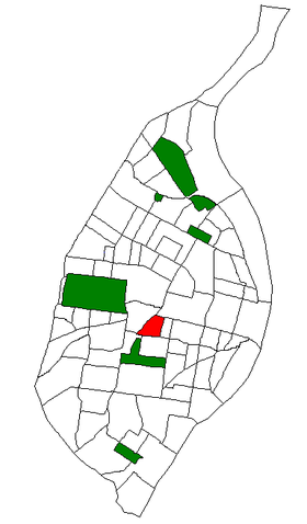
Location of Botanical Heights within St. Louis.

Botanical Heights is a neighborhood of St. Louis, Missouri. Its former name was McRee Town. The Botanical Heights neighborhood is defined by Chouteau Avenue on the North, Interstate 44 on the South, 39th Street on the East and Vandeventer Avenue on the West. This near Southside neighborhood is located just north of the Shaw neighborhood.[2]

References

  1. ^ Census Summary By Neighborhoods
  2. ^ Neighborhood Data Profile for Botanical Heights

Coordinates: 38°37′21″N 90°14′59″W / 38.6224°N 90.2497°W / 38.6224; -90.2497


Wikimedia Foundation. 2010.

Игры ⚽ Поможем решить контрольную работу

Look at other dictionaries:

  • Clifton Heights, St. Louis — Clifton Heights Neighborhoods of St. Louis, Missouri Clifton Heights Lake. Government Country United States State Missouri …   Wikipedia

  • Compton Heights, St. Louis — Compton Heights Neighborhoods of St. Louis, Missouri The Compton Water Tower, located on the northwest corner of Compton Heights, is a local landmark since it can be seen from miles away. Although it is commonly referred to as a water tower, it… …   Wikipedia

  • McKinley Heights, St. Louis — McKinley Heights Neighborhoods of St. Louis, Missouri Government Country United States State Missouri City St. Louis Wards 7 Aldermen Phyllis Young …   Wikipedia

  • St. Louis, Missouri — St. Louis redirects here. For saints named Louis and other uses, see Saint Louis. City of St. Louis   Independent City   From top left: Forest Park Jewel Box …   Wikipedia

  • Neighborhoods of St. Louis, Missouri — Stately French houses in Lafayette Square Grand …   Wikipedia

  • Tiffany, St. Louis — Tiffany Neighborhoods of St. Louis, Missouri Skyline of the Tiffany Neighborhood, from South Grand Blvd. Government Country United States State …   Wikipedia

  • Downtown St. Louis — Downtown Neighborhoods of St. Louis, Missouri The Gateway Arch from Laclede s Landing. Government Country United States State …   Wikipedia

  • Old North St. Louis — Neighborhoods of St. Louis, Missouri Terraced Houses in Old North St. Louis. Government Country United States State Missouri …   Wikipedia

  • Midtown St. Louis — Midtown Neighborhoods of St. Louis, Missouri Government Country United States State Missouri City St. Louis Wards 6, 17, 19 Statistics Total area …   Wikipedia

  • College Hill, St. Louis — College Hill Neighborhoods of St. Louis, Missouri The new Bissell Water Tower (left) and the old Grand Avenue Wat …   Wikipedia

Share the article and excerpts

Direct link
Do a right-click on the link above
and select “Copy Link”