- Cokeville, Wyoming
-
Cokeville, Wyoming — Town — Location of Cokeville, Wyoming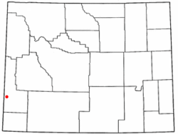
Coordinates: 42°5′6″N 110°57′20″W / 42.085°N 110.95556°WCoordinates: 42°5′6″N 110°57′20″W / 42.085°N 110.95556°W Country United States State Wyoming County Lincoln Area - Total 0.7 sq mi (1.9 km2) - Land 0.7 sq mi (1.9 km2) - Water 0.0 sq mi (0.0 km2) Elevation 6,194 ft (1,888 m) Population (2000) - Total 506 - Density 693.2/sq mi (267.7/km2) Time zone Mountain (MST) (UTC-7) - Summer (DST) MDT (UTC-6) ZIP code 83114 Area code(s) 307 FIPS code 56-15905[1] GNIS feature ID 1609079[2] Cokeville is a town in Lincoln County, Wyoming, United States. The population was 506 at the 2000 census.
Contents
Geography
Cokeville is located at 42°5′6″N 110°57′20″W / 42.085°N 110.95556°W (42.084940, -110.955684)[3].
According to the United States Census Bureau, the town has a total area of 0.7 square mile (1.9 km²), all land.
Demographics
As of the census[1] of 2000, there were 506 people, 166 households, and 125 families residing in the town. The population density was 693.2 people per square mile (267.6/km²). There were 195 housing units at an average density of 267.2 per square mile (103.1/km²). The racial makeup of the town was 95.83% White, 0.40% African American, 2.0% Pacific Islander, 0.99% from other races, and 0.79% from two or more races. Hispanic or Latino of any race were 2.37% of the population.
There were 166 households out of which 37.3% had children under the age of 18 living with them, 69.3% were married couples living together, 4.8% had a female householder with no husband present, and 24.1% were non-families. 21.7% of all households were made up of individuals and 9.0% had someone living alone who was 65 years of age or older. The average household size was 3.05 and the average family size was 3.66.
In the town the population was spread out with 37.0% under the age of 18, 8.3% from 18 to 24, 19.4% from 25 to 44, 21.1% from 45 to 64, and 14.2% who were 65 years of age or older. The median age was 31 years. For every 100 females there were 103.2 males. For every 100 females age 18 and over, there were 98.1 males.
The median income for a household in the town was $31,705, and the median income for a family was $39,000. Males had a median income of $35,000 versus $22,083 for females. The per capita income for the town was $12,900. About 7.1% of families and 10.4% of the population were below the poverty line, including 15.9% of those under age 18 and none of those age 65 or over.
History
The Shoshone Indians were the first inhabitants of the area. The first settler, Tilford Kutch, arrived in 1869. In 1873, he opened a trading post and ran a ferry across Smiths Fork. After the arrival of the railroad in 1882, the town grew, and was incorporated in 1910. Following the railroad, sheep ranching became more popular, reaching its peak in 1918, when Cokeville was informally called the "Sheep Capital of the World".
On May 16, 1986, 167 children and adults were held hostage during the Cokeville Elementary School hostage crisis. The children and adults escaped after the bomb exploded. The hostage takers both died.
Education
Public education in the town of Cokeville is provided by Lincoln County School District #2. Zoned campuses include Cokeville Elementary School (grades K-6) and Cokeville High School (grades 7-12).
In 1990, Cokeville was named "Title Town" by USA Today for the number of state sporting victories won by the local athletic programs. In 2006 - high school football coach Todd Dayton was ranked in the top 10 "winning-est" high school coaches by USA Today.
Transportation
By air
Cokeville Munincipal Airport (U06) is an operational munincipal airport serving the Town of Cokeville and surrounding areas. It is 3 nautical miles (6 km) south of Cokeville. The airport is located on CR 207, and can be accessible by WYO 231, and from east of Laketown, Utah, by Manhead Road. The airport is 6,270 feet (1,911 m) above sea level, and 320 acres (1.3 km2) big. It is owned by the town hall of Cokeville.
By road
 WYO 231 is a spur of US 30, and is the "main street" of Cokeville.
 US 30 is the only thoroughfare of the town, and provides access to Interstate 80 and nearby Idaho.
 WYO 232 branches off US 30 that serves a rural area northeast of Cokeville. If you went straight after US 30, you'll be on WYO 231.
Notable residents
- Minerva Teichert - Western and LDS artist.
References
- ^ a b "American FactFinder". United States Census Bureau. http://factfinder.census.gov. Retrieved 2008-01-31.
- ^ "US Board on Geographic Names". United States Geological Survey. 2007-10-25. http://geonames.usgs.gov. Retrieved 2008-01-31.
- ^ "US Gazetteer files: 2010, 2000, and 1990". United States Census Bureau. 2011-02-12. http://www.census.gov/geo/www/gazetteer/gazette.html. Retrieved 2011-04-23.
External links
Municipalities and communities of Lincoln County, Wyoming City 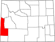
Towns Afton | Alpine | Cokeville | Diamondville | La Barge | Opal | Star Valley Ranch | Thayne
CDPs Alpine Northeast | Alpine Northwest | Auburn | Bedford | Etna | Fairview | Fontenelle | Grover | Oakley | Smoot | Taylor | Turnerville
Unincorporated
communitiesFootnotes ‡This populated place also extends into Idaho
Categories:- Populated places in Lincoln County, Wyoming
- Towns in Wyoming


Wikimedia Foundation. 2010.