- Arvada, Wyoming
-
Arvada, Wyoming — CDP — Location of Arvada, Wyoming
Coordinates: 44°39′15″N 106°7′52″W / 44.65417°N 106.13111°WCoordinates: 44°39′15″N 106°7′52″W / 44.65417°N 106.13111°W Country United States State Wyoming County Sheridan Area – Total 2.1 sq mi (5.5 km2) – Land 2.1 sq mi (5.5 km2) – Water 0.0 sq mi (0.0 km2) Elevation 3,671 ft (1,119 m) Population (2000) – Total 33 – Density 15.4/sq mi (5.9/km2) Time zone Mountain (MST) (UTC-7) – Summer (DST) MDT (UTC-6) ZIP code 82831 Area code(s) 307 FIPS code 56-03725[1] GNIS feature ID 1609064[2] Arvada is a census-designated place (CDP) in Sheridan County, Wyoming, United States. The population was 33 at the 2000 census.
Contents
Geography
Arvada is located at 44°39′15″N 106°7′52″W / 44.65417°N 106.13111°W (44.654207, -106.131238)[3].
According to the United States Census Bureau, the CDP has a total area of 2.1 square miles (5.5 km²), all of it land.
History
Arvada, Wyoming is located on the west bank of the Powder River, about fifty miles northwest of Gillette. From 1888 to 1891, a stage line that ran from Sundance to Buffalo crossed the Powder River on a ferry boat at the future site of Arvada.[4] The town of Suggs, Wyoming was established on the east bank of the river in 1891, and a the post office opened September 14, 1891.[5] Suggs was named for a local rancher.[6]
During the summer of 1892, railroad crews working on the Burlington and Missouri River Railroad, built a bridge across the Powder River at Suggs, although the railroad had only reached Gillette at that point in time. Suggs quickly became an "end of tracks town" with bars, brothels, and gambling establishments.[4]
During the Johnson County War of 1892, a group of Buffalo Soldiers from Fort Robinson, took the train to Gillette, and marched to Suggs. There the black soldiers built "Camp Bettens" in spite of a hostile and racist local population. One black soldier was killed and two wounded in gun battles with locals in a fight known as the "Battle of Suggs."[7] Camp Bettens was built in mid-June 1892, and was abandoned in mid-November[8]
When the railroad reached Suggs in 1892, railroad officials planned the new town of Arvada on the west bank of the Powder River, and Suggs was abandoned. The post office was moved from Suggs to Arvada on July 20, 1893.[5]
The Arvada area has deposits of coal at a shallow depth, and in the early days, local wells produced natural gas in solution in the drinking water. The drinking water would catch on fire, and could burn.[9]
In 2011, the US Postal Service proposed closing the Arvada post office along with 42 other Wyoming post offices. [10]
Demographics
At the 2000 census[1], there were 33 people, 18 households and 9 families residing in the CDP. The population density was 15.4 per square mile (6.0/km²). There were 26 housing units at an average density of 12.1/sq mi (4.7/km²). The racial makeup of the CDP was 84.85% White, 6.06% Native American, and 9.09% from two or more races.
There were 18 households of which 27.8% had children under the age of 18 living with them, 27.8% were married couples living together, 16.7% had a female householder with no husband present, and 50.0% were non-families. 44.4% of all households were made up of individuals and 22.2% had someone living alone who was 65 years of age or older. The average household size was 1.83 and the average family size was 2.56.
21.2% of the population were under the age of 18, 6.1% from 18 to 24, 24.2% from 25 to 44, 27.3% from 45 to 64, and 21.2% who were 65 years of age or older. The median age was 44 years. For every 100 females there were 120.0 males. For every 100 females age 18 and over, there were 136.4 males.
The median household income was $11,875, and the median family income was $46,250. Both males and females had a median income of $0. The per capita income for the CDP was $13,500. There were no families and 11.8% of the population living below the poverty line, including no under eighteens and none of those over 64.
Education
Public education in the community of Clearmont is provided by Sheridan County School District #3. Schools serving the town include Arvada Elementary School (grades K-6), Arvada-Clearmont Junior High School (grades 7-8), and Arvada-Clearmont High School District (grades 9-12).
References
- ^ a b "American FactFinder". United States Census Bureau. http://factfinder.census.gov. Retrieved 2008-01-31.
- ^ "US Board on Geographic Names". United States Geological Survey. 2007-10-25. http://geonames.usgs.gov. Retrieved 2008-01-31.
- ^ "US Gazetteer files: 2010, 2000, and 1990". United States Census Bureau. 2011-02-12. http://www.census.gov/geo/www/gazetteer/gazette.html. Retrieved 2011-04-23.
- ^ a b Bill O'Neal (June 2004). The Johnson County War. Eakin Press. ISBN 978-1-57168-876-7. http://books.google.com/books?id=Gy_POQAACAAJ. Retrieved 6 September 2011.
- ^ a b Ruth Dolzeal (1976). The Postoffices of Wyoming: July 25, 1868 to December 31, 1975. The Author. http://books.google.com/books?id=zgEnPwAACAAJ. Retrieved 6 September 2011.
- ^ Mae Bobb Urbanek (April 1988). Wyoming place names. Mountain Press Pub. Co.. ISBN 978-0-87842-204-3. http://books.google.com/books?id=MpglAAAAMAAJ. Retrieved 6 September 2011.
- ^ Schubert, Frank N. "The Suggs Affray: The Black Cavalry in the Johnson County War". The Western Historical Quarterly, Vol. 4, No. 1 (January, 1973), pp. 57–68.
- ^ Robert A. Murray (1968). Military posts in the Powder River country of Wyoming, 1865-1894. University of Nebraska Press. http://books.google.com/books?id=OTHWAAAAMAAJ. Retrieved 6 September 2011.
- ^ Federal Writers' Project; Writers' Program of the Work Projects Administration in the State of Wyoming. Wyoming: A Guide to Its History, Highways and People. US History Publishers. pp. 158. ISBN 978-1-60354-049-0. http://books.google.com/books?id=kayF9jqCaccC&pg=PA158. Retrieved 6 September 2011.
- ^ U.S. Postal Service considers closing 43 Wyoming post offices, Casper Star Tribune, http://trib.com/news/state-and-regional/article_c3d0f32f-c08b-5dd9-921b-f4de0738511d.html, retrieved July 27, 2011
Municipalities and communities of Sheridan County, Wyoming City 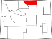
Towns CDPs Unincorporated
communitiesCategories:- Census-designated places in Wyoming
- Populated places in Sheridan County, Wyoming


Wikimedia Foundation. 2010.