- Lake Tahoe
-
"Tahoe" redirects here. For other uses, see Tahoe (disambiguation).
Lake Tahoe 
Lake Tahoe from the east shore (in Nevada) Location California and Nevada,USA Coordinates 39°05′30″N 120°02′30″W / 39.09167°N 120.04167°WCoordinates: 39°05′30″N 120°02′30″W / 39.09167°N 120.04167°W Lake type Geologic block faulting Primary outflows Truckee River Basin countries United States Max. length 22 mi (35 km) Max. width 12 mi (19 km) Surface area 191.588 sq mi (496.21 km2):[1]
Placer Co., CA (40.961%)
El Dorado Co., CA (28.626%)
Douglas Co., NV (13.207%)
Washoe Co., NV (10.955%)
Carson City., NV (6.251%)Average depth 1,000 ft (300 m)[2] Max. depth 1,645 ft (501 m) Water volume 122,160,280 acre·ft (150.68249 km3) Residence time 650 years Shore length1 71 mi (114 km) Surface elevation 6,225 ft (1,897 m)[2] Frozen Never Islands one – Fannette Island Settlements South Lake Tahoe, CA
Stateline, NV
Tahoe City, CA1 Shore length is not a well-defined measure. Lake Tahoe (Washo: dewʔá:gaʔa)[3] is a large freshwater lake in the Sierra Nevada of the United States. At a surface elevation of 6,225 ft (1,897 m), it is located along the border between California and Nevada, west of Carson City. Lake Tahoe is the largest alpine lake in North America.[4] Its depth is 1,645 ft (501 m), making it the USA's second-deepest (the deepest is Crater Lake in Oregon, being 300 ft (91 m) deeper, at 1,945 ft (593 m)).[2] Additionally, Lake Tahoe is listed as the 26th largest lake by volume in the world at 122,160,280 acre·ft (150.68249 km3).
The lake was formed about 2 million years ago and is a part of the Lake Tahoe Basin with the modern lake being shaped during the ice ages. It is known for the clarity of its water and the panorama of surrounding mountains on all sides.[5] The area surrounding the lake is also referred to as Lake Tahoe, or simply Tahoe.
Lake Tahoe is a major tourist attraction in both Nevada and California. It is home to a number of ski resorts, summer outdoor recreation, and tourist attractions. Snow and skiing are a significant part of the area's economy and reputation.[6][7] Mountain and lake scenery are attractions throughout the year. The Nevada side also includes large casinos. Highways provide year-round access from Reno, Carson City, and Sacramento.
Contents
Geography
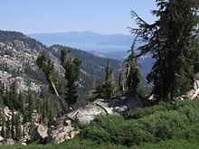
Lake Tahoe is the second deepest lake in the U.S., with a maximum depth of 1,645 feet (501 m),[2][8] trailing only Oregon's Crater Lake at 1,949 ft (594 m).[8] Tahoe is also the 16th[9] deepest lake in the world, and the fifth deepest in average depth. It is about 22 mi (35 km) long and 12 mi (19 km) wide and has 72 mi (116 km) of shoreline and a surface area of 191 square miles (490 km2). Washoe Indians used the lake. Approximately two-thirds of the shoreline is in California.[10] The south shore is dominated by the lake's largest city, South Lake Tahoe, California, which adjoins the town of Stateline, Nevada, while Tahoe City, California, is located on the lake's northwest shore. Although highways run within sight of the lake shore for much of Tahoe's perimeter, many important parts of the shoreline now lie within state parks or are protected by the United States Forest Service. The Lake Tahoe Watershed (USGS Huc 18100200) of 505 sq mi (1,310 km2) includes the land area that drains to the lake and the Lake Tahoe drainage divide traverses the same general area as the Tahoe Rim Trail.
See also: List of Lake Tahoe peaks and Lake Tahoe-Nevada State ParkNatural history
Geology
 Lake Tahoe from space
The Lake Tahoe Basin was formed by a geologic block (normal) faulting. A geologic block fault is a fracture in the Earth's crust causing blocks of land to move up or down. Uplifted blocks created the Carson Range on the east and the Sierra Nevada on the west. Down-dropped blocks (a graben) created the Lake Tahoe Basin in between.[2]
More technically, Lake Tahoe is the youngest of several extensional basins of the Walker Lane Deformation Belt that accommodates nearly 12 mm/yr of dextral shear between the Sierra Nevada Microplate and North America.[11][12] The Lake Tahoe basin is formed by a series of large down-to-the-east normal faults, including the West Tahoe—Dollar Point fault, Stateline/North Tahoe fault and the Incline Village fault.[13] These right-stepping en-echelon faults are capable of large magnitude 7 earthquakes, with the most recent M7 paleoquake (~1500 AD) occurring on the Incline Village fault with nearly 9.7 ft (3.0 m) of vertical offset.[14] The West Tahoe-Dollar Point Fault (WTDPF) appears to be the most active and potentially hazardous fault in the basin. A study in Fallen Leaf Lake, just south of Lake Tahoe, used seafloor mapping techniques to image evidence for paleoearthquakes on the WTDPF and revealed the last earthquake occurred between 4,100 and 4,500 years ago.[15]
Some of the highest peaks of the Lake Tahoe Basin that formed during the process of Lake Tahoe creation are Freel Peak at 10,891 feet (3,320 m), Monument Peak at 10,067 feet (3,068 m), Pyramid Peak at 9,983 feet (3,043 m) (in the Desolation Wilderness), and Mount Tallac at 9,735 feet (2,967 m).[2] The north shore boasts 3 peaks at 10,000+ feet; Mount Rose, Houghton and Relay peaks. Mt. Rose is a very popular hiking and backcountry skiing destination.
Eruptions from the extinct volcano Mount Pluto formed a dam on the north side. Melting snow filled the southern and lowest part of the basin to form the ancestral Lake Tahoe. Rain and runoff added additional water.[16]
Modern Lake Tahoe was shaped and landscaped by scouring glaciers during the Ice Ages, which began a million or more years ago. Lake Tahoe is fed from 63 tributaries with the Truckee River as the only outlet.[4] The Truckee flows northeast through Reno, Nevada and into Pyramid Lake, Nevada which has no outlet.
Soils of the basin come primarily from andesitic volcanic rocks and granodiorite, with minor areas of metamorphic rock. Some of the valley bottoms and lower hill slopes are mantled with glacial moraines, or glacial outwash material derived from the parent rock. Cryopsamments, Cryumbrepts, rockland, rock outcrops and rubble and stony colluvium account for over 70% of the land area in the basin (see USA soil taxonomy). The basin soils (in the < 2 mm fraction) are generally 65-85% sand (0.05–2.0 mm).
Given the great depth of Lake Tahoe, and the locations of the normal faults within the deepest portions of the lake, modeling suggests that earthquakes on these faults can trigger tsunamis. Wave heights of these tsunamis are predicted to be on the order of 10 to 33 ft (3 to 10 m) in height, capable of traversing the lake in just a few minutes.[17] A massive collapse of the western edge of the basin that formed McKinney Bay around 50,000 years ago is thought to have generated a tsunami/seiche wave with a height approaching 330 ft (100 m).[18]
Climate
 Fallen Leaf Lake and Lake Tahoe in background from Angora Ridge Rd. to the Angora Lakes Resort
Mean annual precipitation ranges from over 55 in (1,400 mm) in watersheds on the west side of the basin to about 26 inches (660 mm) near the lake on the east side of the basin. Most of the precipitation falls as snow between November and April, although rainstorms combined with rapid snow melt account for the largest floods. There is a pronounced annual runoff of snowmelt in late spring and early summer, the timing of which varies from year to year. In some years, summertime monsoon storms from the Great Basin bring intense rainfall, especially to high elevations on the east side of the basin.
August is normally the warmest month at the Lake Tahoe Airport (elevation 6,254 ft (1,906 m)) with an average maximum of 78.7 °F (25.9 °C) and an average minimum of 39.8 °F (4.3 °C). January is the coolest month with an average maximum of 41.0 °F (5.0 °C) and an average minimum of 15.1 °F (−9.4 °C). The all-time maximum of 99 °F (37.2 °C) was recorded on July 22, 1988. The all-time minimum of −29 °F (−33.9 °C) was recorded on December 9, 1972, and February 7, 1989. Temperatures exceed 90 °F (32.2 °C) on an average of 2.0 days annually. Minimum temperatures of 32 °F (0 °C) or lower occur on an average of 231.8 days annually, and minimum temperatures of 0 °F (−17.8 °C) or lower occur on an average of 7.6 days annually. Freezing temperatures have occurred every month of the year.[19][20]
Ecology
Main article: Ecology of the Sierra Nevada Salmon (Oncorhynchus nerka) jumping beaver dam
Vegetation in the basin is dominated by a mixed conifer forest of Jeffrey pine (Pinus jeffreyi), lodgepole pine (P. contorta), white fir (Abies concolor), and red fir (A. magnifica).[21] The basin also contains significant areas of wet meadows and riparian areas, dry meadows, brush fields (with Arctostaphylos and Ceanothus) and rock outcrop areas, especially at higher elevations. Ceanothus is capable of fixing nitrogen, but mountain alder (Alnus tenuifolia), which grows along many of the basin’s streams, springs and seeps, fixes far greater quantities, and contributes measurably to nitrate-N concentrations in some small streams. The beaches of Lake Tahoe are the only known habitat for the rare Lake Tahoe yellowcress (Rorippa subumbellata), a plant which grows in the wet sand between low- and high-water marks.[22]
Each autumn, from late September through mid-October, mature kokanee salmon (Oncorhyncus nerka), transform from silver-blue color to a fiery vermilion, and run up Taylor Creek, near South Lake Tahoe. As spawning season approaches the fish acquire a humpback and protuberant jaw. After spawning they die and their carcasses provide a feast for gatherings of mink (Neovison vison), bears (Ursus americanus), and Bald eagles (Haliaeetus leucocephalus). These salmon were transplanted from the North Pacific to Lake Tahoe in 1944.[23]
North American Beaver (Castor canadensis) were re-introduced to the Tahoe Basin by the California Department of Fish and Game (CDFG) and the U.S. Forest Service between 1934 and 1949. Descended from no more than nine individuals, 1987 beaver populations on the upper and lower Truckee River had reached a density of 0.72 colonies (3.5 beavers) per kilometer.[24] At the present time beaver have been seen in Tahoe Keys, Meeks Creek at Meeks Bay on the western shore, and King's Beach on the north shore, so the descendants of the original nine beavers have apparently migrated around most of Lake Tahoe.[25][26] That beaver were once native to the area is supported by the fact that the Washo have a word for beaver, c'imhélhel[27][28] and the northern Paiute of Walker Lake, Honey Lake and Pyramid Lake have a word for beaver su-i'-tu-ti-kut'-teh.[29] When Stephen Powers visited the northern Paiute to collect Indian materials for the Smithsonian Institution in preparation for the Centennial Exhibition of 1876, he reported that the northern Paiute wrapped their hair in strips of beaver fur, made medicine from parts of beaver and that their creation legend included beaver.[29]
Human history
Native people
The area around Lake Tahoe was originally inhabited by the Washoe tribe of Native Americans. Lake Tahoe was the center and heart of Washoe Indian territory, including the upper valleys of the Walker, Carson and Truckee Rivers. The English name for Lake Tahoe derives from the Washo dá’o' a ga, "edge of the lake".[30]
Exploration
Lt. John C. Frémont was the first person of European descent to see Lake Tahoe, during Fremont's second exploratory expedition on February 14, 1844.[31] John Calhoun Johnson, Sierra explorer and founder of "Johnson's Cutoff" (now U.S. Route 50), was the first white man to see Meeks Bay and from a peak above the lake he named Fallen Leaf Lake after his Indian guide. His first job in the west was in the government service, carrying the mail on snowshoes from Placerville to Nevada City, during which time he named the lake "Lake Bigler" in honor of California’s third governor John Bigler. In 1853 William Eddy, the surveyor general of California, identified Tahoe as Lake Bigler. In 1862 the U.S. Department of the Interior first introduced the name Tahoe. Both names were used until well into the next century. The lake didn't receive its official and final designation as Lake Tahoe until 1945.
California and Nevada reached the compromise to partition Tahoe between the two when Nevada became a state in 1864. With the state line east of the approximate centerline of the lake and then at 39 degrees north latitude, the state border runs southeasterly towards the Colorado River.[32][33]
Mining era
Upon discovery of gold in the South Fork of the American River in 1848, thousands of gold seekers going west passed near the basin on their way to the gold fields. European civilization first made its mark in the Lake Tahoe basin with the 1858 discovery of the Comstock Lode, a silver deposit just 15 miles (24 km) to the east in Virginia City, Nevada. From 1858 until about 1890, logging in the basin supplied large timbers to shore up the underground workings of the Comstock mines. The logging was so extensive that loggers cut down almost all of the native forest. In 1864, Tahoe City was founded as a resort community for Virginia City, the first recognition of the basin’s potential as a destination resort area.[34]
Development
Public appreciation of the Tahoe basin grew, and during the 1912, 1913 and 1918 congressional sessions, congressmen tried unsuccessfully to designate the basin as a national park.[34]
 The only outlet of Lake Tahoe and the headwaters of the Truckee River at Lake Tahoe Dam
While Lake Tahoe is a natural lake, it is also used for water storage by the Truckee-Carson Irrigation District (TCID). The lake level is controlled by a dam built in 1913 at the lake's only outlet, the Truckee River, at Tahoe City. The 18-foot (5.5 m) high dam can increase the lake's capacity by 744,600 acre·ft (0.9185 km3).[35]
During the first half of the 20th century, development around the lake consisted of a few vacation homes. The post-World War II population and building boom, followed by construction of gambling casinos in the Nevada part of the basin during the mid-1950s, and completion of the interstate highway links for the 1960 Winter Olympics held at Squaw Valley, resulted in a dramatic increase in development within the basin. From 1960 to 1980, the permanent residential population increased from about 10,000 to greater than 50,000, and the summer population grew from about 10,000 to about 90,000.[34] Since the 1980s, development has slowed due to controls on land use.
Government and politics
Lake Tahoe lies within the borders of both California and Nevada, and as such is not governed by any single entity. In California, Lake Tahoe is divided between Placer County and El Dorado County. In Nevada, Lake Tahoe is divided among Washoe County, Douglas County and Carson City (an independent city).
The Tahoe Regional Planning Agency (TRPA) is a bi-state compact between California and Nevada, that is charged with environmental protection of the Lake Tahoe Basin through land-use regulation and planning.[36] Schisms between TRPA and local residents lead to the formation of grass-roots organizations that hold firm to strict environmentalism.[37]
Mansions
Lake Tahoe is also the location of several 19th and 20th century palatial homes of historical significance. The Thunderbird Lodge built by George Whittel Jr once included nearly 27 miles (43 km) of the Nevada shoreline. Vikingsholm was the original settlement on Emerald Bay and included an island teahouse and a 38 room home. The Ehrman Mansion is a summer home built by a former Wells Fargo president in Sugar Pine Point and is now a state park.
Environmental issues
Water quality
 Secret Beach on Lake Tahoe's Nevada side
In spite of land-use planning and export of treated sewage effluent from the basin, the lake is becoming increasingly eutrophic (having an excessive richness of nutrients), with primary productivity increasing by more than 5% annually, and clarity decreasing at an average rate of 0.25 meters per year.[citation needed] Until the early 1980s, nutrient-limitation studies showed that primary productivity in the lake was nitrogen-limited. Now, after a half-century of accelerated nitrogen input (much of it from direct atmospheric deposition), the lake is phosphorus-limited.
Test results over the last eight years have shown a stabilization in lake clarity, announced the Lake Tahoe Research Group in March 2009. Fine sediment, much of it resulting from land disturbance in the basin, accounts for about half of the loss in clarity.
Lake Tahoe is a tributary watershed drainage element within the Truckee River Basin, and its sole outlet is the Truckee River, which continues on to discharge to Pyramid Lake. Because of the sensitivity of Truckee River water quality (involving two protected species, the cui-ui[38] sucker fish and the Lahontan cutthroat trout), this drainage basin has been studied extensively. The primary investigations were stimulated by the U.S. Environmental Protection Agency, who funded the development of the DSSAM model to analyze water quality below Lake Tahoe.
Lake Tahoe never freezes.[39] Since 1970, it has mixed to a depth of at least 1,300 ft (400 m) a total of 6 or 7 times. Dissolved oxygen is relatively high from top to bottom. Analysis of the temperature records in Lake Tahoe has shown that the lake warmed (between 1969 and 2002) at an average rate of 0.015 °C per year. The warming is caused primarily by increasing air temperatures, and secondarily by increasing downward long-wave radiation. The warming trend is reducing the frequency of deep mixing in the lake, and may have important effects on water clarity and nutrient cycling.
Ecosystem changes
Since the 1960s, the Lake's food web and zooplankton populations have undergone major changes. In 1963–65, opossum shrimp (Mysis diluviana) were introduced to enhance the food supply for the introduced Kokanee salmon (Onchorhynchus nerka). The shrimp began feeding on the lake's cladocerans (Daphnia and Bosmina), and their populations virtually disappeared by 1971.[40] The shrimp provide a food resource for salmon and trout, but also compete with juvenile fish for zooplankton. Since the 1970s, the cladoceran populations have somewhat recovered, but not to former levels.
In June 2007, the Angora Fire burned approximately 3,100 acres (1,300 ha) throughout the South Lake Tahoe area. While the impact of ash on the lake's ecosystem is predicted to be minimal, the impact of potential future erosion is not yet known.[41]
Environmental protection
Until recently, construction on the banks of the Lake had been largely under the control of wealthy real estate developers. Construction activities have resulted in a clouding of the lake's blue waters. Currently, the Tahoe Regional Planning Agency is regulating construction along the shoreline.[42] (and has won two Federal Supreme Court battles over recent decisions). These regulations are unpopular with many residents, especially those in the Tahoe Lakefront Homeowners Association.[citation needed]
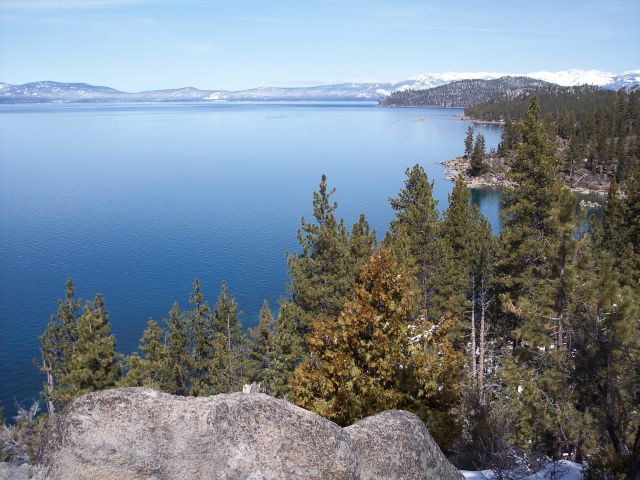
 Emerald Bay, Lake Tahoe
The League to Save Lake Tahoe (Keep Tahoe Blue)[43] has been an environmental watchdog in the Lake Tahoe Basin for 50 years. Founded when a proposal to build a four-lane highway around the lake—with a bridge over the entrance to Emerald Bay—was proposed in 1957, the League has thwarted poorly designed development projects and environmentally unsound planning. The League embraces responsible and diversified use of the Lake's resources while protecting and restoring its natural attributes.[44]
Since 1980, the Lake Tahoe Interagency Monitoring Program (LTIMP) has been measuring stream discharge and concentrations of nutrients and sediment in up to 10 tributary streams in the Lake Tahoe Basin, California-Nevada. The objectives of the LTIMP are to acquire and disseminate the water quality information necessary to support science-based environmental planning and decision making in the basin. The LTIMP is a cooperative program with support from 12 federal and state agencies with interests in the Tahoe Basin. This data set, together with more recently acquired data on urban runoff water quality, is being used by the Lahontan Regional Water Quality Control Board to develop a program (mandated by the Clean Water Act) to limit the flux of nutrients and fine sediment to the Lake.
UC Davis remains a primary steward of the lake. The UC Davis Tahoe Environmental Research Center is dedicated to research, education and public outreach, and to providing objective scientific information for restoration and sustainable use of the Lake Tahoe Basin.[45] Each year, it produces a well-publicized “State of the Lake” assessment report.
Tourist activities
Much of the area surrounding Lake Tahoe is devoted to the tourism industry and there are many restaurants, ski slopes, golf courses and casinos catering to visitors.
Winter sports
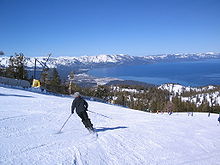 Ski slopes overlooking Lake Tahoe
 Lake Tahoe Gondola Ride
During ski season, thousands of people from all over Nevada and California, including Reno, Las Vegas, Los Angeles, San Diego, San Francisco, and Sacramento, flock to the slopes for downhill skiing. Lake Tahoe, in addition to its panoramic beauty, is well known for its blizzards.[6]
Some of the major ski areas in Tahoe include:
- Heavenly Mountain Resort: the largest ski area in California and Nevada, located near Stateline
- Squaw Valley: the second largest ski area, known for its hosting of the 1960 Winter Olympics, located near Tahoe City
- Alpine Meadows: a medium sized ski area on the north shore only a few miles from Squaw Valley
- Diamond Peak: a small ski area located in Incline Village, Nevada
- Northstar at Tahoe: a popular north shore ski area
- Kirkwood Mountain Resort: a ski area which gets more snow than any other ski area in the Tahoe region
- Sierra-at-Tahoe: a medium sized south shore ski area
- Boreal Mountain Resort: a small ski area on Donner Pass
- Sugar Bowl Ski Resort: a medium sized ski area in Donner Pass
- Donner Ski Ranch: a very small ski area on Donner Pass
- Homewood Mountain Resort: a medium sized ski area on the west shore
- Mount Rose Ski Resort: a medium sized ski area north-east of the Lake, on Slide Mountain
The majority of the ski resorts in the Lake Tahoe region are on the northern end of the lake, near Truckee, California and Reno, Nevada. Kirkwood, Sierra-at-Tahoe and Heavenly are located on the southern side of the lake, approximately 80 miles (129 km) from Reno. Scattered throughout Tahoe are public and private sled parks. Some, such as Granlibakken are equipped with rope tows to help sledders get up the hill.
Many ski areas around Tahoe also have snow tubing, such as Squaw Valley. Throughout Tahoe, cross-country skiing, snowmobile riding and snowshoeing are also popular.
Water sports
 Boat at Lake Tahoe
During late Spring to early Fall, the lake is popular for water sports and beach activities. The two cities most identified with the Lake Tahoe tourist area are South Lake Tahoe, California and the smaller Stateline; smaller centers on the northern shoreline include Tahoe City and Kings Beach.
Other popular activities include parasailing, jet ski rentals and eco-friendly paddle sport rentals. There are rental locations located around Lake Tahoe. Kayaking and stand up paddle boards have also become very popular.
Boating is a primary activity in Tahoe in the summer. There are lake front restaurants all over the lake, most equipped with docks and buoys (See the restaurants section). There are all sorts of boating events, such as sailboat racing, firework shows over the lake, guided cruises, and more. As an interstate waterway, Lake Tahoe is subject to the United States Coast Guard. Lake Tahoe is home to Coast Guard Station Lake Tahoe.[46]
SCUBA diving is popular at Lake Tahoe, with some dive sites offering dramatic drop-offs or wall dives. Diving at Lake Tahoe is considered advanced due to the increased risk of decompression sickness (DCS) while diving at such a high altitude.[47][48]
Hiking and bicycling
 View from the Tahoe Rim Trail
There are hundreds of hiking and mountain biking trails all around the lake. They range in length, difficulty and popularity. One of the most famous of Tahoe's trails is the Tahoe Rim Trail, a 165-mile (270-km) trail that circumnavigates the lake. Directly to the west of the lake is the Granite Chief Wilderness, which provides great hiking and wilderness camping. Also, to the southwest is the very popular Desolation Wilderness. One of the most popular trailheads is the Eagle Lake Trailhead. The Flume Trail is one of Mountain Biking Magazine's Top 10 Trails in the US. There are also several paved off-road bicycle paths.
Gambling
 Casinos in Stateline, Nevada
Gambling is legal on the Nevada side of Lake Tahoe. Casinos, each with a variety of slot machines and table games, are located on the South Shore in Stateline, and on the North Shore in Crystal Bay and Incline Village.
Transport
Lake Tahoe can be reached directly by car, and indirectly by train or air. The nearest passenger train service is the Amtrak station in Truckee.
Highways
 Cave Rock Tunnel on US 50
 U.S. Route 50 in South Lake Tahoe
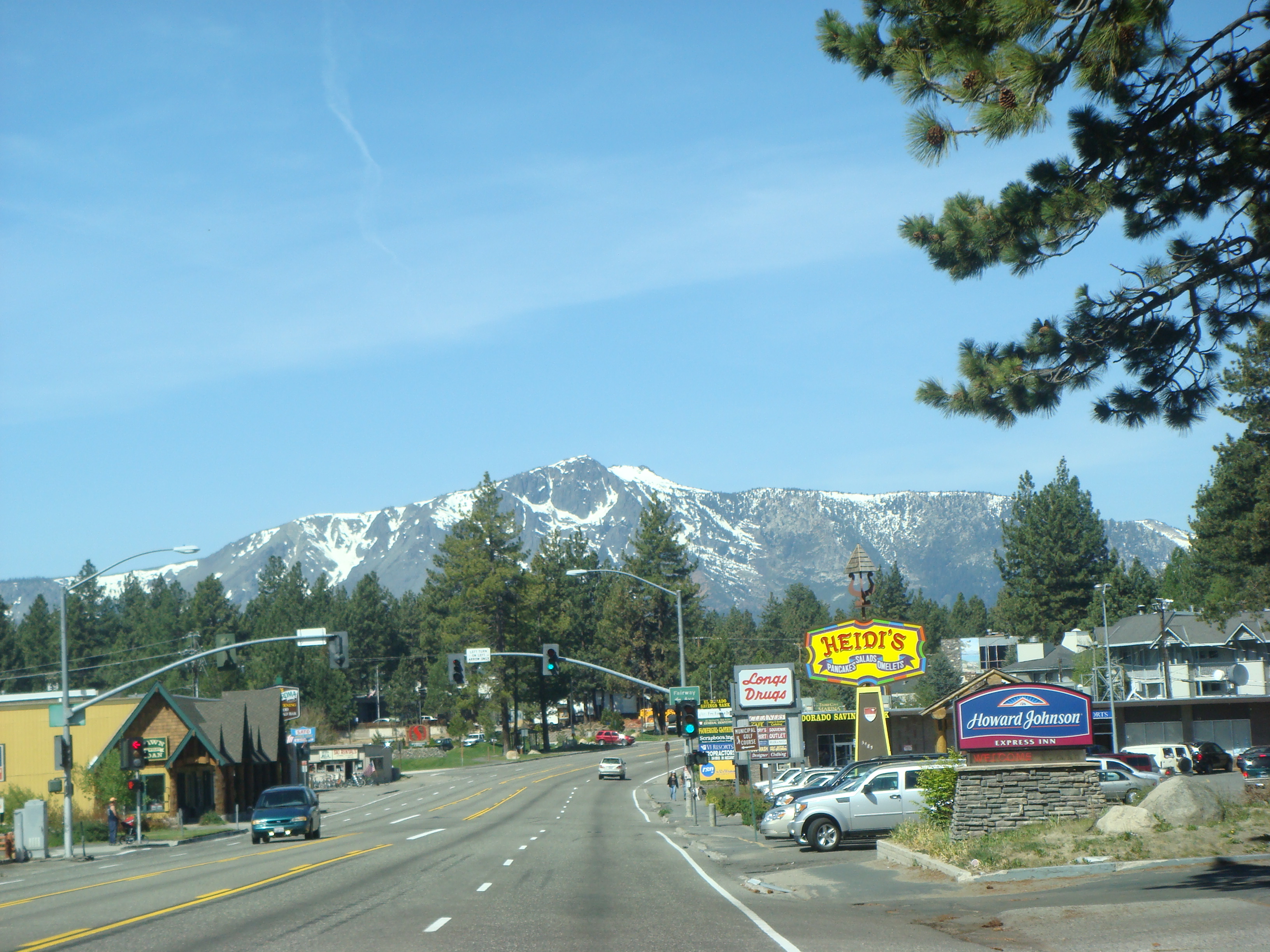
Visitors can reach Lake Tahoe under ideal conditions within two hours from the Sacramento area, one hour from Reno or thirty minutes from Carson City. In winter months, chains or snow tires are often necessary to reach Tahoe from any direction. Traffic can be heavy on weekends due to tourists if not also from weather.
The primary routes to Lake Tahoe are on Interstate 80 via Truckee, U.S. Highway 50, and Nevada Highway 431 via Reno. Most of the highways accessing and encircling Lake Tahoe are paved two-lane mountain roads. US 50 is a four-lane highway passing south of the lake and along part of the eastern shore.
California Highway 89 follows the western shore of the lake through the picturesque wilderness and connects camping, fishing and hiking locations such as those at Emerald Bay State Park, DL Bliss State Park and Camp Richardson. Farther along are communities such as Meeks Bay and Tahoe City. Finally, the highway turns away from the lake and heads northwest toward Truckee.
California Highway 28 completes the circuit from Tahoe City around the northern shore to communities such as Kings Beach, Crystal Bay, and into Incline Village, Nevada where the road becomes Nevada Highway 28. Highway 28 returns along the eastern shore to US Highway 50 near Spooner Lake.
Airports serving Lake Tahoe
- Reno-Tahoe International Airport/KRNO (Reno, Nevada)
- Sacramento International Airport/KSMF (Sacramento, California)
- Lake Tahoe Airport/KTVL (South Lake Tahoe, California)
- Truckee-Tahoe Airport/KTRK (Truckee, California)
- Minden-Tahoe Airport/KMEV (Minden, Nevada)
In the media
The Ponderosa Ranch of the TV series Bonanza was formerly located on the Nevada side of Lake Tahoe.[49] The opening sequence of the TV series was filmed at the McFaul Creek Meadow, with Mount Tallac in the background. In September 2004 the Ponderosa Ranch closed its doors, after being sold to developer David Duffield for an undisclosed price.[50][51]
In the motion picture The Godfather Part II, the Corleone family lived in a compound on the shores of the Nevada side of Lake Tahoe. In a famous scene from the final minutes of the film, Fredo Corleone is taken out onto the lake for a fishing trip, only to be executed for treachery, on the orders of his brother Michael (Al Pacino), who watches from the shore. The house and grounds portrayed in the film are actually located at Fleur du Lac, the summer estate of Henry J. Kaiser, on the California side of Lake Tahoe. The only structures used in the movie that remain are the complex of old native stone boathouses with their wrought iron gates. Although Fleur du Lac is private property and no one is allowed ashore there, the boathouses and multi-million dollar condominiums are easily viewed from the lake.
Most of the film Smoking Aces was filmed In South Lake Tahoe and Stateline. Many of the hotels and casinos are visible in the film with their older names. The climactic scenes of the 1987 Charles Bronson film Assassination were filmed around and on Lake Tahoe. Tahoe also is featured prominently in the plot of the noir classic Out of the Past. Both The Bodyguard and City Of Angels filmed their climactic scenes at and around Lake Tahoe and the surrounding Fallen Leaf Lake (California). Meg Ryan's bike-riding scene prominently features Lake Tahoe in the background. In 1989, 2 episodes of the second season of the comedy Full House was filmed at Lake Tahoe. It was titled "Luck be a Lady" The British TV program Top Gear filmed at Lake Tahoe in Episode 2 of Series 12 in 2008.
The 2001 film The Deep End, starring Tilda Swinton, was set in Lake Tahoe, and won the Best Cinematography award at the Sundance Film Festival.
On September 13, 2010 two Navy helicopters took a dip in the lake, apparently inadvertently, then landed at a nearby airport. No environmental damage was reported, though the helicopters did sustain some damage.[52]
List of Tributaries of Lake Tahoe
This list of tributaries of Lake Tahoe groups rivers and creeks that flow into the lake by their locations on the north, east, south and west shores, and lists them in a clock-wise order. Sub-tributaries are listed under the tributaries they feed, sorted by the elevation of the confluence so that tributaries entering nearest Lake Tahoe appear first. Numbers in parentheses are Geographic Names Information System feature ids.
-
This list is incomplete; you can help by expanding it.
North Shore
- Griff Creek (266778) – flows from Martis Peak to Kings Beach
East Shore
- Marlette Creek (860476) – heads on Marlette Lake and runs west to Lake Tahoe
South Shore
- Trout Creek (236569) – originates south of Freel Peek in the Carson Range to South Lake Tahoe
- Cold Creek (221315) – sources in Star Lake on north slope of Jobs Sister and runs to Trout Creek
- Upper Truckee River (236928) – flows from Red Lake Peak to South Lake Tahoe
- Taylor Creek (268098) – heads in Fallen Leaf Lake and enters lake west of Camp Richardson
- Tallac Creek (268070) – starts on Mount Tallac and flows north to Lake Tahoe
West Shore
- Meeks Creek (263441) – heads on Rubicon Lake and flows to Meeks Bay
See also
- Clear Lake
- List of largest reservoirs of California
- Mono Lake
Notes
- ^ "Lake Tahoe census tract blocks, 2000 Census, United States Census Bureau". Factfinder.census.gov. http://factfinder.census.gov/servlet/DTTable?_bm=y&-show_geoid=Y&-tree_id=4001&-_showChild=Y&-context=dt&-errMsg=&-all_geo_types=Y&-mt_name=DEC_2000_SF1_U_P001&-redoLog=false&-transpose=N&-search_map_config=. Retrieved 2011-11-15.
- ^ a b c d e f
 This article incorporates public domain material from the United States Geological Survey document "Facts About Lake Tahoe" (retrieved on October 26, 2008).
 - ^ "The Washo Project". Washo.uchicago.edu. http://washo.uchicago.edu/dictionary/results.php?SearchBy=SearchGloss&SearchKey=lake. Retrieved 2011-11-15.
- ^ a b "Amazing Lake Tahoe". Lake Tahoe Visitors Authority. http://www.bluelaketahoe.com/page.php?p=amaz&l=1. Retrieved October 26, 2008.
- ^ "Water Quality". The League To Save Lake Tahoe. http://keeptahoeblue.org/facts/water.php. Retrieved October 26, 2008.
- ^ a b "Lake Tahoe Resorts Winter sports". porterstahoe.com. http://www.porterstahoe.com/lake-tahoe-resorts.asp. Retrieved October 26, 2008.
- ^ Munson, Jeff (October 21, 2008). "In rocky economy, ski-resort jobs are seen as more than free passes". Nevada Appeal. http://www.nevadaappeal.com/article/20081021/NEWS/810209953/1070. Retrieved October 29, 2008.
- ^ a b The World's Deepest Lakes – US Department of the Interior: National Park Service|accessdate=October 31, 2008
- ^ "Deepest Lake in the World Deepest Lake in the United States". Geology.com. http://geology.com/records/deepest-lake.shtml. Retrieved October 31, 2008.
- ^ "Lake Tahoe Trivia" (Press release). Lake Tahoe Visitors Authority. June 10, 2005. http://www.bluelaketahoe.com/media/release.php?p=p_display&l=2&t=1&id=128. Retrieved October 26, 2008.
- ^ Oldow, J.S.; C.L.V. Aiken, J.L. Hare, J.F. Ferguson and R.F. Hardyman (January 2001). "Active displacement transfer and differential block motion within the central Walker Lane, western Great Basin". Geology 29 (1): 19–22. doi:10.1130/0091-7613(2001)029<0019:ADTADB>2.0.CO;2.
- ^ Unruh, Jeffrey; James Humphrey and Andrew Barron (April 2003). "Transtensional model for the Sierra Nevada frontal fault system, eastern California". Geology 31 (4): 327–330. doi:10.1130/0091-7613(2003)031<0327:TMFTSN>2.0.CO;2.
- ^ Kent, G.M.; J.M. Babcock, N.W. Driscoll, A.J. Harding, J.A. Dingler, G.G. Seitz, J.V. Gardner, L.A. Mayer, C.R. Goldman, A.C. Heyvaert, R.C. Richards, R. Karlin, C.W. Morgan, P.T. Gayes and L.A. Owen (May 2005). "60 k.y. record of extension across the western boundary of the Basin and Range province: Estimate of slip rates from offset shoreline terraces and a catastrophic slide beneath Lake Tahoe". Geology 33 (5): 365–368. doi:10.1130/G21230.1.
- ^ Seitz, G.G.; Kent, G., Dingler, J., Karlin, R., Babcock, J., Driscoll, N., and Turner, R. (2005). "First paleoseismic results from the Lake Tahoe Basin: Evidence for three M7 range earthquakes on the Incline Village fault". Annual Meeting. Seismological Society of America.
- ^ Brothers, D.S.; G.M. Kent, N.W. Driscoll, S.B. Smith, J.A. Dingler, R. Karlin, A.J. Harding, G.G. Seitz, J.M. Babcock, (April 2009). "New Constraints on Deformation, Slip Rate, and Timing of the Most Recent Earthquake on the West Tahoe-Dollar Point Fault, Lake Tahoe Basin, California". Bulletin of the Seismological Society of America 99 (2a): 499. doi:10.1785/0120080135. ISBN 0120080135.
- ^ "Frequently Asked Questions about Lake Tahoe and the Basin". Lake Tahoe Basin Management Unit. Forest Service, U.S. Department of Agriculture. http://www.fs.fed.us/r5/ltbmu/faqs/. Retrieved June 20, 2007.
- ^ Ichinose, G.A.; Anderson, J.G.; Satake, K.; Schweickert, R.A.; Lahren, M.M. (April 2000). "The potential hazard from tsunami and seiche waves generated by large earthquakes within Lake Tahoe, California-Nevada". Geophysical Research Letters 27 (8): 1203–1206. Bibcode 2000GeoRL..27.1203I. doi:10.1029/1999GL011119.
- ^ Gardner, J.V. (July 2000). "The Lake Tahoe debris avalanche". 15th Annual Geological Conference. Geological Society of Australia.
- ^ "Tahoe, California – Climate Summary". Desert Research Institute. http://www.wrcc.dri.edu/cgi-bin/cliMAIN.pl?ca8758. Retrieved October 31, 2008. (1903–2007 climate data)
- ^ "Climate Data – North Lahontan Hydrologic Region". State of California, Department of Water Resources. http://www.water.ca.gov/floodmgmt/hafoo/csc/climate_data/nlahontan.cfm. Retrieved October 31, 2008. (30-year climate data)
- ^ "Trees Indigenous to Lake Tahoe". Northstar-at-Tahoe Resort. Booth Creek Ski Holdings, Inc.. http://www.northstarattahoe.com/info/ski/media/tahoe_environment.asp. Retrieved October 31, 2008.
- ^ "The Nature Conservancy: ''Rorippa subumbellata''". Natureserve.org. http://www.natureserve.org/explorer/servlet/NatureServe?searchName=Rorippa+subumbellata. Retrieved 2011-11-15.
- ^ Marcia Williamson (Oct. 1992). "Tahoe's drama of the kokanee". Sunset Magazine. http://www.highbeam.com/doc/1G1-12884197.html. Retrieved May 8, 2010.
- ^ Beier P, Barrett RH (1989). "Beaver Distribution in the Truckee River Basin, California". California Fish and Game. http://oak.ucc.nau.edu/pb1/vitae/Beier-Barrett.1987.CDFG_Beaver.pdf. Retrieved Jan. 17, 2010.
- ^ "The Beavers of the Truckee River". Tahoe Arts and Mountain Culture. July 20, 2009. http://www.tahoeculture.com/2009/07/20/the-beavers-of-the-truckee-river-going-to-town/. Retrieved August 16, 2010.
- ^ Keaven Van Lom (Jan. 16, 2010). "This is Wildlife Management in the 21st century?". Moonshine Ink. http://moonshineink.com/articles.php/70/1618. Retrieved August 16, 2010.
- ^ A. L. Kroeber (1919). "30". Handbook of Indians of California. http://www.yosemite.ca.us/library/kroeber/miwok.html. Retrieved August 19, 2010.
- ^ "The Washo Project". University of Chicago. http://washo.uchicago.edu/dictionary/results.php?AttestationID=2479&SearchBy=SearchGloss&SearchKey=beaver. Retrieved August 19, 2010.
- ^ a b Don D. Fowler, Catherine S. Fowler, Stephen Powers (Summer-Autumn, 1970). "Stephen Powers' "The Life and Culture of the Washo and Paiutes"". Ethnohistory, Vol. 17, No. 3/4 17 (3): 117–149. JSTOR 481206.
- ^ Bright, William (2004). Native American Place Names of the United States. Norman: University of Oklahoma Press, p. 34.
- ^ "Lake Tahoe Facts and Figures". Tahoe Regional Planning Association. http://www.trpa.org/default.aspx?tabindex=5&tabid=95. Retrieved October 26, 2008.
- ^ "Truckee River Chronology". Nevada Department of Conservation & Natural Resources. http://water.nv.gov/WaterPlanning/truckee/truckee1.cfm#N_13_. Retrieved October 26, 2008.
- ^ Brean, Henry (April 27, 2009). "Four Corners mistake recalls long border feud between Nevada, California". Las Vegas Review-Journal. http://www.lvrj.com/news/43760307.html. Retrieved April 27, 2009.
- ^ a b c This article incorporates public domain material from the United States Geological Survey document "Stream and Ground-Water Monitoring Program, Lake Tahoe Basin, Nevada and California" (retrieved on November 24, 2009).
- ^ "Water Delivery Projects and Facilities". Lahontan Basin Area Office. U.S. Bureau of Reclamation. http://www.usbr.gov/mp/lbao/water_projects.html. Retrieved November 24, 2009.
- ^ "Tahoe Regional Planning Agency". http://www.trpa.org.
- ^ "Friends of Lake Tahoe". http://www.friendsoflaketahoe.org/mission.html.
- ^ Gimenez Dixon (1996). Chasmistes cujus. 2006. IUCN Red List of Threatened Species. IUCN 2006. www.iucnredlist.org. Retrieved on May 10, 2006. Listed as Critically Endangered (CR B1+2b v2.3)
- ^ "Lake Tahoe Facts". Heavenly Mountain Resort. http://www.skiheavenly.com/lake-tahoe/tahoe-town-facts.aspx. Retrieved October 3, 2010.
- ^ Goldman, C.R.; M.D. Morgan, S.T. Threlkeld, N. Angeli (1979). "A Population Dynamics Analysis of the Cladoceran Disappearance from Lake Tahoe, California-Nevada". Limnology and Oceanography 24 (2): 289–297. doi:10.4319/lo.1979.24.2.0289.
- ^ Carl T. Hall (June 26, 2007). "Raging Tahoe Fire's Roots: 150 Years of Mismanagement". San Francisco Chronicle: p. A–1.
- ^ "Construction Monitoring". Tahoe Regional Planning Agency. http://www.trpa.org/default.aspx?tabindex=1&tabid=40.
- ^ Baunfire.com. "Keep Tahoe Blue – History". Keeptahoeblue.org. http://www.keeptahoeblue.org/aboutus/history/. Retrieved 2011-11-15.
- ^ "History of The League to Save Lake Tahoe". keeptahoeblue.org. http://www.keeptahoeblue.org/about/history.php. Retrieved September 25, 2008.
- ^ "Tahoe Environmental Research Center". http://terc.ucdavis.edu.
- ^ Hartman, Joanna. "Tahoe Coast Guard changes command". tahoe.com (Sierra Sun). http://www.tahoe.com/article/SS/20070805/NEWS/70805008/0/COMMUNITY06. Retrieved October 26, 2008.
- ^ Egi, S. M.; Brubakk, Alf O. (1995). "Diving at altitude: a review of decompression strategies". Undersea and Hyperbaric Medicine 22 (3): 281–300. ISSN 1066-2936. OCLC 26915585. PMID 7580768. http://archive.rubicon-foundation.org/2194. Retrieved March 11, 2009.
- ^ "Altitude Diving". http://www.tdconline.com/training/specialty/altitude.html. Retrieved October 26, 2008.
- ^ "Bonanza". TVLand. Viacom International Inc.. http://www.tvland.com/shows/bonanza/. Retrieved October 31, 2008.
- ^ "TVacres.com". TVacres.com. http://www.tvacres.com/farms_ranches_ponderosa.htm. Retrieved 2011-11-15.
- ^ "GoCalifornia.about.com". GoCalifornia.about.com. 2004-09-27. http://gocalifornia.about.com/cs/laketahoe/a/ponderosa.htm. Retrieved 2011-11-15.
- ^ "Navy Confirms Helos Took Lake Tahoe Dip". Military.com. September 27, 2010. http://www.military.com/news/article/navy-confirms-helos-took-lake-tahoe-dip.html?wh=news&ESRC=dod.nl. Retrieved October 3, 2010.
References
- Becker, Andrew. "The naming of Tahoe's mountains". tahoe.com. http://www.tahoe.com/article/20060201/COMMUNITY07/11113035. Retrieved November 1, 2008.
- Byron, Earl R.; Charles R. Goldman (January 1, 1989). "Land-Use and Water Quality in Tributary Streams of Lake Tahoe, California-Nevada". Journal of Environmental Quality 18 (1): 84–88. doi:10.2134/jeq1989.00472425001800010015x. https://www.agronomy.org/publications/jeq/abstracts/18/1/JEQ0180010084. Retrieved November 1, 2008.
- Chang, C. C. Y.; J. S. Kuwabara and S. P. Pasilis (1992). "Phosphate and iron limitation of phytoplankton biomass in Lake Tahoe". Canadian Journal of Fisheries and Aquatic Science 49 (6): 1206–1215. doi:10.1139/f92-136.
- Coats, R. N., and C. R. Goldman. 2001. Patterns of nitrogen transport in streams of the Lake Tahoe basin, California-Nevada. Water Resour. Res. 37: 405–415.
- Coats, R. N., J. Perez-Losada, G. Schladow, R. Richards and C. R. Goldman. 2006. The Warming of Lake Tahoe. Climatic Change (In Press).
- Crippen, J. R., and B. R. Pavelka. 1970. The Lake Tahoe basin, California-Nevada U.S. Geological Survey Water-Supply Paper 1972.
- Gardner, James V.; Larry A. Mayer and John Hughes-Clarke (January 16, 2003). "The bathymetry of Lake Tahoe, California-Nevada". Open-File Report 98-509. U.S. Geological Survey. http://tahoe.usgs.gov/openfile.html. Retrieved November 1, 2008.
- Goldman, C. R., A. Jassby and T. Powell. 1989. Interannual fluctuations in primary production: meteorological forcing at two subalpine lakes. Limnol. Oceanogr. 34: 310–323.
- Goldman, C. R., A. D. Jassby and S. H. Hackley. 1993. Decadal, interannual, and seasonal variability in enrichment bioassays at Lake Tahoe, California-Nevada, USA. Can.J. Fish. Aquat. Sci. 50: 1489–1496.
- Hatch, L. K., J. E. Reuter and C. R. Goldman, 2001. Stream phosphorus transport in the Lake Tahoe Basin, 1989–1996. Environmental Monitoring and Assessment 69: 63–83.
- Jassby, A. D., C. R. Goldman and T. M. Powell. 1992. Trend, seasonality, cycle, and irregular fluctuations in primary productivity at Lake Tahoe, California-Nevada, USA. Hydrobiol. 246: 195–203.
- Jassby, A. D., J. E. Reuter, R. P. Axler, C. R. Goldman and S. H. Hackley, 1994. Atmospheric deposition of nitrogen and phosphorus in the annual nutrient load of Lake Tahoe (California-Nevada). Water Resour. Res. 30: 2207–2216.
- Jassby, A. D., C. R. Goldman and J. E. Reuter. 1995. Long-term change in Lake Tahoe (California-Nevada, U.S.A.) and its relation to atmospheric deposition of algal nutrients. Arch. Hydrobiol. 135: 1–21.
- Jassby, A. D., C. R. Goldman, J. E. Reuter and R. C. Richards. 1999. Origins and scale dependence of temporal variability in the transparency of Lake Tahoe, California-Nevada. Limnol. Oceanog. 44: 282–294.
- Jassby, A., J. Reuter and C. R. Goldman. 2003. Determining long-term water -quality change in the presence of climate variability: Lake Tahoe (U.S.A.). Can. J. Fish. Aquat. Sci. 60: 1452–1461.
- Leonard, R. L., L. A. Kaplan, J. F. Elder, R. N. Coats and C. R. Goldman, 1979. Nutrient Transport in Surface Runoff from a Subalpine Watershed, Lake Tahoe Basin, California. Ecological Monographs 49: 281–310.
- Nagy, M., 2003. Lake Tahoe Basin Framework Study Groundwater Evaluation Lake Tahoe Basin, California and Nevada. U.S. Army Corps of Engineers, Sacramento, CA.
- Naslas, G. D., W. W. Miller, R. R. Blank and G. F. Gifford, 1994. Sediment, nitrate, and ammonium in surface runoff from two Tahoe basin soil types. Water Resour. Bull. 30: 409–417.
- Richards, R. C., C. R. Goldman, E. Byron and C. Levitan, 1991. The mysids and lake trout of Lake Tahoe: A 25-year history of changes in the fertility, plankton, and fishery of an alpine lake. Am. Fish. Soc. Symp. 9: 30–38.
- Schuster, S., and M. E. Grismer, 2004. Evaluation of water quality projects in the Lake Tahoe Basin. Environmental Monitoring and Assessment 90: 225–242.
- Scott, E. B. 1957. The Saga of Lake Tahoe. Early Lore and History of the Lake Tahoe Basin.
External links
- Lake Tahoe Data Clearinghouse – USGS/Western Geographic Science Center
- US EPA's Lake Tahoe webpage
- The Lake of the Sky by George Wharton James
- Truckee River Watershed Council
- Tahoe Institute for Natural Science
- Lake Tahoe remote Meteorological Data Sites
- Lake Tahoe Watershed- California Rivers Assessment database
- Lake Tahoe at the Open Directory Project
Greater Sacramento Counties Douglas (NV) · El Dorado · Nevada · Placer · Sacramento · Sutter · Yolo · Yuba
Major City Cities
and
towns100k–200k25k–100kArden Arcade · Auburn · Carmichael · Citrus Heights · Davis · Folsom · Florin · Laguna · Lincoln · North Highlands · Orangevale · Parkway-South Sacramento · Rancho Cordova · Rocklin · West Sacramento · Woodland · Yuba City
10k–25kCameron Park · El Dorado Hills · Fair Oaks · Foothill Farms · Galt · Gardnerville Ranchos (NV) · Granite Bay · Grass Valley · La Riviera · Linda · Marysville · North Auburn · Olivehurst · Placerville · Rosemont · Rio Linda · South Lake Tahoe · South Yuba City · Truckee · Vineyard
Sub-regions Gold Country · Lake Tahoe · Sacramento Valley · Sierra Nevada · Yuba-Sutter Area
 State of Nevada
Topics - Delegations
- Geography
- Government
- History
- People
- Transportation
- Visitor attractions
Society - Crime
- Demographics
- Economy
- Education
- Politics
Regions - Black Rock Desert
- Eagle Valley
- Great Basin
- Lake Mead
- Lake Tahoe
- Las Vegas Valley
- Mojave Desert
- Pahranagat Valley
- Sierra Nevada
Metro areas - Las Vegas-Paradise
- Reno-Sparks
- Carson City
Counties Cities and
communities- Alamo
- Amargosa Valley
- Austin
- Baker
- Battle Mountain
- Beatty
- Boulder City
- Caliente
- Carlin
- Carson City
- Elko
- Ely
- Enterprise
- Eureka
- Fallon
- Fernley
- Gardnerville Ranchos
- Gerlach
- Goldfield
- Hawthorne
- Henderson
- Incline Village
- Las Vegas
- Laughlin
- Lovelock
- Mesquite
- Minden
- North Las Vegas
- Pahrump
- Paradise
- Pioche
- Primm
- Rachel
- Reno
- Spanish Springs
- Sparks
- Spring Creek
- Spring Valley
- Stateline
- Summerlin South
- Sun Valley
- Sunrise Manor
- Tonopah
- Virginia City
- West Wendover
- Winnemucca
- Whitney
- Winchester
- Yerington
Former counties Categories:- Landforms of Douglas County, Nevada
- Lakes of El Dorado County, California
- History of El Dorado County, California
- Lakes of Nevada
- Lakes of the Great Basin
- Landmarks in California
- Landmarks in Nevada
- Mountain lakes
- Lakes of Placer County, California
- Sacramento metropolitan area
- Sierra Nevada (U.S.)
- Northern California
- Landforms of Washoe County, Nevada
- Borders of California
- Borders of Nevada
- Visitor attractions in El Dorado County, California
- Visitor attractions in Placer County, California
- Visitor attractions in Douglas County, Nevada


Wikimedia Foundation. 2010.