- Bent's Old Fort National Historic Site
Infobox_nrhp2 | name =Bent's Old Fort
nhl=yes
nhs=yes
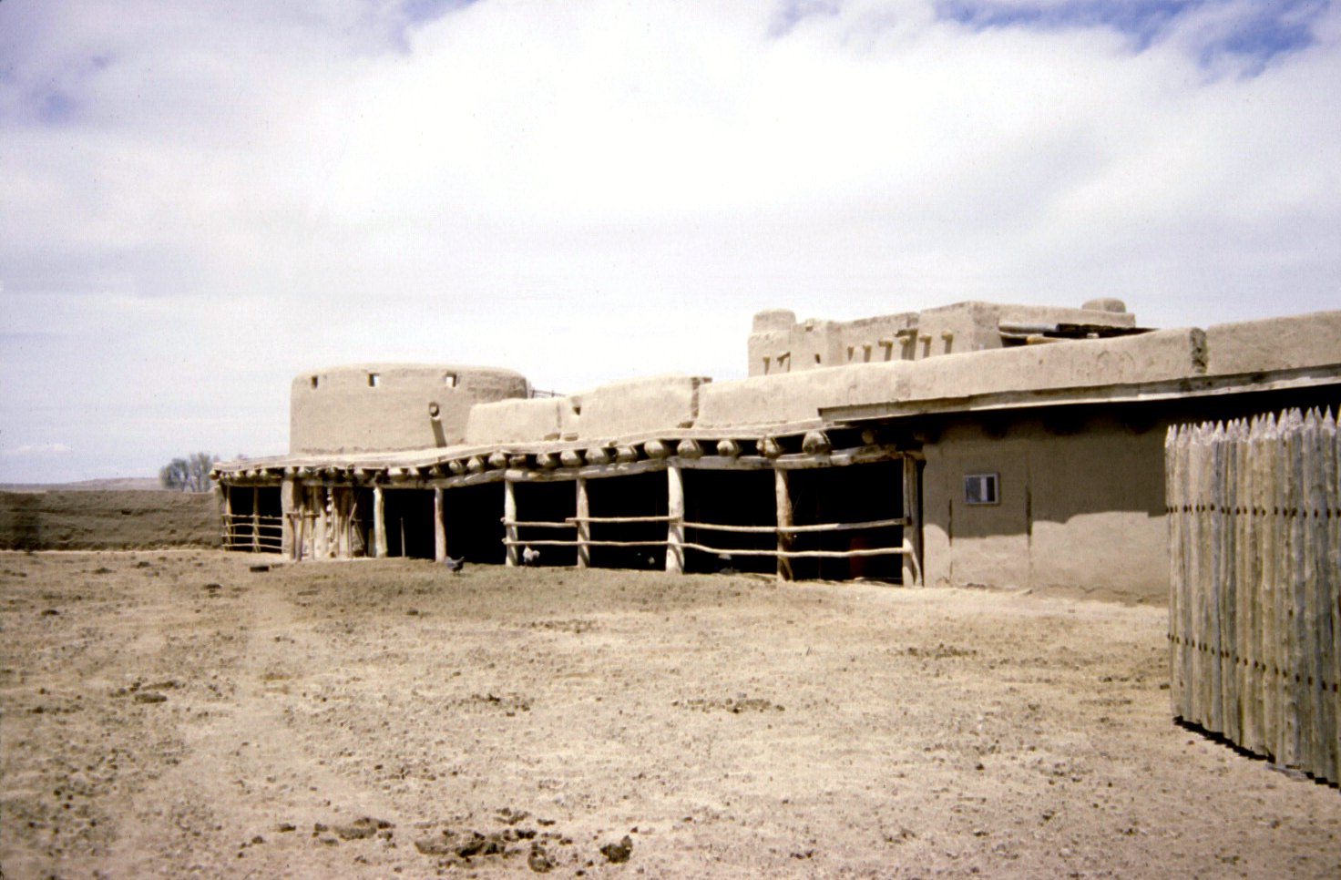
caption = Bent's Old Fort
location = Otero County,Colorado ,USA
nearest_city=La Junta, Colorado
lat_degrees = 38
lat_minutes = 02
lat_seconds = 34
lat_direction = N
long_degrees = 103
long_minutes = 25
long_seconds = 45
long_direction = W
locmapin = Colorado
built =1833
area = 799 acres (3.23 km²)
architect=William Bent ;Charles Bent
architecture=
established_nhs =June 3 ,1960
visitation_num = 23,952
visitation_year = 2007
designated_nhl=December 19 ,1960 cite web|url=http://tps.cr.nps.gov/nhl/detail.cfm?ResourceId=155&ResourceType=District
title=Bent's Old Fort|date=2007-09-28|work=National Historic Landmark summary listing|publisher=National Park Service]
added =October 15 ,1966 cite web|url=http://www.nr.nps.gov/|title=National Register Information System|date=2007-01-23|work=National Register of Historic Places|publisher=National Park Service]
governing_body =National Park Service
refnum=66000254Bent's Old Fort is an 1833 fort located in Otero County,
Colorado ,USA . William andCharles Bent , along withCeran St. Vrain , built the fort to trade with SouthernCheyenne andArapaho Plains Indians and trappers for buffalo robes. For much of its 16-year history, the fort was the only major permanent white settlement on theSanta Fe Trail betweenMissouri and the Mexican settlements. It was destroyed under mysterious circumstances in 1849.The area of the fort was designated a
National Historic Site under theNational Park Service onJune 3 ,1960 . It was further designated aNational Historic Landmark later that year onDecember 19 ,1960 .,cite web|url=PDFlink| [http://pdfhost.focus.nps.gov/docs/NRHP/Text/66000254.pdf "Bent's Old Fort or Fort William", April 20, 1984, by Carl McWilliams and Karen Johnson] |439 KiB |title=National Register of Historic Places Inventory-Nomination|date=1983|publisher=National Park Service] ,cite web|url=PDFlink| [http://pdfhost.focus.nps.gov/docs/NRHP/Photos/66000254.pdf Bent's Old Fort or Fort William--Accompanying 20 photos, from 1983.] |899 KiB |title=National Register of Historic Places Inventory-Nomination|date=1983|publisher=National Park Service] The fort was reconstructed and is open to the public.History
The adobe fort quickly became the center of the Bent, St. Vrain Company's expanding trade empire that included
Fort St. Vrain to the north andFort Adobe to the south, along with company stores inNew Mexico at Taos and Santa Fe. The primary trade was with the SouthernCheyenne andArapaho Indians for buffalo robes.For much of its 16-year history, the fort was the only major permanent non-hispanic white settlement on the
Santa Fe Trail betweenMissouri and the Mexican settlements. The fort provided explorers, adventurers, and theU.S. Army a place to get needed supplies, wagon repairs, livestock, good food, water and company, rest and protection in this vast "Great American Desert". During theMexican-American War in 1846, the fort became a staging area for ColonelStephen Watts Kearny 's "Army of the West".Destruction
For much of the 20th century there have been two main opposing theories for the 1849 destruction of the Fort. In his book "Colorado" (1889),
George Bancroft attributes the Fort's demise to an attack by local indigenous tribes; "Bent's fort was also captured subsequently and the inmates slaughtered". This theory has since been largely discounted. Historians now lean towards the explanation that William Bent himself attempted to sell the Fort to theU.S. Army and, when he failed to extract a sum he felt the sale warranted he mined the fort withgunpowder andexplosive charges and "blew it to pieces" on August 21, 1849. Certainly eye-witnesses who saw the fort after its abandonment tend to describe damage and destruction as being greater than would have been the case had the Fort simply fallen prey to abandonment and neglect. In the novel "Flashman and the Redskins" byGeorge MacDonald Fraser , the protagonist describes the Fort's destruction by the detonation of the mines, during an attack by Ute and Chief Dog Kiowa raiders.Archeological excavations and original sketches, paintings and diaries were used in the fort's reconstruction in 1976.In popular culture
*In George Macdonald's Flashman novel - Flashman and the Redskins - Flashman the 'fictional' anti-hero is present at the destruction of Bents' Fort. According to the novel, the fort is "blown to pieces" by Bent himself, who set gunpowder lines leading to huge stockpiles of explosives.
Further reading
*cite book
last = Lavender
first = David
title = Bent's Fort
publisher = University of Nebraska Press
date = 1954
location = Garden City, N.Y.
oclc= 26332056 ; reprinted in 1972 by University of Nebraska Press, ISBN 0-8032-5753-8
*cite book
last= Blassingame|first= Wyatt|title= Bent's Fort, Crossroads of the Great West|year= 1967|publisher= Garrard Pub. Co.|location= Champaign, Ill.|pages = 96 p.|oclc= 887106 ; for juvenile audienceReferences
External links
* [http://www.nps.gov/beol/index.htm National Park Service: Bent's Old Fort National Historic Site]
* [http://www.rockymountainprofiles.com/bents_fort_colorado.htm Photos of Bents Fort provided by Rocky mountain Profiles]
* [http://memory.loc.gov/cgi-bin/ampage?collId=pphhsheet&fileName=co/co0000/co0001/sheet/browse.db&action=browse&recNum=0&title2=Old%20Fort%20Bent,%20La%20Junta,%20Bent%20County,%20CO&displayType=1&maxCols=2&itemLink=S?pp/hh:@field(SUBJ+@od1(COLORADO--Bent+County--La+Junta))Architectural Architectural drawings and documentation] atHistoric American Buildings Survey
Wikimedia Foundation. 2010.