Ballycullane

Ballycullane

Infobox Irish Place
name = Ballycullane
gaeilge = Baile Uí Choileáin
motto =
map

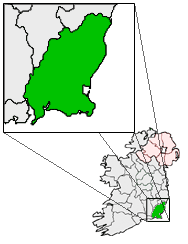
pin coords = left: 34px; top: 92px
north coord = 52.274 | west coord = 6.830
area = | elevation = 46m ( 150.9ft)
province = Leinster
county = Wexford
population = | town pop = 219 [ [http://www.cso.ie/census/documents/census2006_volume_1_pop_classified_by_area.pdf Irish Census of Population 2006] (PDF file).]
census yr = 2006
stdcode = 051
web = |

Ballycullane (Irish: "Baile Uí Choileáin") is a small village located in the south-west of County Wexford, in Ireland.

History

Ballycullane Railway Station opened on 1 August 1906. [http://www.railbrit.co.uk/Ireland/Irish_railways.pdf]

Details

Today, the village contains a shop, a Pub, a Primary School, [or National School.] a Railway Station, and a Garda Station. [ [http://www.garda.ie/statlinks/wexford.html Garda Station telephone numbers Wexford/Wicklow Division ] ]

The village also contains a R.C. church and an adjoining cemetery. This church was built in 1840, but it was extensively renovated in 1970, giving it a much more modern appearance.

References & footnotes


Wikimedia Foundation. 2010.

Игры ⚽ Поможем написать реферат

Look at other dictionaries:

  • Ballycullane railway station — Infobox Ireland station name = Ballycullane other name= Baile Uí Choileáin code = caption = manager = Iarnród Éireann locale = Ballycullane borough = County Wexford years = 1 August 1906 events = Station opens years1 = 3 November 1975 events1 =… …   Wikipedia

  • Балликаллейн холт — Координаты: 52°17′00.15″ с. ш. 6°50′18.08″ з. д. / 52.283375° с. ш. 6.838357° з. д.  …   Википедия

  • County Wexford — Contae Loch Garman Coat of arms …   Wikipedia

  • Балликаллейн — Деревня Ирландии Балликаллейн англ. Ballycullane, ирл. Baile Uí Choileáin Страна …   Википедия

  • Rail transport in Ireland — Rail services in Ireland are provided by Iarnród Éireann in the Republic of Ireland and by Northern Ireland Railways in Northern Ireland. The gauge on main lines is RailGauge|1600 Irish gauge, as opposed to the standard gauge of RailGauge|1435 of …   Wikipedia

  • Gorey — This article is about the town in Ireland. For the artist, see Edward Gorey. For the town in Jersey, see Gorey, Jersey. Gorey Guaire   Town   …   Wikipedia

  • Monamolin — Village square, Manomolin Monamolin or Monamoling (Irish: Muine Moling) is a small rural village in County Wexford, Ireland, about 11 km (6.8 mi) south of the town of Gorey. Monamolin (in the parish of the same name) …   Wikipedia

  • Bunclody — Bun Clóidí   Town   Market Square, Bunclody …   Wikipedia

  • List of railway stations in Ireland — This article lists railway stations both in the Republic of Ireland and Northern Ireland. In The Republic of Ireland A * Adamstown * Arklow * Ashtown * Athenry * Athlone * Athy * Attymon B *Bagenalstown *Balbriggan *Ballina *Ballinasloe… …   Wikipedia

  • List of census towns in the Republic of Ireland — This page lists the towns of Ireland as defined by the Central Statistics Office for the 2002 census.Under the Local Government Acts, 1994 (S.I. 171 of 1994) and 2001 (S.I. 591 of 2001), the following cities and towns have legally defined… …   Wikipedia

Share the article and excerpts

Direct link
Do a right-click on the link above
and select “Copy Link”