Mold cape — in the British Museum Material Gold Created 1900 1600 BC … Wikipedia
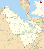
Mold, Flintshire — Coordinates: 53°09′58″N 3°07′59″W / 53.166°N 3.133°W / 53.166; 3.133 … Wikipedia
mold — mold1 moldable, adj. moldability, n. /mohld/, n. 1. a hollow form or matrix for giving a particular shape to something in a molten or plastic state. 2. the shape created or imparted to a thing by a mold. 3. something formed in or on a mold: a… … Universalium
St Mary's Church, Mold — St Mary s Church, Mold, from the south … Wikipedia
The Man in the High Castle — … Wikipedia
Mary Castle — Born Mary Ann Noblett January 22, 1931(1931 01 22) Pampa, Texas, U.S. Died April 29, 1998(1998 04 29) (aged 67) Palm Springs, California, U.S. Occupation … Wikipedia
Bishops Castle Railway — The original plan behind the Bishops Castle Railway in 1861 was to build a line from Craven Arms to Montgomery, thus linking the Shrewsbury to Hereford line to the Oswestry to Newtown, Powys line (later called the Cambrian Line), linking Mid… … Wikipedia
Wrexham, Mold and Connah's Quay Railway — The Wrexham, Mold and Connah s Quay Railway (WMCQR) was incorporated on 7 August 1862 to build a line from Wrexham to Buckley. OverviewThe Buckley Railway had already been incorporated on 14 June 1860 to build a 5 mile line from that town to a… … Wikipedia
Mynydd Isa — Coordinates: 53°10′N 3°07′W / 53.17°N 3.12°W / 53.17; 3.12 … Wikipedia
St Mary's Church, Cilcain — Tower and west end of St Mary s Church, Cilcain Coordinates … Wikipedia

