- Findon, West Sussex
-
Coordinates: 50°52′06″N 0°24′26″W / 50.8682°N 0.4072°W
Findon 
High Street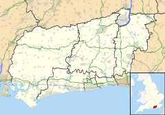
 Findon
Findon shown within West SussexArea 16.14 km2 (6.23 sq mi) [1] Population 1,848 [1] 2001 Census - Density 114 /km2 (300 /sq mi) OS grid reference TQ121088 - London 45 miles (72 km) NNE Parish Findon District Arun Shire county West Sussex Region South East Country England Sovereign state United Kingdom Post town WORTHING Postcode district BN14 Dialling code 01903 Police Sussex Fire West Sussex Ambulance South East Coast EU Parliament South East England UK Parliament Arundel and South Downs List of places: UK • England • West Sussex This article is about the village in West Sussex. For village in Scotland, see Findon, Aberdeenshire.Findon is a village and civil parish in the Arun District of West Sussex, England, four miles (6.4 km) north of Worthing. The parish has an area of 16.41 km² and a population of 1848 persons (2001 census).
Findon lies between two hills; Cissbury with its iron age hill fort to the east and Church Hill to the west. On both hills there are remains of stone age flint mines where shafts were sunk about 12.2 metres (40 feet) to reach the best seams of flint which were mined from radiating galleries.[2] The village is now bypassed by the A24 as it crosses the South Downs: the bypass was constructed in 1938. A modern settlement to the south of the village, inside the boundary of the Borough of Worthing is called Findon Valley.
The parish church, dedicated to St John the Baptist, stands to the west of the village and the A24 road near the 18th century mansion Findon Place. The church is built of flint to an unusual design, the nave and north aisle having been given a single span roof with king-posts resting on the arcade, probably in the 15th century. The screen is a rare 13th century example, but heavily restored.[2] There are five public houses, The Gun Inn, The Black Horse, The Village House, The Snooty Fox (part of the Findon Manor Hotel) and John Henry's four of which are located in the High Street. The village has a small primary school, situated on School Hill, called Saint John the Baptist. It boasts many annual events, including a fireworks display and May Day celebrations.
The parish includes the hamlet of Nepcote on the east side of the village. Nepcote Green is the venue for the annual Findon sheep fair held in early September. Originally a charter fair dating from as early as 1261 many thousands of sheep were penned on the green for sale in earlier times. Wooden hurdles for pens were stored in the purpose built Wattle House on the green which also included living accommodation. Nowadays the fair is a sheep show and funfair.
The actress Nancy Price lived in a cottage called 'Arcana' in Heather lane, in the downs above Findon for many years[3].
The Monarch's Way long-distance footpath crosses the village, the only significant settlement on the route between Arundel and Bramber.
See also
- Rose Setten - BBC Young Choirgirl of the Year for 2004, from All Saints Church, Findon Valley
References
- ^ a b "2001 Census: West Sussex – Population by Parish". West Sussex County Council. http://www.westsussex.gov.uk/communityandliving/census2001/pop_parish_summary.pdf. Retrieved 26 March 2009.
- ^ a b Nairn, Ian; Pevsner, Nikolaus (1965). The Buildings of England: Sussex. Harmondsworth: Penguin Books. pp. 222–3. ISBN 0-14-071028-0.
- ^ http://www.findonvillage.com/0361_margot_and_nancy.htm
External links
Towns Villages and Hamlets Aldingbourne · Aldwick · Ancton · Angmering · Atherington · Barnham · Bilsham · Binsted · Burpham · Clapham · Climping · East Preston · Eastergate · Elmer · Felpham · Ferring · Findon · Flansham · Fontwell · Ford · Houghton · Kingston Gorse · Lagness · Lyminster · Madehurst · Middleton-on-Sea · Nepcote · North Bersted · Nyetimber · Offham · Pagham · Patching · Poling · Rose Green · Rustington · Shripney · Slindon · South Bersted · South Stoke · Toddington · Tortington · Walberton · Warningcamp · Wepham · Westergate · Wick · YaptonCivil Parishes Categories:- Villages in West Sussex
- Arun
- Monarch's Way
- West Sussex geography stubs


Wikimedia Foundation. 2010.