- Chandpur District
-
Chandpur
চাঁদপুর— District — Location of Chandpur in Bangladesh
Coordinates: 23°12′50″N 90°38′10″E / 23.2139°N 90.6361°ECoordinates: 23°12′50″N 90°38′10″E / 23.2139°N 90.6361°E Country  Bangladesh
Division Chittagong Division Area - Total 1,704.06 km2 (657.9 sq mi) Population (1991) - Total 2,210,162 - Density 1,297/km2 (3,359.2/sq mi) Literacy rate - Total 37.8% Time zone BST (UTC+6) - Summer (DST) BDST (UTC+7) Website Chandpur(চাঁদপুর জেলা) Chandpur (Bengali: চাঁদপুর)is a district in east-central Bangladesh. It is located at the mouth of the Meghna River. It is a part of the Chittagong Division. The town of Chandpur is terminus of a metre gauge branch of Bangladesh Railways. It also has a water terminal situated here.
Geography
Chandpur district has a total area of 1704.06 square kilometers. It is bounded by Munshiganj District and Comilla District on the north, Noakhali District, Lakshmipur District and Barisal District on the south, Comilla District on the east, and Meghna River, Shariatpur District and Munshiganj District on the west.
Chandpur is the confluence the Padma River (the main branch of the Ganges River) and the Meghna River, which meet near Chandpur Town. Important tributaries of the Meghna River flowing through Chandpur are Dakatia River, Dhanagoda River, Matlab River and Udhamdi River.
Subdivisions
Chandpur has 6 municipalities, 60 wards, 195 mahallas, 7 upazilas, 1 thana, 87 union parishads and 1226 villages. The municipalities are Chandpur Sadar, Shahrasti, Motlob, Changer Char and Hajiganj. The administrative subdivisions called upazilas are:
- Chandpur Sadar Upazila
- Faridganj Upazila
- Haimchar Upazila
- Haziganj Upazila
- Kachua Upazila
- Matlab Upazila
- Shahrasti Upazila
Religious composition(1991)
The district of Chandpur consists
- 3620 mosques,
- 128 Hindu temples,
- 16 Buddhist temples and
- 03 churches.
Education
Chandpur holds a number of educational institutions such as Schools & Colleges.
Institutions are:
- 1.Al-Amin Academy School & College,Chandpur
- 2.chandpur govt. college
- 3.chandpur govt. girls college
- 4. Protyashi R.A High School
- 5.Hasan ali Govt. high school.
- 6.Matripith govt. girls high school
Population
2210162;
male & female
- male 48.67%,
- female 51.33%;
Religion
- Muslim 92.55%,
- Hindu 7.18%,
- Buddhist 0.06%,
- Christian 0.07% and
- others 0.14%.
Archaeological heritage and relics
Rasti Shah Dargah, Begum Mosque, Hajiganj Bara Mosque, Suja Mosque, Alamgiri Mosque, Mada Khan Mosque, Kalimandir at Matlab, Math at Lohagara, Math at Naorai, Math at Tultuli (Kachua), Raths at Sachar and Matlab, Pata of Behula at Ujani, ramnants of the fort at Nasir Court, Kali Bari at Meher, Neelkuthi at Shahebganj, Baraduara at Kasimbazar, Kalibari Mandir (1878) at Chandpur Sadar.
Literacy and educational institutions
Average literacy 37.8%; male 42.7%, female 33%. Educational institutions: university college 1, government college 2, non-government college 36, primary teacher's training institute 1, government high school 6, non-government high school 224, madrasa 1157, government primary school 786, non-government primary school 684, mass education school 76, BRAC school 28, community school 61, satellite school 37, kindergarten school 11, government deaf and dump school 1.
Locally published newspapers and periodicals
Dainik Chandpur Kantha, Dainik Chandpur Darpan; Weekly Chandpur, Weekly Chandpur Sangbad, Weekly Rupasi, Weekly Dibachitra, Weekly Hajiganj; extinct- Nababanga (1947), Alo (1947), Weekly Annagram (1960), Bharat Hitashi, Rakta Palash, Raktim Surya and Mohana.
Cultural organisation
- Club 460,
- public library 9,
- cinema hall 12,
- theatre group 14,
- literary society 5,
- park 2,
- youth organisation 45,
- cooperative society 3129,
- voluntary organisation 451 and
- women's organisation 15.
Main occupations
Agriculture 35.13%, fishing 3.03%, agricultural labour 20.04%, wage labourer 3.15%, commerce 12%, transport 2.24%, construction 1.64%, service 11.68%, others 11.09%.
Land use
Total land 167009 hectares,
- cultivable land 112210 hectares;
- fallow land 48311 hectares;
- single crop 15.03%,
- double crop 59.93% and
- treble crop 25.04%;
- land under irrigation 60921 hectares.
Land control
Among the peasants 22% are landless, 27% marginal, 39% small, 10% intermediate and 2% rich; cultivable land per head 0.08 hectare.
Agriculture
Crops grown in the area include paddy, jute, mustard seed, supari (nut), wheat, potato and sugarcane.
Formerly,[when?] linseed, sesame, kaun and china, local variety of rice, varieties of dal (pulse) were also important crops.[citation needed]
Mango, jackfruit, papaya, banana, papaya, coconut, palm and guava are grown.
Fisheries, dairies, and poultry farms also exist.
Communication facilities
Roads
- pucca 215 km,
- semi pucca 91 km and
- mud road 1407 km;
- railways: 50 km;
- waterways: 190 nautical mile.
Traditional transport
Palanquin, bullock cart and horse carriage. These means of transport are either extinct or nearly extinct.
Manufactories
Jute mills 11, rice and flour mill 185, ice factory 14, cold storage 4, chemical industries 1, iron work 3, aluminum product 1, match factory 2.
Cottage industries
Cottage industries include weaving, shital pati, potteries, bamboo and cane work, fishing net making, blacksmith, tailoring, goldsmith.
Hats, bazars and fairs
Total number of hats and bazars are 213, most noted of which are Puran Bazar, Natun Bazar, Baburhat, Kachua, Faridganj, Fatehpur, Suchipara, Begum Bazar, Hajiganj, Warukh, Matlab, Shahtali, Satnal; noted fairs are Austami Snan Mela (Chandpur), Meher Kali Mela (Shahrasti), Paush Samkranti Mela, Bijoy Mela, Asutami Mela (Aliganj, Hajiganj), Lengtar Mela (Badarpur, Matlab) and Boi (book) Mela.
Main exports
Hilsa fish, shrimp, betel nut and potato.
NGO activities
Operationally important NGOs are brac, asa, CARE, grameen bank, Autta Nibedita, Aman, DPHE, BAVS, VOSD, Save Our Life.
Health centres
Zila sadar hospital 1, charitable dispensary 1, upazila health complex 7, satellite clinic 20, health and family welfare centre 76, maternity centre 3, eye hospital 1, diabetic hospital 1, red crescent hospital 1, tuberculosis hospital 1, private clinic 6, railway hospital
See also
References
 Divisions and districts of Bangladesh
Barisal Division 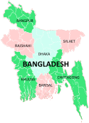
Chittagong Division Bandarban · Brahmanbaria · Chandpur · Chittagong · Comilla · Cox's Bazar · Feni · Khagrachari · Lakshmipur · Noakhali · RangamatiDhaka Division Dhaka · Faridpur · Gazipur · Gopalganj · Jamalpur · Kishoreganj · Madaripur · Manikgonj · Munshiganj · Mymensingh · Narayanganj · Narsingdi · Netrokona · Rajbari · Shariatpur · Sherpur · TangailKhulna Division Rajshahi Division Rangpur Division Sylhet Division Categories:


Wikimedia Foundation. 2010.