- Maryland Route 136
-
Maryland Route 136

Route information Maintained by MDSHA Length: 30.04 mi[1] (48.34 km) Major junctions South end:  MD 7 near Abingdon
 MD 543 in Creswell
 MD 22 in Churchville
 US 1 near Dublin
 MD 440 in Dublin
 MD 165 in Whiteford
 MD 24 near Pylesville
North end:  MD 23 in Norrisville
Location Counties: Harford Highway system Maryland highway system
Interstate • US • State • Minor • Former • Turnpikes←  MD 135
MD 137  →
→Maryland Route 136 (MD 136) is a state highway in the U.S. state of Maryland. The state highway runs 30.04 miles (48.34 km) from MD 7 near Abingdon north to MD 23 in Norrisville. MD 136 is an L-shaped route that connects the communities of Creswell, Churchville, Dublin, and Whiteford in eastern Harford County with each other and with Norrisville in the county's northwestern corner. The state highway is connected to the cities of Aberdeen and Havre de Grace via its connection with MD 22. MD 136 is also linked to the county seat of Bel Air from the east through MD 22, from the northeast by U.S. Route 1 (US 1), from the north via MD 24, and from the northwest by MD 23. The state highway starts on the coastal plain near the Chesapeake Bay and crosses Harford County's two main tributaries of the Susquehanna River, Deer Creek and Broad Creek, while traversing a wide swath of the Piedmont. MD 136 is the second longest Maryland state highway entirely within one county after MD 235.
The first section of MD 136 was constructed east from what is now MD 165 in Whiteford in the early 1920s. That highway was extended south to US 1 near Dublin in the mid 1920s. MD 136 was extended south to US 40 (now MD 7) in the early 1930s; the highway was also extended north from Whiteford to Graceton in the same period. The portion of MD 136 between MD 24 and MD 23 was originally MD 517, which was constructed in the mid 1930s. MD 136 was extended west over the gap between Graceton and MD 24 and assumed all of MD 517 to Norrisville in the mid 1950s.
Contents
Route description
MD 136 begins at an intersection with MD 7 (Philadelphia Road) east of Abingdon at the edge of Bush Declaration Natural Resources Management Area, just north of the confluence of Bynum Run and James Run to form the Bush River. The junction is near the site of the signing of the Bush Declaration, a 1775 resolution of Harford County citizens that supported the activities leading up to American Revolution. MD 136 heads north through farmland as two-lane Calvary Road, which crosses over Interstate 95 (John F. Kennedy Memorial Highway) with no access. I-95 can be accessed via MD 543 (Fountain Green Road/Creswell Road), which MD 136 intersects in the village of Creswell.[1][2]
North of Creswell, MD 136 passes to the west of Stoney Demonstration Forest, crosses Broad Run adjacent to a quarry in the hamlet of Calvary, and passes close to the historic home Webster's Forest, which is accessed via Asbury Road. The state highway continues north to Churchville, where MD 136 intersects MD 22 (Churchville Road) next to the village's namesake, Churchville Presbyterian Church. A short distance east of the intersection, MD 22—which connects Bel Air and Aberdeen—intersects MD 155 (Level Road), which leads to Havre de Grace.[1][2]
MD 136 leaves Churchville as Priestford Road, which passes by the Churchville Test Area, an auxiliary unit of Aberdeen Proving Ground used to test Army vehicles. The state highway traverses Deer Creek at Priest Ford, which is the site of Priest Neal's Mass House and Mill Site, a historic church, and a junction with Harmony Church Road, which leads through the Lower Deer Creek Valley Historic District. MD 136 passes a loop of old alignment, Poplar Grove Road, before intersecting US 1 (Conowingo Road) at an acute angle in the hamlet of Poplar Grove. The state highway continues north as Whiteford Road, which passes another loop of old alignment, Dublin School Road, before meeting MD 440 (Dublin Road) in the village of Dublin.[1][2]
MD 136 heads northwest out of Dublin, crossing Broad Creek and intersecting Robinson Mill Road, which follows the creek east to the Broad Creek Soapstone Quarries. The state highway intersects MD 646 (Prospect Road) in the hamlet of Prospect before approaching Whiteford. Whiteford and the neighboring village of Cardiff are part of the Whiteford-Cardiff Historic District, which preserve buildings from the 19th century when the area was a center of the slate industry. MD 136 expands to a four-lane undivided highway and intersects Old Pylesville Road, which serves as the main street of the villages, before intersecting MD 165 (Pylesville Road).[1][2]
MD 136 reduces to two lanes as it heads west from Whiteford toward the hamlet of Graceton, where the state highway intersects MD 624 (Graceton Road) within 2,000 feet (610 m) of the Pennsylvania state line. The state highway veers southwest and crosses Broad Run again before reaching Five Forks, where the state highway intersects Clermont Mill Road and MD 24 (Rocks Road). MD 136 heads west as Harkins Road, intersecting Fawn Grove Road in the hamlet of Harkins and traversing three tributaries of Deer Creek—Falling Branch, Big Branch, and Island Branch—before reaching its northern terminus at MD 23 (Norrisville Road) in Norrisville.[1][2]
History
The first section of MD 136 to be constructed was Whiteford Road from Prospect to Whiteford by 1923.[3] The remainder of Whiteford Road south to US 1 was constructed between 1924 and 1927.[4][5] Priestford Road was built starting in 1930 from US 1.[6] Both the Priestford Road and Calvary Road portions of MD 136 were completed in 1932, including a new bridge over Deer Creek at Priest Ford. In 1933, MD 136 achieved its original extent when the state highway was extended north from Whiteford to Graceton.[7][8] The Harkins Road portion of MD 136 was originally designated MD 517.[9] MD 517 was constructed as a modern highway from MD 24 at Five Forks west to Harkins in 1933.[7][8] Harkins Road was extended west 2 miles (3.2 km) from Harkins in 1934 and 1935.[7][10] MD 517 was completed west to MD 23 in Norrisville in 1936.[11][12] MD 136 was relocated through Dublin in 1952 and 1953.[13] The state highway reached its current extent in 1956 when the county highway between Graceton and Five Forks was transferred to state control; MD 136 was extended southwest to Five Forks then assumed all of MD 517 to its present northern terminus in Norrisville.[14]
Junction list
The entire route is in Harford County.
Location Mile[1] Destinations Notes Abingdon 0.00 MD 7 (Philadelphia Road) – Riverside, EdgewoodSouthern terminus Creswell 2.39 MD 543 (Fountain Green Road/Creswell Road) – Riverside, Fountain GreenChurchville 6.19 MD 22 (Churchville Road) – Bel Air, Aberdeen, Havre de GraceDublin 11.81 US 1 (Conowingo Road) – Bel Air, Rising Sun12.81 MD 440 (Dublin Road) – Ady, DarlingtonProspect 16.24  MD 646 south (Prospect Road) / Prospect Road north – Ady
Whiteford 19.16 MD 165 (Pylesville Road) – Pylesville, CardiffGraceton 21.64  MD 624 (Graceton Road) – Pylesville, Fawn Grove, PA
23.75 MD 24 (Rocks Road) – Bel Air, Fawn Grove, PANorrisville 30.04 MD 23 (Norrisville Road) – Jarrettsville, Stewartstown, PANorthern terminus 1.000 mi = 1.609 km; 1.000 km = 0.621 mi References
- ^ a b c d e f g "Highway Location Reference: Harford County" (PDF). Maryland State Highway Administration. 2009. http://www.marylandroads.com/Location/2009_HARFORD.pdf. Retrieved 2011-02-23.
- ^ a b c d e Google, Inc. Google Maps – Maryland Route 136 (Map). Cartography by Google, Inc. http://maps.google.com/maps?f=d&source=s_d&saddr=MD-136+N%2FCalvary+Rd&daddr=MD-136+N%2FWhiteford+Rd+to:MD-136+N%2FHarkins+Rd&hl=en&geocode=FZxSWgIdAk10-w%3BFZYOXQIdUjd0-w%3BFSbFXQId9jRw-w&mra=ls&sll=39.652689,-76.26503&sspn=0.007467,0.01929&ie=UTF8&t=h&z=10. Retrieved 2011-02-23.
- ^ Maryland Geological Survey. Map of Maryland: Showing State Road System and State Aid Roads (Map) (1923 ed.).
- ^ Report of the State Roads Commission of Maryland. 1924-1926. Baltimore: Maryland State Roads Commission. January 1927. pp. 44–45, 84. http://www.archive.org/details/annualreportsofs1924mary. Retrieved 2011-02-23.
- ^ Maryland Geological Survey. Map of Maryland: Showing State Road System and State Aid Roads (Map) (1927 ed.).
- ^ Report of the State Roads Commission of Maryland. 1927-1930. Baltimore: Maryland State Roads Commission. 1930-10-01. p. 214. http://www.archive.org/details/reportofstateroa1927mary. Retrieved 2011-02-23.
- ^ a b c Report of the State Roads Commission of Maryland. 1931-1934. Baltimore: Maryland State Roads Commission. 1934-12-28. pp. 338–339. http://www.archive.org/details/reportofstateroa1931mary. Retrieved 2011-02-23.
- ^ a b Maryland Geological Survey. Map of Maryland Showing State Road System: State Aid Roads and Improved County Road Connections (Map) (1933 ed.).
- ^ Maryland State Roads Commission. General Highway Map: State of Maryland (Map) (1939 ed.).
- ^ Maryland Geological Survey. Map of Maryland Showing State Road System: State Aid Roads and Improved County Road Connections (Map) (1935 ed.).
- ^ Report of the State Roads Commission of Maryland. 1935-1936. Baltimore: Maryland State Roads Commission. 1936-12-04. p. 81. http://www.archive.org/details/reportofstateroa1935mary. Retrieved 2011-02-23.
- ^ Maryland State Roads Commission. Map of Maryland Showing State Road System (Map) (1936 ed.).
- ^ Report of the State Roads Commission of Maryland. 1953-1954. Baltimore: Maryland State Roads Commission. 1954-11-12. p. 179. http://www.archive.org/details/reportofstateroa1953mary. Retrieved 2011-02-23.
- ^ Maryland State Roads Commission. Maryland: Official Highway Map (Map) (1956 ed.).
External links
Roads in Harford County, Maryland State highways 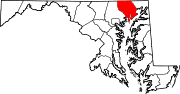
U.S. Highways Interstate Highways Categories:- State highways in Maryland
- Roads in Harford County, Maryland


Wikimedia Foundation. 2010.