- Curtin, Nicholas County, West Virginia
-
Curtin — Unincorporated community — Location within the state of West Virginia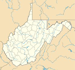
 Curtin
Coordinates: 38°17′29″N 80°38′24″W / 38.29139°N 80.64°WCoordinates: 38°17′29″N 80°38′24″W / 38.29139°N 80.64°W Country United States State West Virginia County Nicholas Time zone Eastern (EST) (UTC-5) - Summer (DST) EDT (UTC-4) ZIP codes FIPS code GNIS feature ID Curtin is a nearly abandoned unincorporated community in eastern Nicholas County, West Virginia, United States. The area is situated at the bottomland surrounding the mouth of the Cherry River at its confluence with the Gauley River. Curtin is also the location where West Virginia Route 55 and West Virginia Route 20 cross the Gauley.
History
Curtin was once a lumber boomtown and served a hub for the transportation of lumber in Nicholas and Webster Counties in the early part of the 1900s. It was the site of a railroad bridge across the Cherry and a ferry across the Gauley on the road between Richwood and Craigsville.
Eventually, timber harvest fell in the area, the railroad stopped operation, and a bridge replaced the ferry for motorized traffic. Now all that remains of the town are a couple of houses, some scattered foundations, the modern highway bridge, the old pillars of the since-demolished railroad bridge, and a rail trail accessible from Holcomb.
Municipalities and communities of Nicholas County, West Virginia County seat: Summersville City 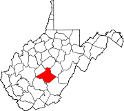
Town CDPs Belva‡ | Birch River | Craigsville | Dixie‡ | Fenwick | Nettie | Tioga
Unincorporated
communitiesAllingdale | Bentree‡ | Calvin | Canvas | Cottle | Curtin | Drennen | Gad | Gilboa | Green Valley | Holcomb | Hominy Falls | Hookersville | Keslers Cross Lanes | Leivasy | Lockwood | Muddlety | New Hope | Mt. Lookout | Mount Nebo | Nallen‡ | Odell Town | Persinger | Poe | Pool | Runa | Saxman | Snow Hill | Swiss | Tolbert | Werth | Woodbine | Zela
Footnotes ‡This populated place also has portions in an adjacent county or counties
Categories:- Populated places in Nicholas County, West Virginia
- Unincorporated communities in West Virginia
- Mountain Lakes geography stubs


Wikimedia Foundation. 2010.