- Makaising
-
Makaising — Village development committee — Location in Nepal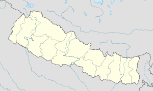
 Makaising
Coordinates: 27°53′N 84°41′E / 27.883°N 84.683°ECoordinates: 27°53′N 84°41′E / 27.883°N 84.683°E Country  Nepal
NepalZone Gandaki Zone District Gorkha District Population (1991) - Total 2,231 Time zone Nepal Time (UTC+5:45) Makaising is a village development committee in Gorkha District in the Gandaki Zone of northern-central Nepal. At the time of the 1991 Nepal census it had a population of 2,231 and had 416 houses in the village.[1]
References
- ^ "Nepal Census 2001". Nepal's Village Development Committees. Digital Himalaya. http://www.digitalhimalaya.com/collections/nepalcensus/form.php?selection=1. Retrieved 2008-08-31.
 Aanppipal, Aaru Arbang, Aaru Chanuate, Aarupokhari, Asrang, Baguwa, Bakrang, Bhirkot, Bhumlichok, Bihi, Borlang, Bunkot, Chhaikampar, Chhoprak, Chumchet, Chyangli, Darbhung, Deurali, Dhawa, Dhuwakot, Finam, Fujel, Gaikhur, Gakhu, Ghairung, Ghyachok, Ghyalchok, Gorakhkali, Gumda, Hansapur, Harbhi, Jaubari, Kashigaun, Kerabari, Kerauja, Kharibot, Khoplang, Laprak, Lapu, Lho, Makaising, Manakamana, Manbu, Masel, Muchhok, Namjung, Nareshwor, Palumtar, Panchkhuwadeurali, Pandrung, Prithbinarayan, Prok, Ranishwara, Samagaun, Saurpani, Shreenathkot, Simjung, Sirdibas, Swara, Taklung, Takukot, Takumajhalakuribot, Tandrang, Tanglichok, Taple, Tara Nagar, Thalajung, Thumi, Uiya, Warpak
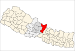 Categories:
- Populated places in Gorkha District
- Gandaki Zone geography stubs


Wikimedia Foundation. 2010.