- Cornmill Stream
-
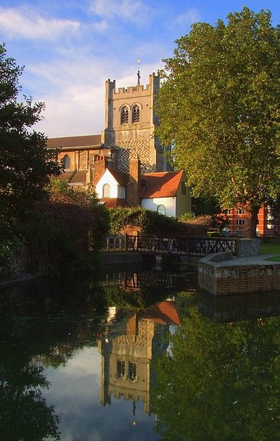
 The stream above Waltham Abbey church
 Harold's bridge spanning the Cornmill Stream
The Cornmill Stream is a minor tributary of the River Lea in the English county of Essex.
History
The stream is an artificial watercourse which may have been built by 1086 to serve the mills mentioned in the Domesday Book at Waltham Abbey.[1] [2]
Course
 The stream at Waltham Abbey town hall
After leaving the River Lee Flood Relief Channel (Horsemill Stream) at Fishers Green the stream flows south to form the western boundary with the former Waltham Abbey Royal Gunpowder Mills before flowing through the Waltham Abbey SSSI within the Gunpowder Mills property. Above Waltham Abbey the stream divulges from the Old River Lea [3] with both channels bordering the Cornmill Stream and Old River Lea, SSSI. The stream passes under the 14th century Harold's Bridge and the B194 road (Abbey View) before flowing through a sluice in the abbey's grounds. The stream flows underground to emerge adjacent to Waltham Abbey town hall. Flowing through an urban area to rejoin the River Lee Flood Relief Channel below the town of Waltham Abbey. Coordinates: 51°41′23″N 0°00′07″W / 51.689663°N 0.001856°W
References
- ^ Waltham Abbey historic town assessement Retrieved September 12, 2008
- ^ British history Retrieved September 12, 2008
- ^ Hertfordshire County council Retrieved September 12, 2008
Counties: Bedfordshire · Essex · Hertfordshire · Greater London · Mouth: River Thames
Settlements: Luton · Harpenden · Wheathampstead · Welwyn Garden City · Hertford · Ware · Stanstead Abbotts · Hoddesdon · Broxbourne · Cheshunt
Waltham Abbey · Ponders End · Edmonton · Tottenham · Upper Clapton · Hackney Wick · Stratford · Bromley-by-Bow · Canning Town · Leamouth
Major tributaries: River Ash · River Beane · River Ching · River Mimram · River Moselle · River Rib · River Stort
Minor tributaries: Bayford Brook · Broxbourne Mill Stream · Cobbins Brook · Coppermill Stream · Cornmill Stream • Cuffley Brook · Dagenham Brook ·
Hackney Brook · Millhead Stream • Pymmes Brook · Rags Brook • River Lynch · Salmons Brook
Small River Lea & Turnford Brook · Spital Brook · Theobalds Brook · Turkey Brook · Woollens Brook · Wormleybury BrookCategories:- Geography of Essex


Wikimedia Foundation. 2010.