- Chandeleur Island Light
-
Chandeleur Island Light 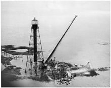
1971 Location Chandeleur Islands, Gulf of Mexico, Louisiana Year first constructed 1848 Year first lit 1896 (most recent tower) Automated 1951? Deactivated destroyed by Katrina, 2005 Foundation Pile Construction Iron Tower shape Skeletal with cylinder Markings / pattern Brown with black lantern Focal height 102 ft (31 m) Original lens 3rd order Fresnel lens Characteristic various, most recent: Flashing white Fog signal none USCG number [1] Chandeleur Light

Nearest city: New Orleans, Louisiana Coordinates: 30°2′50″N 88°52′41″W / 30.04722°N 88.87806°WCoordinates: 30°2′50″N 88°52′41″W / 30.04722°N 88.87806°W Area: 0.1 acres (0.040 ha) Built: 1896 Architectural style: Lighthouse Tower Governing body: US Coast Guard NRHP Reference#: 86001404
[2]Added to NRHP: June 25, 1986 The Chandeleur Island Light was a lighthouse first established in 1848 near the northern end of the Chandeleur Islands in the Gulf of Mexico, off the east coast of Louisiana.
History
The first light was finished in 1848 with nine lamps in 21 inch (530 mm) reflectors about 55 ft (17 m) above the base. The tower and the keeper's house were destroyed in August, 1852.
A second, brick, tower was in operation by 1855, with a focal plane of 50 ft (15 m). By 1865 it had a 4th order Fresnel lens. This tower was the only building on the site that survived the hurricane of October 1, 1893, but it was badly damaged and was taken down. Congress appropriated $35,000 for its replacement. [3]
A new, iron skeleton tower with a 3rd order Fresnel lens (focal plane 102 feet, 31 m) was erected in its place in 1895.[4] This survived damage from a number of storms and increasing erosion of the islands.
The light figured in a case before the United States Supreme Court. After a barge carrying fertilizer ran aground, it was determined that the Coast Guard had been negligent in maintaining the proper operation of the light. The Court held that the United States was liable. [5]
The light was added to the National Register of Historic Places in 1986 as Chandeleur Light.
Hurricane Katrina completely toppled the light in 2005.
 The light in 1960. Note how much more land there is than in 1971, above.
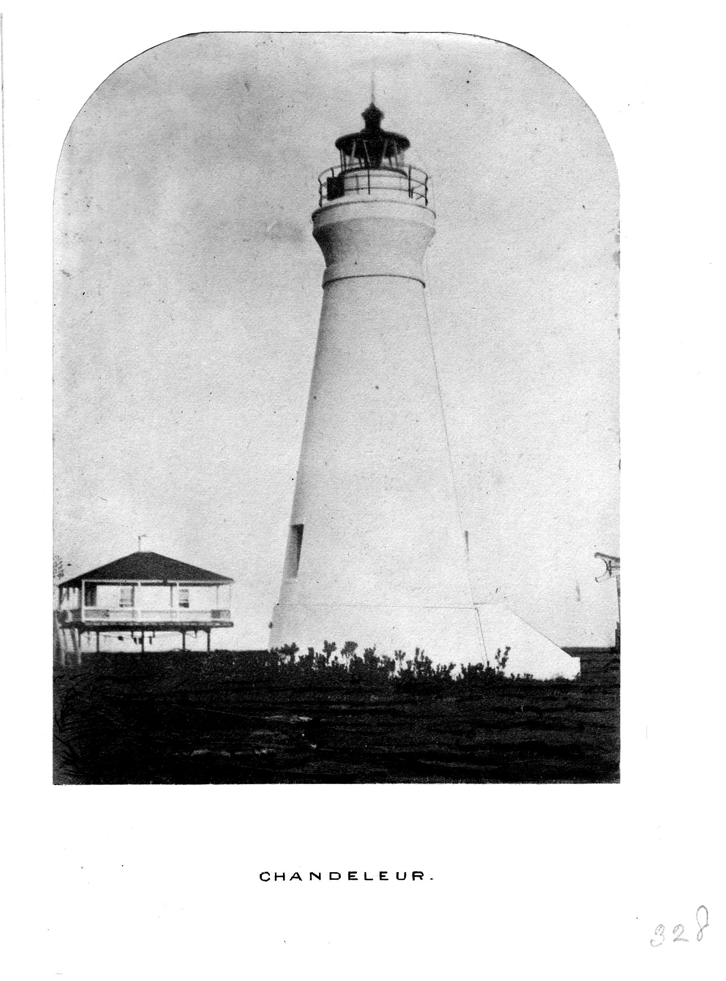
 The 1856 brick tower
External links
References
- ^ "Historic Light Station Information and Photography: Louisiana". United States Coast Guard Historian's Office. http://www.uscg.mil/history/weblighthouses/LHLA.asp.
- ^ "National Register Information System". National Register of Historic Places. National Park Service. 2009-03-13. http://nrhp.focus.nps.gov/natreg/docs/All_Data.html.
- ^ (28 Stat. 375)
- ^ Breton National Wildlife Refuge. Refuge brochure. U.S. Fish & Wildlife Service. August, 2006, p.4.
- ^ Indian Towing Co. v. United States 350 U.S. 61 (1955)
Chandeleur Island Light · New Canal Light · Pass Manchac Light · Point Au Fer Reef Light · Sabine Pass Light · Southwest Reef Light · Tchefuncte River Range Lights · Trinity Shoal LightU.S. National Register of Historic Places Topics Lists by states Alabama • Alaska • Arizona • Arkansas • California • Colorado • Connecticut • Delaware • Florida • Georgia • Hawaii • Idaho • Illinois • Indiana • Iowa • Kansas • Kentucky • Louisiana • Maine • Maryland • Massachusetts • Michigan • Minnesota • Mississippi • Missouri • Montana • Nebraska • Nevada • New Hampshire • New Jersey • New Mexico • New York • North Carolina • North Dakota • Ohio • Oklahoma • Oregon • Pennsylvania • Rhode Island • South Carolina • South Dakota • Tennessee • Texas • Utah • Vermont • Virginia • Washington • West Virginia • Wisconsin • WyomingLists by territories Lists by associated states Other Categories:- Lighthouses in Louisiana
- National Register of Historic Places in Louisiana
- Lighthouses on the National Register of Historic Places
- Buildings and structures completed in 1896
- Buildings and structures in St. Bernard Parish, Louisiana
- Structures affected by Hurricane Katrina
- Louisiana Registered Historic Place stubs
- United States lighthouse stubs


Wikimedia Foundation. 2010.