- Chère
-
Chère 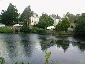
The Chère at Châteaubriant.Origin Soudan
47°42′01″N 01°17′25″W / 47.70028°N 1.29028°WMouth Vilaine
47°42′25″N 01°50′13″W / 47.70694°N 1.83694°WCoordinates: 47°42′25″N 01°50′13″W / 47.70694°N 1.83694°WBasin countries France Length 65.1 km (40.5 mi) Source elevation 80 m (260 ft) Mouth elevation 3 m (9.8 ft) Avg. discharge 2.4 m3/s (85 cu ft/s) at mouth Basin area 390 km2 (150 sq mi) The Chère (French: la Chère) is a 65.1 km (40.5 mi) long river in the Loire-Atlantique and Ille-et-Vilaine départements, western France. Its source is at Soudan. It flows generally west. It is a left tributary of the Vilaine into which it flows between Pierric and Sainte-Anne-sur-Vilaine.
Communes along its course
This list is ordered from source to mouth:
- Loire-Atlantique: Soudan, Châteaubriant, Rougé, Saint-Aubin-des-Châteaux, Sion-les-Mines, Mouais, Derval,
- Ille-et-Vilaine: Grand-Fougeray,
- Loire-Atlantique: Pierric,
- Ille-et-Vilaine: Sainte-Anne-sur-Vilaine
Notes
- This article incorporates information from the revision as of September 20, 2009 of the equivalent article on the French Wikipedia.
References
Categories:- Rivers of France
- Vilaine Basin
- Geography of Brittany
- Loire-Atlantique geography stubs
- Ille-et-Vilaine geography stubs

Wikimedia Foundation. 2010.