- Chittening
-
Coordinates: 51°31′44″N 2°40′30″W / 51.529°N 2.675°W
Chittening 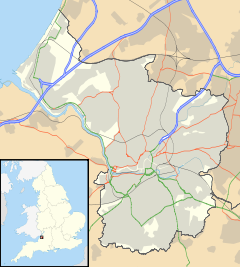
 Chittening
Chittening shown within BristolOS grid reference ST532813 Unitary authority Bristol Region South West Country England Sovereign state United Kingdom Post town BRISTOL Postcode district BS11 Dialling code 0117 Police Avon and Somerset Fire Avon Ambulance Great Western EU Parliament South West England UK Parliament Bristol North West List of places: UK • England • Bristol Chittening is an industrial estate 2 miles north of Avonmouth, Bristol, England on the A403 road, near the River Severn. It lies within the Bristol city boundary.
Contents
History
Chittening was once a farm, historically in the parish of Henbury. In the First World War a munitions factory was built on the site, where cylinders and shells were filled with chloropicrin and, from June 1918, with mustard gas.[1]
The industrial estate (or "trading estate") developed after the war, under the management of the Port of Bristol Authority. In 1951 a factory producing carbon black was built next to the estate, and operated until 2008 when its closure was announced.[2]
Between 1917 and 1964 Chittening was served by Chittening Platform railway station.
Name
Chittening was first recorded in 1658 as Chitnend. The name apparently comes from the Middle English chitten ende, meaning "end [of a parish or estate] where there are the young of animals".[3]
Chittening Warth
Chittening Warth is an area of salt marsh beside the Severn Estuary, just to the west of the industrial estate. At low tide the mudflats there are visited by large numbers of birds, including Dunlin, Eurasian Curlew, Eurasian Oystercatcher, Common Redshank and Whimbrel. In some winters there are large populations of field voles, which attract Short-eared Owls.[4]
Transport
Chittening is served by St Andrews Road railway station.
References
- ^ Haber L.F. (1986) The Poisonous Cloud Oxford University Press ISBN 978 0198581420 Chapter 10
- ^ Bristol Evening Post, 3 December 2008
- ^ Smith, A.H. (1964) Place Names of Gloucestershire Vol.3 p.138 Cambridge University Press
- ^ Bristol City Council Biodiversity Action Plan: Estuarine habitats
Categories:- Districts of Bristol
- Buildings and structures in Bristol
- Industrial parks in the United Kingdom

Wikimedia Foundation. 2010.