- Downend, South Gloucestershire
-
Coordinates: 51°29′41″N 2°30′18″W / 51.4947°N 2.5049°W
Downend 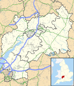
 Downend
Downend shown within GloucestershirePopulation Downend and Bromley Heath OS grid reference ST650774 Unitary authority South Gloucestershire Ceremonial county Gloucestershire Region South West Country England Sovereign state United Kingdom Post town BRISTOL Postcode district BS Dialling code 0117 Police Avon and Somerset Fire Avon Ambulance Great Western EU Parliament South West England UK Parliament Filton and Bradley Stoke List of places: UK • England • Gloucestershire 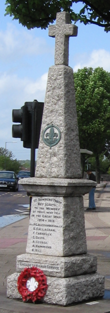 Downend War Memorial
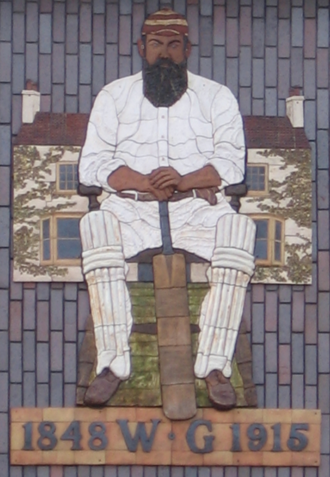
 A mural of W. G. Grace in Downend
Downend is a suburb of Bristol in South Gloucestershire, England. It is located to the North East of Bristol and bordered by the Bristol City suburb of Fishponds to its south west and the South Gloucestershire suburbs of Staple Hill to the south, Frenchay to the west and Mangotsfield to the East. You can find the town on Google Earth with the coordinates N 51 29 16 W 2 30 15.
The outward expansion of Downend dating from the 1980s has been contained by the presence of the M4 motorway which swings around the northern side of Bristol. Downend has little industry within its boundaries, consisting mainly of domestic housing and local shopping facilities. A welcome development since 2003 is the opening of several premises as independently owned restaurants, allowing residents to eat out locally and a designer clothes store. Downend has its fair share of parks including The King George V Playing Fields, and there is also a local cricket club located in the centre of Downend. Secondary and primary schools based in Downend include Downend School,Stanbridge Primary School, Bromley Heath Junior and Infant schools and Christ Church Primary and Junior schools. There are a few local churches although the closest are Downend Baptist Church on Salisbury Road and the Christ Church on Downend Road. Badminton Road Methodist Church, between Downend and the Avon Ring Road, serves the newer housing alongside Badminton Road and in the Bromley Heath area.
Downend's greatest claim to fame is that the cricketer W. G. Grace was born in the village, and played cricket as a boy for the nearby West Gloucestershire Cricket Club, which had been founded by his father, the Downend GP. Sarah Dallin and Keren Woodward, members of the band Bananarama, also grew up in Downend (but attended Mangotsfield School). The rock band New Rhodes also lived in Downend for a short time.
The woods near Downend were the site of an air crash on 6 November 1957, when a prototype Bristol Britannia aircraft crashed killing the 15 man crew. The prototype aircraft crashed into nearby Britannia Woods, Downend after sweeping across the expanse of 1950s Downend.
Contents
Sport and recreation
Downend has a wide range of local parks and open spaces, most notably King George's Field in memorial to King George V, the playing fields are used for Football in the Winter and Cricket in the summer months.
Downend school features the majority of the area's sports facilities, on the school's site there is a Sports Centre, Sports Hall, Changing + shower areas and a Gymnasium. The school has an all-weather football pitch which is hired out regularly for football training by local teams, Netball, Basketball and Nine Tennis Courts , Cricket nets and long jump pits. However there are no rugby pitches because the council decide what sporting facilities it chooses, even though there are three football pitches and the all-weather pitch.
Nearby Stanbridge Primary School offers a range of dance and keep fit classes for the local community outside school hours.
There are also tennis courts at Cleeve Hill Tennis Club, Queensholm Park and Page Park. Football is also played at Queensholm Park, Blackhorse Lane, Blackhorse Road and Page Park.
A wide range of sports facilities are also available at Kingswood Leisure Centre. Facilities include swimming pools, a gym & various courts.
Some nearby community spaces include King George V playing fields, the former Downend School lower site playing fields and Page park.
Downend is close to the Avon Ring Road Cycle Path and the Bristol & Bath Railway Path, which link up with the Avon Cycleway and the National Cycle Network.
The annual Guy Fawkes Night fireworks display is organised by the Great Western Round Table.[1][2] The 40th anniversary show in 2011 was provided for the first time by Skyburst Illuminations of Bedminster, Bristol.[3]
See also
References
- ^ "40th anniversary for Downend Fireworks Show". Bristol Evening Post. November 03, 2011. http://www.thisisbristol.co.uk/40th-anniversary-Downend-Fireworks/story-13740959-detail/story.html. Retrieved November 04, 2011. "Downend Fireworks Show, organised by the Great Western Round Table [...]"
- ^ hrbrsd (November 02, 2011). "Forty years of fireworks". kingswoodpeople. Northcliffe Media. http://www.kingswoodpeople.co.uk/years-fireworks/story-13732632-detail/story.html. Retrieved November 11, 2011. "The annual Downend Firework Show, hosted by the Great Western Round Table (GWRT), which attracts crowds of up to 13,000 each year, can trace its beginnings back to Westerleigh Road in 1971."
- ^ "Night to go with a bang for firm behind 130 displays". Bristol Evening Post. November 01, 2011. http://www.thisisbristol.co.uk/Night-bang-firm-130-displays/story-13721417-detail/story.html. Retrieved November 04, 2011. ""This year we're firing Downend Firework Show for the first time which is a great honour," [...]"
External links
- Downend School Website
- Stanbridge Primary School Website
- Downend Baptist Church
- Downend Christ Church
- Badminton Road Methodist Church
- Downend Christadelphian Church
- Downend Round Table
- Downend Flyers GFC and LFC
- Downend FC
- Downend & Bromley Heath Parish Council Website
- Downend Parish Magazine - August 1905
Subdivisions of Bristol Constituencies Wards Ashley · Avonmouth · Bedminster · Bishopston · Bishopsworth · Brislington East · Brislington West · Cabot · Clifton · Clifton East · Cotham · Easton · Eastville · Filwood · Frome Vale · Hartcliffe · Henbury · Hengrove · Henleaze · Hillfields · Horfield · Kingsweston · Knowle · Lawrence Hill · Lockleaze · Redland · Southmead · Southville · St George East · St George West · Stockwood · Stoke Bishop · Westbury-on-Trym · Whitchurch Park · Windmill HillNeighbourhoods City centre · Arnos Vale · Ashley Down · Ashton Gate · Ashton Vale · Avonmouth · Baptist Mills · Barton Hill · Bedminster · Bedminster Down · Bishopston · Bishopsworth · Blaise Hamlet · Bower Ashton · Brentry · Brislington · Broadmead · Broomhill near Brislington · Broomhill near Stapleton · Canon's Marsh · Chester Park · Chittening · Clifton · Cliftonwood · Coombe Dingle · Cotham · Crew's Hole · Crofts End · Easton · Eastville · Filwood Park · Fishponds · Golden Hill · Greenbank · Hartcliffe · Headley Park · Henbury · Hengrove · Henleaze · Hillfields · Horfield · Hotwells · Kensington Park · Kingsdown · Knowle · Knowle West · Lawrence Hill · Lawrence Weston · Lockleaze · Lodge Hill · Mayfield Park · Monks Park · Montpelier · Old City · Redcliffe · Redfield · Redland · Sea Mills · Shirehampton · Sneyd Park · Southmead · Southville · Speedwell · Spike Island · St Andrews · St Annes · St George · St Jude's · St Pauls · St Philips Marsh · St Werburghs · Stapleton · Stockwood · Stoke Bishop · Stokes Croft · Totterdown · Tyndalls Park · Upper Knowle · Westbury-on-Trym · Westbury Park · Whitchurch · Whitehall · Windmill Hill · WithywoodThe following suburbs are in the same urban area but lie in South Gloucestershire
Bradley Stoke · Conham · Downend · Emersons Green · Filton · Frenchay · Hambrook · Hanham · Little Stoke · Kingswood · Mangotsfield · Patchway · Soundwell · Staple Hill · Stoke Gifford · WinterbourneOther Notable Areas Bristol Harbour · Buildings · Churches · Cribbs Causeway · Places of interest · Stokes Croft
Categories:

Wikimedia Foundation. 2010.