- Mirăslău
-
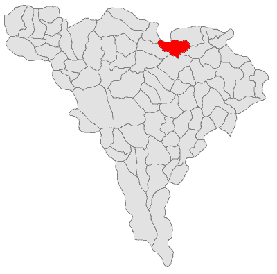
Mirăslău — Commune — Location of Mirăslău Location of Mirăslău
 Mirăslău
Coordinates: 46°22′00″N 23°43′00″E / 46.3666667°N 23.7166667°ECoordinates: 46°22′00″N 23°43′00″E / 46.3666667°N 23.7166667°E Country  Romania
County Alba County Status Commune Government – Mayor Aurel Mărginean (National Liberal Party) Area – Total 66.59 km2 (25.7 sq mi) Population (2002) – Total 2,334UNIQ195c08fcdb07ac9-ref-00,000,000-QINU Time zone EET (UTC+2) – Summer (DST) EEST (UTC+3) Mirăslău (German: Mireslau, Hungarian: Miriszló) is a commune located in Alba County, Romania. It has a population of 2334. The commune is composed of six villages: Cicău (Csákó), Decea (Marosdécse), Lopadea Veche (Oláhlapád), Mirăslău, Ormeniş (Marosörméyes) and Rachiş (Oláhrákos).
The commune is the site of a battle in 1600 between the Wallachian army led by Michael the Brave and the Hungarian noblemen supported by the Austrian general Giorgio Basta (see Battle of Mirăslău).
At the 2002 census, 71.4% of inhabitants were Romanians, 26.9% Hungarians and 1.6% Roma. 66.4% were Romanian Orthodox, 25% Reformed and 4% Greek-Catholic.
References
- ^ (Romanian) "Mirăslău", at the Erdélyi Magyar Adatbank's Recensământ 2002; Retrieved on September 4, 2009
Alba County, Romania Cities 
Towns Abrud · Baia de Arieş · Câmpeni · Cugir · Ocna Mureş · Teiuş · Zlatna
Communes Albac · Almaşu Mare · Arieşeni · Avram Iancu · Berghin · Bistra · Blandiana · Bucerdea Grânoasă · Bucium · Câlnic · Cenade · Cergău · Ceru-Băcăinţi · Cetatea de Baltă · Ciugud · Ciuruleasa · Crăciunelu de Jos · Cricău · Cut · Daia Română · Doştat · Fărău · Galda de Jos · Gârda de Sus · Gârbova · Hopârta · Horea · Ighiu · Întregalde · Jidvei · Livezile · Lopadea Nouă · Lunca Mureşului · Lupşa · Meteş · Mihalţ · Mirăslău · Mogoş · Noşlac · Ocoliş · Ohaba · Pianu · Poiana Vadului · Ponor · Poşaga · Rădeşti · Râmeţ · Rimetea · Roşia de Secaş · Roşia Montană · Sălciua · Săliştea · Sâncel · Săsciori · Sântimbru · Scărişoara · Stremţ · Şibot · Sohodol · Şpring · Şugag · Şona · Unirea · Vadu Moţilor · Valea Lungă · Vidra · Vinţu de Jos
Categories:- Communes in Alba County
- Alba County geography stubs

Wikimedia Foundation. 2010.