- City Park, Houston
-
For other uses, see City Park.
City Park is a development in Houston, Texas, United States that encompasses the subdivisions of City Park and City Park West. The neighborhood, consisting of 1,500 houses, is on a 375 acres (152 ha) tract along Orem Drive, between Texas State Highway 288 and Almeda Road.[1] City Park, located along Sims Bayou, is centered at the intersection of Kirby Drive and West Orem Drive.[2] Jenna Colley of the Houston Business Journal said that the subdivision is one seven minute drive away from the Texas Medical Center.[1]
The City Park subdivision homes are built by K. Hovnanian Homes. The companies that build City Park West subdivision homes include Lennar Homes, Legend Homes, and Gehan Homes.[3] The development is also slated for a 4.5-acre (18,000 m2) park in addition to its many walking trails and playgrounds.[4]
Contents
History
In April 2002 Sam Yager Jr., the president of Sam Yager Inc., a land management company, approached City of Houston planners with the proposed City Park project. During that year planners from the City of Houston and Harris County agreed to enter a public-private partnership to facilitate the development of City Park on then-vacant land. At the time Orem Drive did not extend eastward to Texas State Highway 288, nor did it extend westward to Kirby Drive. The city and county agreed to build separate extensions of Orem Drive. Al Haines, the chief administrative officer of the City of Houston in 2002, said that the City Park project caused the city to prioritize the extension of Orem Drive. The Houston City Council agreed to create a municipal utility district (MUD) designed to reimburse the costs of the utility infrastructure construction. Yager said that the City Park project would have been too expensive to implement if the MUD had not been created. The City of Houston participated in the City Park project to provide jobs, lower housing prices, and encourage the development of retail businesses in the surrounding area.[1]
The subdivision, built on former farmland, was intended to provide living space for people who work in the Texas Medical Center and Downtown Houston. The project had a cost of $250 million. Upon completion the nearly 1,500 houses within City Park were to be priced between $70,000 and $140,000. The project was Yager's firm's first project within the City of Houston limits. Yager's firm managed the project, as Parkside Homes was the home builder. Yager's investors, which did not receive any tax abatements included GBF/LIC 288 Ltd and Lumbermen's Investment Corp. The City of Houston expected $1.5 million in revenues within seven to eight years of the development of City Park. Haines said that market forces would determine whether City Park is financially successful.[1] In 2005 the price range of houses in City Park was between $90,000 and $140,000. During that year Business Week said that in City Park "sales are strong, even though the lots and homes are much smaller than those for comparable money in the exurbs, and they are in the Houston Independent School District, which some young families want to avoid."[5] After the developers of City Park had announced their plans, other developers wishing to create subdivisions in southern Houston began including the creation of MUDs in their plans.[6]
Government and infrastructure
City Park is in Houston City Council District D.[7]
Education
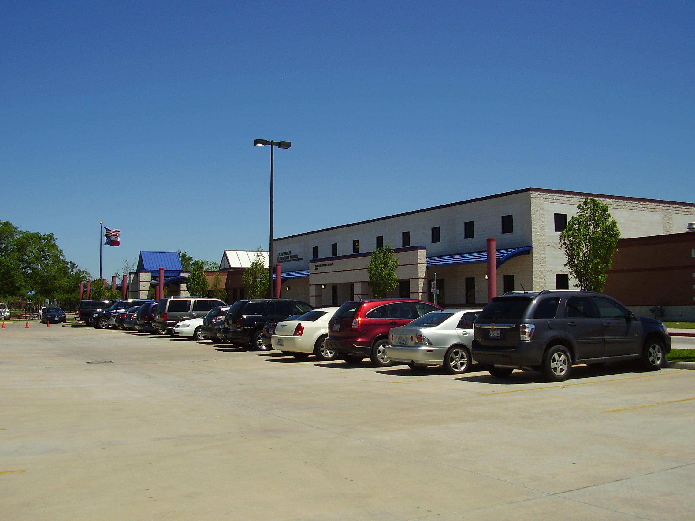
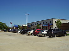 Reynolds Elementary School
Residents are zoned to schools in the Houston Independent School District.[2] The community is within Trustee District IX, represented by Lawrence Marshall as of 2008.[8]
As of 2011 zoned schools include Reynolds Elementary School,[9] Attucks Middle School,[10] and Worthing High School.[11]
Prior to 2011 it was zoned to Woodson K-8 School for Grades 6-8.[12]
The City Park website advertises its proximity to other HISD schools, including[4]:
- Codwell Elementary School
- Frost Elementary School
- Law Elementary School
- Thomas Middle School
- Sterling High School
The developer plans include a site for a future Houston ISD school.[2]
See also
References
- ^ a b c d Colley, Jenna. "Public + private = City Park." Houston Business Journal. Friday September 20, 2002. Retrieved on March 12, 2010.
- ^ a b c "General Plan." City Park. Accessed October 30, 2008.
- ^ "Builders." City Park. Retrieved on November 26, 2008.
- ^ a b "Amenities." City Park. Accessed October 30, 2008.
- ^ "Living Too Large In Exurbia." Business Week. October 17, 2005. Retrieved on March 12, 2010.
- ^ Sarnoff, Nancy. "Land rush surges on south side." Houston Business Journal. Friday November 1, 2002. Retrieved on March 12, 2010.
- ^ City of Houston, Council District Maps, District D." City of Houston. Retrieved on November 5, 2011.
- ^ "Trustee Districts Map." Houston Independent School District. Retrieved on November 11, 2008.
- ^ "Reynolds Elementary Attendance Zone." Houston Independent School District. Accessed October 30, 2008.
- ^ "Attucks Middle Attendance Zone." Houston Independent School District. Retrieved on oCTOBER 26, 2011.
- ^ "Worthing High School Attendance Zone." Houston Independent School District. Accessed October 30, 2008.
- ^ "Woodson Middle Attendance Zone." Houston Independent School District. Accessed October 30, 2008.
External links
 City of HoustonNickname: Space City
Topics History | Geography | Climate | Politics | Mayors | Economy | Demographics | Culture | Architecture | Transportation | Education | Nicknames | Sister cities
Attractions Theater District | Bayou Place | Museum District | Houston Zoo | Hermann Park | Space Center Houston | the Galleria | Waterwall Park | Memorial Park | Discovery Green | Lee and Joe Jamail Skatepark | University of Houston
Business Districts Downtown | Uptown | Texas Medical Center | Greenway Plaza | Energy Corridor | Westchase | Memorial City | Greenspoint
See also: List of companies in HoustonCommunities Acres Homes | Addicks | Alief | Almeda | Bordersville | Boulevard Oaks | Braeburn | Braeswood Place | Brays Oaks | Blue Ridge | Chinatown | Clear Lake City | Denver Harbor | East Downtown | East End | East Houston | Genoa | Glenbrook Valley | Greater Sharpstown | Gulfton | Harrisburg | Hiram Clarke | Houston Heights | Independence Heights | Inwood Forest | Kingwood | Magnolia Park | Maplewood | Meyerland | Midtown | Montrose District | Museum District | Neartown | Near Northwest | North Shore | Northside | Oak Forest | River Oaks | Riverside Terrace | South Park | Spring Branch | Sunnyside | Upper Kirby
Historic wards: First Ward | Second Ward | Third Ward | Fourth Ward | Fifth Ward | Sixth Ward
See also: The six wards of HoustonNeighborhoods Afton Oaks | Brentwood | Briargrove Park | City Park | Clinton Park | Cloverland | Corinthian Pointe | Crestwood | Eastwood | Garden Oaks | Highland Village | Houston Gardens | Idylwood | Kashmere Gardens | Larchmont | Magnolia Grove | Montrose | Morningside Place | Near North Side | Nottingham Forest | Old Braeswood | Pecan Park | Port Houston | Rice Military | Robindell | Royal Oaks Country Club | Settegast | Sharpstown | Shenandoah | University Oaks | Walnut Bend | Westbury | West End | Westmoreland | Willow Meadows | Willowbend | Woodland Heights
See: List of Houston neighborhoodsEducation Public universities: University of Houston | University of Houston–Clear Lake | University of Houston–Downtown | Texas Southern University
Private universities: Rice University | Houston Baptist University | University of St. Thomas
Community colleges: Houston Community College | Lone Star College | San Jacinto College
See: List of colleges and universities in HoustonCategories:- Neighborhoods in Houston, Texas
Wikimedia Foundation. 2010.