- Climate of Gwadar
-
Coordinates: 25°07′35″N 62°19′21″E / 25.12639°N 62.3225°E
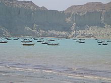
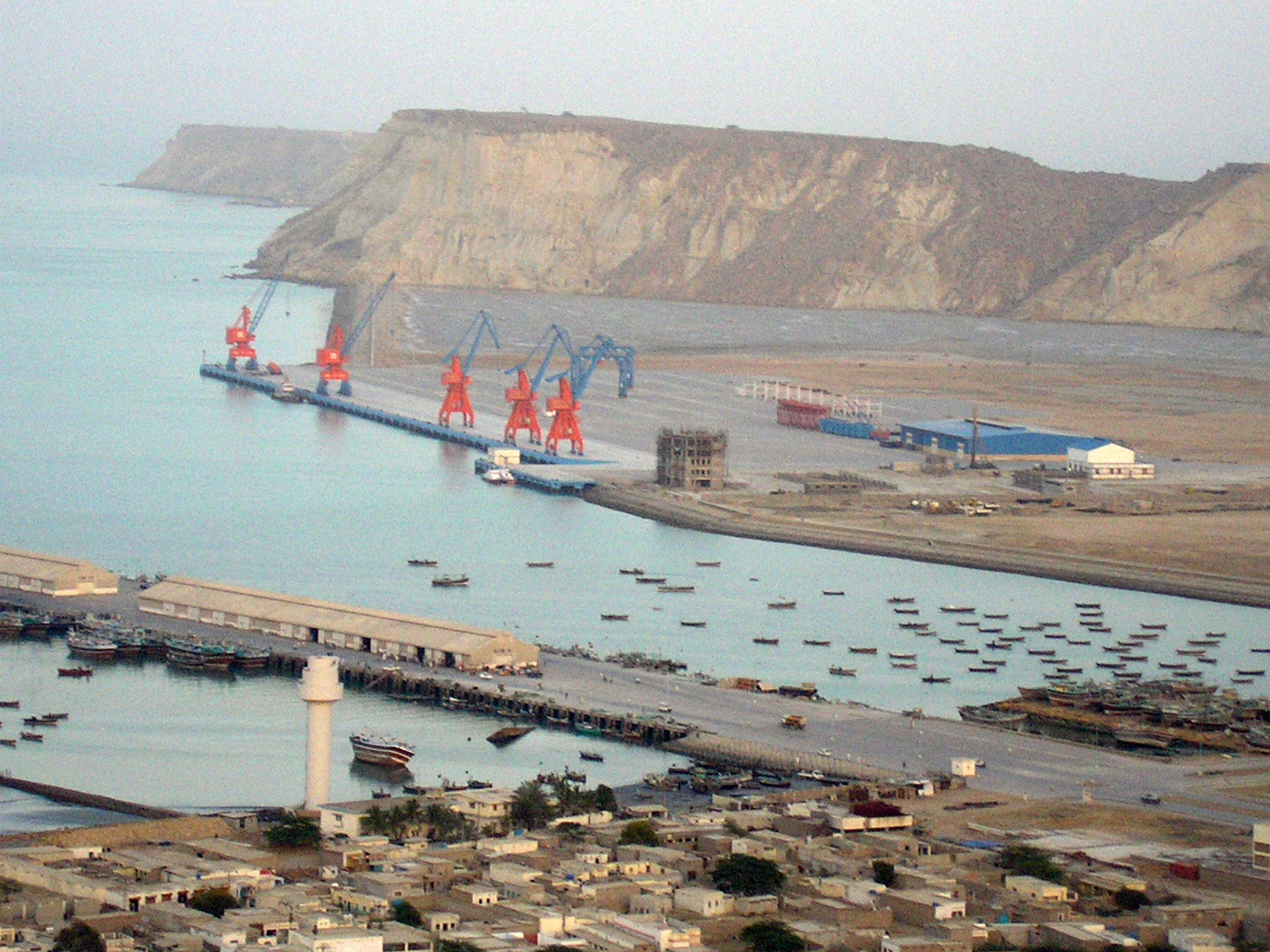
 Port city of Gwadar
The climate of Gwadar is located at 0 metres (0 ft)–300 metres (984 ft) meters above sea level, features dry and hot Arid climate. The oceanic influence keeps the temperature lower than that in the summer and higher in winter. The mean temperature in the hottest month of June remains between 31 °C (88 °F) and 32 °C (90 °F). The mean temperature in the coldest month of January varies from 18 °C (64 °F) to 19 °C (66 °F). The uniformity of temperature is a unique characteristic of the coastal region in Balochistan. Occasionally, winds moving down the Balochistan plateau bring cold spells, otherwise the winter is pleasant. In Gwadar, winter is shorter than summer. Gwadar's weather is identical to that of Middle east as most rain occur from December till January. The highest rainfall of 227 millimetres (8.9 in) in 24 hours was recorded on 6 June 2010.[1]
Climate data for Gwadar, Pakistan Month Jan Feb Mar Apr May Jun Jul Aug Sep Oct Nov Dec Year Record high °C (°F) 31.1
(88.0)33.0
(91.4)40.5
(104.9)44.7
(112.5)45.7
(114.3)48
(118)42.5
(108.5)39.5
(103.1)41.1
(106.0)41.0
(105.8)37
(99)33.1
(91.6)48.0
(118.4)Average high °C (°F) 24.1
(75.4)25
(77)28
(82)31.9
(89.4)34.2
(93.6)34
(93)32.5
(90.5)31.5
(88.7)31.5
(88.7)32
(90)29
(84)25
(77)23.9 Average low °C (°F) 13.8
(56.8)15.1
(59.2)18.4
(65.1)21.7
(71.1)24.9
(76.8)26.9
(80.4)26.9
(80.4)25.8
(78.4)24.4
(75.9)21.7
(71.1)18.0
(64.4)15.1
(59.2)16.9 Record low °C (°F) 2.3
(36.1)1.3
(34.3)8.0
(46.4)12.5
(54.5)15.5
(59.9)20.0
(68.0)20.8
(69.4)20.5
(68.9)18.0
(64.4)13.0
(55.4)5.5
(41.9)0.5
(32.9)0.5
(32.9)Precipitation mm (inches) 25.9
(1.02)22.7
(0.894)13.4
(0.528)4.9
(0.193)0.1
(0.004)2.4
(0.094)6.6
(0.26)2.8
(0.11)0.2
(0.008)0.9
(0.035)3.7
(0.146)21.6
(0.85)89.8
(3.535)Source: [2] Contents
Factors
Gwadar being near the Arabian peninsula has hot and dry weather almost all year round. Following are the main factors that influence the weather over Gwadar.
- Western Disturbances generally occurs during the winter months and causes moderate to above-moderate rainfall, temperatures also decrease due to it.
- Shamal winds mostly occur during the months of April till May, these winds are quite dusty and are stronger in the morning then at night.[3]
- Continental air prevails during the period when there is no precipitation in the city.[4]
Monthly weather conditions
Following is the monthly summary of climatic conditions in Gwadar.
January
January is the coldest month of the city with lowest temperature of 2.3 °C (36.1 °F) on 31 January 2001 while the highest temperature is 31.1 °C (88.0 °F) recorded on 30 January 1963.[2] Western Disturbance plays a vital role in the weather of Gwadar as most winter rains are dumped by it. Gwadar being close to the border of Iran gets moderate to above moderate rain in this month as Western disturbances are strong near western borders of Pakistan. The highest rain for this month is 199.1 millimetres (7.84 in) recorded in 1970 while the average is 25.9 millimetres (1.02 in).[2] The heaviest rain in 24 hours occurred on 13 January 1970 that is 99 millimetres (3.9 in).[2]
February
February is also very chilly in the city with lowest temperature of 1.2 °C (34.2 °F) on 1 February 2001 while the highest temperature is 33 °C (91 °F) recorded on 27 February 2008.[2] Moderate intensity rains also occur in this month the highest monthly rainfall is 265.7 millimetres (10.46 in) recorded in 1986 and average is 22.7 millimetres (0.89 in), while the heaviest 24 rainfall is 145.8 millimetres (5.74 in) recorded on 21, 1987.[2]
March
Hot and dry weather is main factor of this month with highest temperature of 40.1 °C (104.2 °F) recorded on 29 March 1999, while lowest temperature of 8 °C (46 °F) recorded on 4 March 2003.[2] Rain is a rare in this month with average rainfall of 15 millimetres (0.59 in) while the highest for this month is 129 millimetres (5.1 in) in 2005 and the heaviest 24 hour rainfall occurred 2 March 2005 which is of 116 millimetres (4.6 in).[2]
April
Again hot and dry weather hovers over the city with slight increase in temperatures. The highest temperature of 44.7 °C (112.5 °F) recorded on 6 April 2001, while lowest temperature of 12 °C (54 °F) recorded on 30 April 2004.[2] No rain occurs in this month with average rainfall of 0.1 millimetres (0.0039 in) while the highest for this month is 73.4 millimetres (2.89 in) in 1961 and the heaviest 24 hour rainfall occurred 14 April 1994 which is of 50 millimetres (2.0 in).[2]
May
The weather in May is identical to that of April. The heat wave is the main factor of this month. The highest temperature recorded in the city was 45.7 °C (114.3 °F) on 25 May 1992, while the lowest was 15.5 °C (59.9 °F) recorded on 2 May 2001. There is no rain in this month but drizzle may occur rarely, the highest monthly rainfall of May is 5.4 millimetres (0.21 in) recorded in 1982, while the average rain is 0.5 millimetres (0.020 in) and the heaviest 24 hour rain of may is also 5.4 millimetres (0.21 in) recorded on 2 May 1982.
June
 Hills overlooking Gwadar.
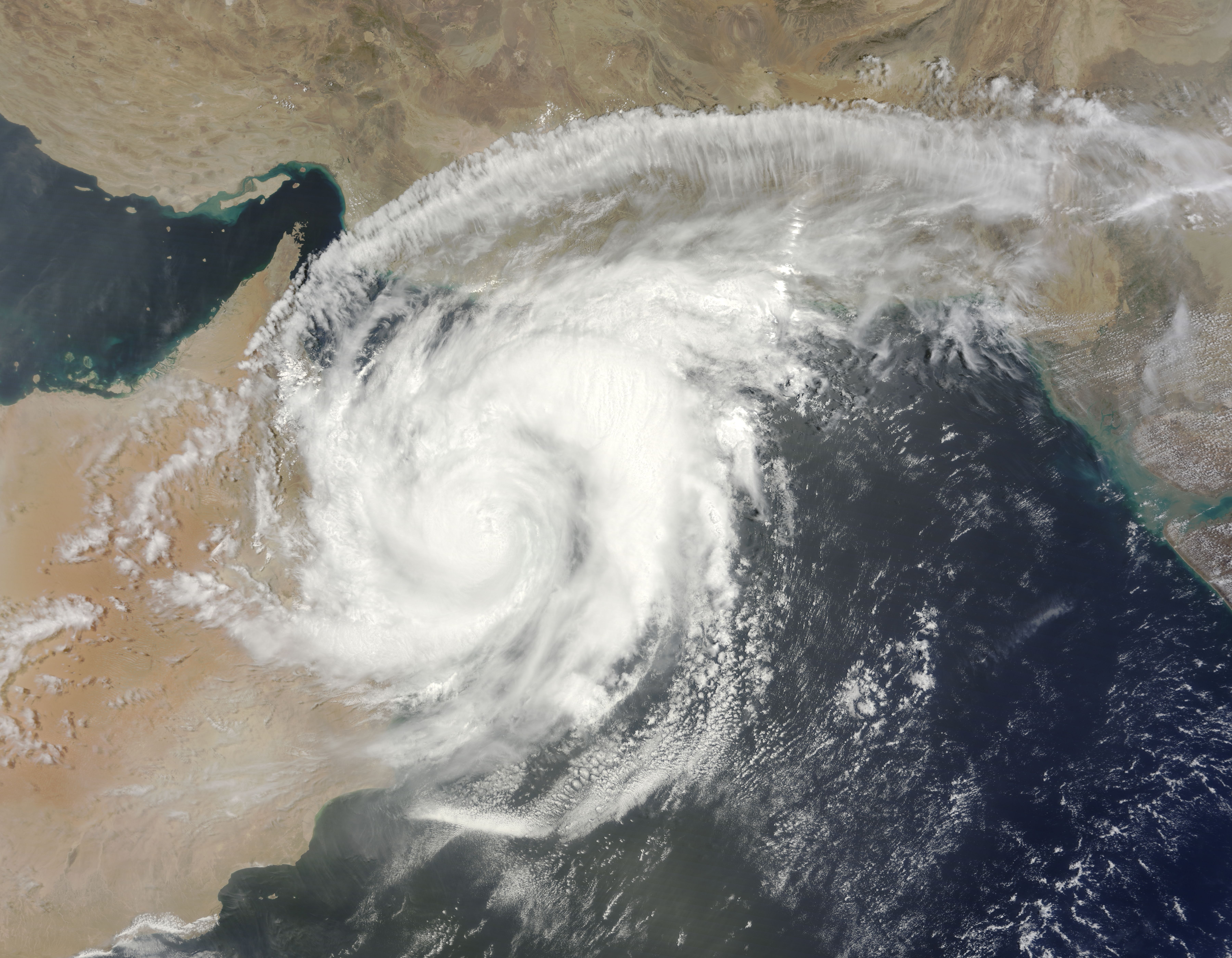
June is the hottest month of Gwadar city. As the hottest temperature is 48 °C (118 °F) recorded on 8 June 1979, while the lowest temperature is recorded on 2 June 2000 which is of 20 °C (68 °F). Rains do not occur in this month only Tropical cyclone that form in Arabian sea if they approach Gwadar then light rain occurs as these cyclone get weak by the time they reach Gwadar. Cyclone Gonu passed away from Gwadar with light rain but strong winds blown in early June 2007. While on 26 June 2007 Cyclone Yemyin as a weak tropical low made a landfall near Gwadar with 36 millimetres (1.4 in) rain[5] and during the first weak of June 2010 Category-1 Cyclone Phet devastated the city with strong windstorms of 120 km/h and a heavy downpour of 372 millimetres (14.6 in) was recorded in two days, with 143 millimetres (5.6 in) was recorded on 5 June and a record breaking 227 millimetres (8.9 in) in 24 hours was recorded on 6 June 2010.[1] Phet's rainfall also make a record highest monthly rainfall of Gwadar while the average is only 2.4 millimetres (0.094 in).
July
July is identical to June, the weather remains hot and humid. The highest temperature is 42.5 °C (108.5 °F) recorded on 14 July 1987 while the lowest temperature is 20.8 °C (69.4 °F) recorded on 12 July 2001. Drizzle may occur in this month. The highest rainfall of this month is 99.1 millimetres (3.90 in) in 1979 while the average is 6.6 millimetres (0.26 in) and the 24 hour rain in this month is 90 millimetres (3.5 in) occurred on 25 July 1976.[6]
August
There is no change in the weather of Gwadar in August as it remains hot and humid but temperatures decreases a little bit. The highest temperature is 39.5 °C (103.1 °F) recorded on 11 August 1962 while the lowest temperature is 20.5 °C (68.9 °F) recorded on 4 August 1999. Drizzle may occur in this month too. The highest rainfall of this month is 56.5 millimetres (2.22 in) in 1979 while the average is 2.8 millimetres (0.11 in) and the 24 hour rain in this month is 32.3 millimetres (1.27 in) occurred on 22 August 1970.
September
September is more hot but less humid than August. But temperatures rises in this month. The highest temperature is 41.1 °C (106.0 °F) recorded on 11 September 1962 while the lowest temperature is 18 °C (64 °F) recorded on 26 September 2004. Trace amount of drizzle may occur in this month. The highest rainfall of this month is 7.4 millimetres (0.29 in) while the average is 0.2 millimetres (0.0079 in) and the 24 hour rain in this month is 5.6 millimetres (0.22 in) occurred on 7 September 1976.
October
 Most of the land in Gwadar is desert.
October is the most driest month of the city and its the month in which Autumn visits the city. The highest temperature is 41 °C (106 °F) recorded on 1 October 1999 while the lowest temperature is 13 °C (55 °F) recorded on 23 October 1975. Drizzle may occur in this month. The highest rainfall of this month is 39 millimetres (1.5 in) in 1997 while the average is 0.9 millimetres (0.035 in) and the 24 hour rain in this month is 12.4 millimetres (0.49 in) occurred on 25 October 1997.
November
The first week of November is hot while the rest is mild with dry weather. The highest temperature is 37.2 °C (99.0 °F) recorded on 1 November 1965 while the lowest temperature is 5.5 °C (41.9 °F) recorded on 27 November 2003. Winter rain showers occur in this month due to Western disturbances. The highest rainfall of this month is 47 millimetres (1.9 in) in 1963 while the average is 3.7 millimetres (0.15 in) and the 24 hour rain in this month is 42 millimetres (1.7 in) occurred on 24 November 1963.
December
December is the month in which the cold wave hits the city because Gwadar is close to the sea making December a mild month. Western disturbances cause heavy showers in this month that decreases the temperature. The highest temperature is 33.1 °C (91.6 °F) recorded on 8 December 2005 while the lowest temperature is 0.5 °C (32.9 °F) recorded on 15 December 2003.[2] Heavy downpour occur in this month. The highest rainfall of this month is 142 millimetres (5.6 in) in 1989 while the average is 21.6 millimetres (0.85 in) and the highest 24 hour rain in this month is 71.2 millimetres (2.80 in) occurred on 6 December 1997.
List of Cyclones that effected Gwadar and the Makran Coast
 Cyclone Phet on its way to Gwadar in 2010Further information: Tropical cyclones and tornadoes in Pakistan
Cyclones do not make a landfall in Gwadar city that instigate in Arabian sea, since Gwadar is located on the extreme western coast of Pakistan. Following are the Cyclone that affected Gwadar city;
- In June 2007, a category-5 Cyclone Gonu (the most strongest cyclone in the Arabian sea) passed near the city as a cyclonic storm with lashing rains and high winds.[6][9]
- On 26 June 2007, Cyclonic storm Cyclone Yemyin made landfall in Balochistan coast as a high-end tropical storm.[5][10]
- In June 2010, a category-4 Cyclone Phet (2nd strongest cyclone in the Arabian sea) passed near Gwadar as a strong category-1 Cyclone. Phet battered the city with record-breaking rains and strong windstorms.[11][12]
Annual rainfall of Gwadar
The following is the annual rainfall for the last few years based on data from the Pakistan Meteorological Department.[13]
- In 2008, more than 44 millimetres (1.7 in) rainfall was recorded.[14]
- In 2009, a total of 150 millimetres (5.9 in) rainfall was recorded.[14]
- In 2010, a total of 432 millimetres (17.0 in) rainfall was recorded.[14]
- In 2011, a total of 13 millimetres (0.51 in) rainfall is recorded as of October 7, 2011.[14]
See also
- Climate of Pakistan
- Climate of Quetta
- Pakistan Meteorological Department
- List of extreme weather records in Pakistan
- 2011 Balochistan floods
References
- ^ a b http://www.pakmet.com.pk/FFD/index_files/rainfalljune10.htm
- ^ a b c d e f g h i j k http://www.pakmet.com.pk/cdpc/Climate/Jiwani_Climate_Data.txt
- ^ http://www.britannica.com/EBchecked/topic/538191/shamal
- ^ http://www.pakmet.com.pk/Pakistan%20Weather%20outlook/November%202009.html
- ^ a b http://www.gwadarnews.com/newsdetail.asp?newsID=1042
- ^ a b http://www.dawn.com/2007/06/06/top15.htm
- ^ a b http://indianweatherman.blogspot.com/2010/06/cyclone-history-for-karachi.html
- ^ http://www.wxp.unisys.com/hurricane/n_indian/1948/index.html
- ^ http://www.gwadarnews.com/newsdetail.asp?newsID=1037
- ^ http://www.reliefweb.int/rw/RWB.NSF/db900SID/SHES-74KT5D?OpenDocument
- ^ http://www.dawn.com/wps/wcm/connect/dawn-content-library/dawn/the-newspaper/front-page/19-heavy-rain-batters-gwadar,-cyclone-eyes-karachi-660-hh-01
- ^ http://centralasiaonline.com/cocoon/caii/xhtml/en_GB/newsbriefs/caii/newsbriefs/2010/06/04/newsbrief-04
- ^ http://www.pakmet.com.pk/
- ^ a b c d http://www.pakmet.com.pk/FFD/index_files/rainfall_data.htm
External links
Categories:- Climate by city


Wikimedia Foundation. 2010.