- Colbost
-
Coordinates: 57°26′37″N 6°38′55″W / 57.443612°N 6.648530°W
Colbost Scottish Gaelic: Cealabost 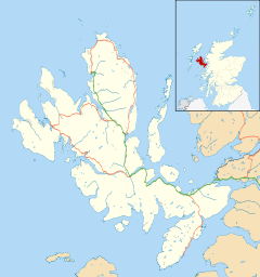
 Colbost
Colbost shown within the Isle of SkyeOS grid reference NG212488 Council area Highland Lieutenancy area Ross and Cromarty Country Scotland Sovereign state United Kingdom Post town ISLE OF SKYE Postcode district IV55 Dialling code 01470 Police Northern Fire Highlands and Islands Ambulance Scottish EU Parliament Scotland UK Parliament Ross, Skye and Lochaber Scottish Parliament Ross, Skye and Inverness West List of places: UK • Scotland • Colbost (Scottish Gaelic: Cealabost) is a scattered hamlet on the B884 road, in the Glendale estate, overlooking Loch Dunvegan on the Scottish island of Skye.
The two main attractions of this small settlement are the The Three Chimneys restaurant and the Croft Museum.
Contents
Three Chimneys
 The Three Chimneys
 Blackhouse at Colbost Folk Museum
The Three Chimneys is a multi-award winning five-star restaurant and hotel. On its annual Top 50 Restaurant magazine listed the Three Chimneys as the 28th best restaurant in the world in 2002 and 32nd in the world in 2003.[1][2]
Colbost Croft Museum
The Colbost Croft Museum, also known as the Folk Museum, is a simple open air exhibit, set in a garden. At the centre of this simple grassy garden is a perfectly preserved 19th century Hebridean crofter's black house, of which there would have been thousands on Skye before the tragic Highland clearances. The house incorporates dry stone walls and a heather-thatched roof. Inside there is the simple furniture that would have been found in such a cottage as well as newspaper clippings related to the clearances. The smell of smoke is dominant, as there is no chimney to accommodate the open fire - just a hole in the roof. At the back of the garden there is more vegetation and two little huts where produce would have been stored, one of which contains a mock illegal whisky brewing plant. Lying around the garden there are various agricultural tools including an old rusty plow. The self-service ticket office is housed in a small shack with an upturned boat for a roof. Sheep often wander into the garden to graze making this not only an open air museum but also a living museum.
References
- ^ "Best Restaurant Awards 2002 | The World’s 50 Best Restaurants". Restaurant. William Reed. 2010-02-15. http://www.theworlds50best.com/past-winners/2002. Retrieved 2010-07-04.
- ^ "Best Restaurant Awards 2003 | The World’s 50 Best Restaurants". Restaurant. William Reed. http://www.theworlds50best.com/past-winners/2003. Retrieved 2010-07-04.
External links
- Colbost Croft Museum - Undiscovered Scotland article
- The Three Chimneys
Skye / An t-Eilean Sgitheanach Main settlements Crofting townships
and settlementsAchachork · Aird of Sleat · Ardvasar · Armadale · Ashaig · Bernisdale · Bornesketaig · Boreraig · Borreraig · Borrodale · Borve · Bracadale · Breakish · Brogaig · Bualintur · Camastianavaig · Camuscross · Carbost, Loch Harport · Carbost, Portree · Claigan · Colbost · Drumfearn · Drynoch · Dunan · Duntulm · Edinbane · Elgol · Ellishadder · Eynort · Eyre · Fasach · Feorlig · Ferindonald · Fiskavaig · Flashader · Flodigarry · Galltrigill · Garafad · Geary · Gedintailor · Gillen · Glendale · Halistra · Harlosh · Heaste · Isleornsay · Kensaleyre · Kilbride · Kilmarie · Kilmore · Kilmuir · Kilvaxter · Kingsburgh · Kylerhea · Lealt · Lower Breakish · Luib · Milovaig · Ollach · Ose · Peinachorran · Portnalong · Ramasaig · Roag · Sconser · Skeabost · Sligachan · Staffin · Stein · Struan · Suladale · Talisker · Tarskavaig · Teangue · Torrin · Totaig · Tote · Treaslane · Trumpan · Uigshader · Ullinish · Upper BreakishMountains and hills Am Basteir · Beinn na Caillich · Blà Bheinn · Bruach na Frìthe · Clach Glas · Glamaig · Healabhal Bheag · Sgurr a' Ghreadaidh · Sgurr a' Mhadaidh · Sgurr Mhic Choinnich · Sgurr na Banachdich · Sgurr nan Gillean · Sgurr Dearg · Marsco · Quiraing/Meall na Suiramach · Sgurr Alasdair · The StorrHistory Armadale Castle · Battle of the Braes · Battle of the Spoiling Dyke · Caisteal Maol · Corriechatachan · Dùn Ringill · Dunvegan Castle · Fairy Flag · Flora MacDonald · Sir Rory Mor's Horn · Rubha an DùnainLocal culture Peninsulas Surrounding islands Ascrib Islands · Crowlin Islands · Eilean Bàn · Eilean Fladday · Eilean Mòr · Eilean Tigh · Eilean Trodday · Fladda-chùain · Harlosh Island · Isay · Lampay · Longay · Mingay · Oronsay · Pabay · Raasay · Scalpay · Rona · Soay · Staffin Island · Tarner Island · WiayCategories:- Populated places in Skye


Wikimedia Foundation. 2010.