- Ollach
-
Coordinates: 57°21′04″N 6°07′58″W / 57.351004°N 6.132657°W
Ollach Scottish Gaelic: An t-Olach 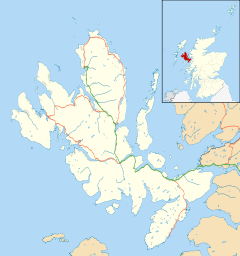
 Ollach
Ollach shown within the Isle of SkyePopulation 20 OS grid reference NG515365 Council area Highland Country Scotland Sovereign state United Kingdom Post town Portree Postcode district IV40 Police Northern Fire Highlands and Islands Ambulance Scottish EU Parliament Scotland List of places: UK • Scotland • Ollach (in Scottish Gaelic, An t-Olach) is a remote settlement, made up of Lower Ollach and Upper Ollach, lying on B883 road, south of Portree, Isle of Skye in the Highlands of Scotland. It is in the council area of Highland.
Ollach is opposite Oskaig on the Isle of Raasay, and the nearest settlement of any size is Camastianavaig. The hamlet of Peinachorran and Balmeanach is directly to the south along the B883.
 Ollach
Skye / An t-Eilean Sgitheanach Main settlements Crofting townships
and settlementsAchachork · Aird of Sleat · Ardvasar · Armadale · Ashaig · Bernisdale · Bornesketaig · Boreraig · Borreraig · Borrodale · Borve · Bracadale · Breakish · Brogaig · Bualintur · Camastianavaig · Camuscross · Carbost, Loch Harport · Carbost, Portree · Claigan · Colbost · Drumfearn · Drynoch · Dunan · Duntulm · Edinbane · Elgol · Ellishadder · Eynort · Eyre · Fasach · Feorlig · Ferindonald · Fiskavaig · Flashader · Flodigarry · Galltrigill · Garafad · Geary · Gedintailor · Gillen · Glendale · Halistra · Harlosh · Heaste · Isleornsay · Kensaleyre · Kilbride · Kilmarie · Kilmore · Kilmuir · Kilvaxter · Kingsburgh · Kylerhea · Lealt · Lower Breakish · Luib · Milovaig · Ollach · Ose · Peinachorran · Portnalong · Ramasaig · Roag · Sconser · Skeabost · Sligachan · Staffin · Stein · Struan · Suladale · Talisker · Tarskavaig · Teangue · Torrin · Totaig · Tote · Treaslane · Trumpan · Uigshader · Ullinish · Upper BreakishMountains and hills Am Basteir · Beinn na Caillich · Blà Bheinn · Bruach na Frìthe · Clach Glas · Glamaig · Healabhal Bheag · Sgurr a' Ghreadaidh · Sgurr a' Mhadaidh · Sgurr Mhic Choinnich · Sgurr na Banachdich · Sgurr nan Gillean · Sgurr Dearg · Marsco · Quiraing/Meall na Suiramach · Sgurr Alasdair · The StorrHistory Armadale Castle · Battle of the Braes · Battle of the Spoiling Dyke · Caisteal Maol · Corriechatachan · Dùn Ringill · Dunvegan Castle · Fairy Flag · Flora MacDonald · Sir Rory Mor's Horn · Rubha an DùnainLocal culture Peninsulas Surrounding islands Ascrib Islands · Crowlin Islands · Eilean Bàn · Eilean Fladday · Eilean Mòr · Eilean Tigh · Eilean Trodday · Fladda-chùain · Harlosh Island · Isay · Lampay · Longay · Mingay · Oronsay · Pabay · Raasay · Scalpay · Rona · Soay · Staffin Island · Tarner Island · WiayCategories:- Populated places in Skye
- Highland geography stubs


Wikimedia Foundation. 2010.