- Colotlán
-
Colotlán — Municipality and town — 
Coat of armsMunicipality location in Jalisco Location in Mexico
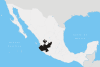
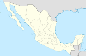
 Colotlán
Coordinates: 22°12′N 103°18′W / 22.2°N 103.3°WCoordinates: 22°12′N 103°18′W / 22.2°N 103.3°W Country  Mexico
State Jalisco Area – Total 505.15 km2 (195 sq mi) Population (2005) – Total 17,557 Time zone CST (UTC-6) – Summer (DST) CDT (UTC-5) The municipality of Colotlán is located in the northern extremity of the Mexican state of Jalisco. The municipality covers an area of approximately 505 square kilometers. Colotlán is located at 22°12′N 103°18′W / 22.2°N 103.3°W. It stands at 1,550 meters above sea level.
Colotlán is bordered on the northeast by the municipality of Santa María de los Ángeles, on the northwest and southeast by the state of Zacatecas and to the southwest by the municipality of Totatiche.
Contents
Population
The population of the municipality of Colotlán in 2000 totaled 14,266. Of these, 12,283 lived in the municipal seat of Colotlán and the remaining lived in surrounding rural areas. The main villages in the Municipailty (known in the region as "Ranchos") are: El Refugio, El Saucillo De Los Pérez, El Carrizal, El Epazote, Los Aguajes, Agua Gorda.
Colotlán had a total of 6,008 economically active individuals in 2000. The manufacturing sector employs the largest percentage of this population (30.6 percent) followed by the wholesale and retail sectors (13.6 percent) and agriculture and ranching (12.0 percent).
The municipality is the origin and an important center of piteado manufacturing.
History
Pre-Hispanic
The name Colotlán means "the place of scorpions" in Nahuatl. Prior to the Spanish conquest, the area surrounding present-day Colotlán was inhabited by indigenous ethnic groups including the Tepecano, Guachichil and Zacatec (largely nomadic groups collectively referred to by the Mexica and later the Spanish as Chichimecs). These groups were continuously at war with the Caxcan who inhabited the surrounding areas.
Colonial
The first Spaniards to set foot in the region were soldiers under the command of Captain Pedro Almíndez Chirino in 1530, who reported that the area was largely uninhabited. The atrocities committed by the expeditions sent by Nuño Beltrán de Guzmán led to an area chieftain by the name of Zacatecas to align various indigenous groups in the area to resist the Spanish incursion in the Mixtón War in 1540.
In 1546, the governor of Nueva Galicia, Cristóbal de Oñate sent Juan de Tolosa, who was successful in convincing the indigenous groups to accept Spanish military presence and evangelization by lavishing their leaders with gifts.
The first Spanish settlement was established by Lucas Tellez, who founded the Tochopa Hacienda. Along with Diego Ramírez, they sought permission from the viceroy Luis de Velasco to found a village. The village was initially populated by part of the 400 Tlaxcaltec families sent to this and other regions in the Chichimeca. The Spanish had negotiated with Tlaxaltec leaders to send families to regions where they had been unsuccessful in subjugating the local indigenous groups. The Tlaxcaltecs, who had allied themselves with the Spanish in the conquest of Tenochtitlan were to serve as models of civility and of sedentary agricultural life for the still indominatable Chichimecs of the region.
On August 21, 1591, Captain Miguel Caldera, mayor of the village of Jerez and the Valley of Tlaltenango, gave the necessary land to estalish a settlement. The land was put under the custody of Fray Ignacio Cárdenas, who named the village Villa de Nueva Tlaxcala de Quiahuistlán, a name by which Colotlan was known until the end of the 18th Century.
The village was divided into three sectors. The first, Tlaxcala, corresponded to the Tlaxcaltecs as well as the few Spaniards who inhabited the village initially. The second, Sayotlan, was home to the local indigenous inhabitants who had been pacified. The third sector, Tochopa, named after the hacienda that had existed prior to the founding of the town, was for immigrant indigenous groups.
While initially under the rule of the government of Nueva Galicia, the cost and logistics of suppressing the indigenous uprisings in the surrounding areas in the 18th century led the colonial government to place the town and its surrounding areas under the rule of a military government in the mid 18th century. Military governors during this period included Simon de Herrera Leiba and Pablo Enrique Yriarte Lanumbe. These military governments were charged with all civil and criminal proceedings in the region under their rule, known as Las Fronteras de Colotlán, which in addition to Colotlan, included the provinces of Nayarit and Bolaños. Upon the military government's dissolution in 1806, the area was divided into nine subdelegations and put under the rule of government of Nueva Galicia.
Modern
On November 12, 1810, a local indigenous leader from the Tlaxcala neighborhood, Marcos Escobedo along with a priest named Pablo José Calvillo, declared Colotlán independent from Spain and put himself and the local indigenous garrisons under the command of Miguel Hidalgo, leader of the independence movement.
In 1824, Colotlán was given the title of city and since that date served as seat of the 8th Canton of Jalisco. A municipal government was established by decree on April 8, 1844.
A small village in the municipality, called Agua Gorda, is the birthplace of Victoriano Huerta Márquez, President of Mexico from 1913 to 1914. He was born on December 23, 1850, son of Jesús Huerta and Refugio Márquez, who was purportedly of Huichol descent. Victoriano Huerta is one of the few Presidents of Mexico who were originally from the Jalisco state (with Valentín Gómez Farías who served as acting president twice)
The area surrounding Colotlan was one of the principal battlegrounds of the Cristero Rebellion which lasted from 1927 to 1929, where pro-Catholic forces rebelled against the liberal and secularizing decrees instituted by Plutarco Elías Calles, which included bans on clergy wearing clerical garb in public and on criticizing the government.
The parish priest of Totatiche, Cristóbal Magallanes Jara, who was canonized by Pope John Paul II in 1992, was executed by firing squad in Colotlán on May 25, 1927 as a consequence of the Cristero conflict.
Colotlán is named "Capital del Cinto Piteado",[1] Capital of the Piteado belt, this hand tailored belt among other things is made in Colotlán, and at one time provided a large portion of the income of the local residents. Demand has diminished for this product in recent years.
Natural Attractions
One of the natural attractions of Colotlán is a natural canyon known as "La Barranca" located about 1 kilometer east of El Refugio, in the south east part of the municipality. This canyon runs for approximately 5 kilometers and is the exit of the basin of approximately 100 square kilometers that was formed in the highlands in the neighbouring state of Zacatecas between the Sierra de Morones and the "Cerro Chichimeco" (Chichimeco mountain, approximately 2,600 meters above sea level). The canyon is also the origin of the "Chichoca" River, that runs east-west and that joins the Colotlán River before joining the Bolaños River, one of the most important afluents, running north-south, of the Lerma-Santiago River.
Sources
- Instituto Nacional de Estadistica, Geografia e Informatica (INEGI)
- Botello Aceves, Brígida del Carmen, en Memoria del Municipio en Jalisco. Unidad Editorial, Gobierno de Jalisco, 1987
References
Municipalities
and
(municipal seats)Acatic · Acatlán de Juárez · Ahualulco de Mercado · Amacueca · Amatitán · Ameca · Arandas · Atemajac de Brizuela · Atengo · Atenguillo · Atotonilco El Alto · Atoyac · Autlán de Navarro · Ayotlán · Ayutla · Bolaños · Cabo Corrientes (El Tuito) · Cañadas de Obregón · Casimiro Castillo · Chapala · Chimaltitán · Chiquilistlán · Cihuatlán · Cocula · Colotlán · Concepción de Buenos Aires · Cuautitlán de García Barragán · Cuautla · Cuquío · Degollado · Ejutla · El Arenal · El Grullo · El Limón · El Salto · Encarnación de Diaz · Etzatlán · Gómez Farías (San Sebastián del Sur) · Guachinango · Guadalajara · Hostotipaquillo · Huejúcar · Huejuquilla El Alto · Ixtlahuacán de los Membrillos · Ixtlahuacan del Río · Jalostotitlán · Jamay · Jesús María · Jilotlán de los Dolores · Jocotepec · Juanacatlán · Juchitlán · La Barca · La Huerta · La Manzanilla · La Manzanilla de La Paz · Lagos de Moreno · Magdalena · Mascota · Mazamitla · Mexticacan · Mezquitic · Mixtlán · Ocotlán · Ojuelos de Jalisco · Píhuamo · Poncitlán · Puerto Vallarta · Quitupan · San Cristobal de la Barranca · San Diego de Alejandría · San Gabriel · San Ignacio · San Juan de los Lagos · San Juanito de Escobedo (Antonio Escobedo) · San Julián, Jalisco · San Marcos · San Martín de Bolaños · San Martín de Hidalgo · San Miguel El Alto · San Sebastián del Oeste · Santa María del Oro · Santa María de los Angeles · Sayula · Tala · Talpa de Allende · Tamazula de Gordiano · Tapalpa · Tecalitlán · Techaluta de Montenegro · Tecolotlán · Tenamaxtlán · Teocaltiche · Teocuitatlán de Corona · Tepatitlán de Morelos · Tequila · Teuchitlán · Tizapan El Alto · Tlajomulco de Zuñiga · Tlaquepaque · Tolimán · Tomatlán · Tonalá · Tonaya · Tonila · Totatiche · Tototlán · Tuxcacuesco · Tuxcueca · Tuxpan · Unión de San Antonio · Unión de Tula · Valle de Guadalupe (Northern) · Valle de Guadalupe (Southern) · Valle de Juárez · Villa Corona · Villa Guerrero · Villa Hidalgo · Villa Purificación · Yahualica de González Gallo · Zacoalco de Torres · Zapopan · Zapotiltic · Zapotitlán de Vadillo · Zapotlán del Rey · Zapotlán el Grande · Zapotlanejo
 Categories:
- Populated places in Jalisco
- Municipalities of Jalisco


Wikimedia Foundation. 2010.