- Arrecifes de Cozumel National Park
-
Arrecifes de Cozumel National Park IUCN Category II (National Park)
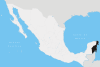
Location Cozumel, Quintana Roo, Mexico Nearest city San Miguel de Cozumel, Quintana Roo, Mexico Coordinates 20°21′14″N 86°58′24″W / 20.35389°N 86.97333°WCoordinates: 20°21′14″N 86°58′24″W / 20.35389°N 86.97333°W Established July 19, 1996[1] Governing body Secretariat of the Environment and Natural Resources The Arrecifes de Cozumel National Park is off the coast of the island of Cozumel in the state of Quintana Roo, Mexico. The cozumel reef system is part of the Mesoamerican Barrier Reef System, the second largest coral reef system in the world. Even though almost the entire island of Cozumel is surrounded by coral reefs, the park only encompasses the reefs on the south side of the island. It begins just south of the International Pier and continues down and around Punta Sur and up just a small portion of the east side of the island.
Contents
Location
The park is located in the municipality of Cozumel in the state of Quintana Roo, Mexico. It is about 20 kilometers (12 mi) off the east coast of the Yucatán Peninsula in the Caribbean Sea.
History
On July 19, 1996, under the direction of president Ernesto Zedillo Ponce de León, Arrecifes de Cozumel was declared a National Marine Park.[1]
Biodiversity
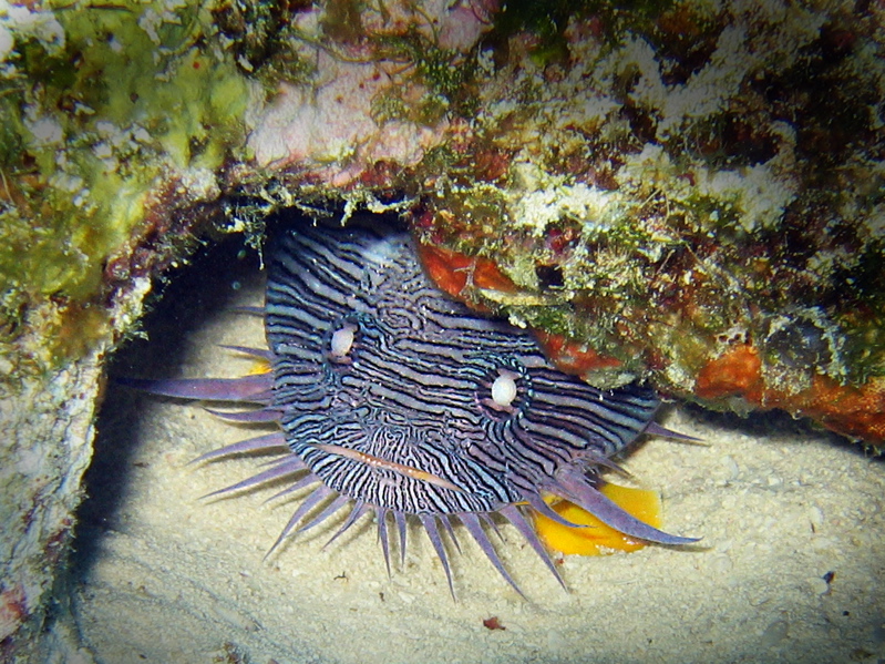
 The Cozumel Splendid Toadfish
Cozumel is home to the Cozumel Splendid toadfish (Sanopus splendidus) which is listed as vulnerable by IUCN and is entirely endemic to the reefs surrounding the island. The park also has several species that are under some degree of protection, including sea turtles (Green turtle, Loggerhead Sea Turtle, and the Hawksbill turtle ), the Queen Conch, and black coral.
Attractions
The park is most known for scuba diving and snorkeling. Popular dive sites include Columbia Reef, Devil's Throat at Punta Sur, Maracaibo, Palancar Reef, Paradise Reef, Paso del Cedral, San Francisco, Yucab, and the shipwreck of the C-53 Felipe Xicoténcatl (intentionally sunk in June 2000 to form an artificial reef). Another interesting point to visit is the MUSA Museo Subacuatico (Underwater Museum') a particular installation with reef sculptures from artists: Salvador Quiroz, Jason Decaires Taylor, Karen Salinas and Rodrigo Quiñones.
References
- ^ a b "CEMDA “Decretos, Arrecifes de Cozumel”" (in Spanish). Mexico. http://www.cemda.org.mx/infoarnap/instrumentos/decretos/arrecifescozumel.htm. Retrieved 2008-09-05.
 State of Quintana RooChetumal (capital)
Municipalities (seats) Bacalar (Bacalar) · Cozumel (San Miguel de Cozumel) · Felipe Carrillo Puerto (Felipe Carrillo Puerto) · Isla Mujeres (Isla Mujeres) · Othón P. Blanco (Chetumal) · Benito Juárez (Cancún) · José María Morelos (José María Morelos) · Lázaro Cárdenas (Kantunilkín) · Solidaridad (Playa del Carmen) · Tulum (Tulum)
Places of interest Akumal · Arrecifes de Cozumel National Park · Banco Chinchorro · Chacchoben · Coba · Isla Contoy · Isla Holbox · Kohunlich · Mahahual · Muyil · Puerto Morelos · Punta Allen · Punta Sur · Riviera Maya · San Gervasio · Sian Ka'an · Tulum · Xcalak · Xcaret · Xelha · Yo'okop
Categories:- IUCN Category II
- Coral reefs
- National parks of Mexico
- Tourism in Mexico
- Cozumel
- Underwater diving sites in Cozumel
- Mesoamerican Barrier Reef System


Wikimedia Foundation. 2010.