- Croxby
-
Coordinates: 53°28′03″N 0°12′33″W / 53.46737500°N 0.20919956°W
Croxby 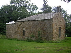
All Saints, Croxby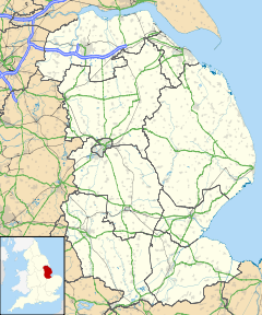
 Croxby
Croxby shown within LincolnshireOS grid reference TF189982 Parish Thoresway District West Lindsey Shire county Lincolnshire Region East Midlands Country England Sovereign state United Kingdom Post town Market Rasen Postcode district LN7 Police Lincolnshire Fire Lincolnshire Ambulance East Midlands EU Parliament East Midlands UK Parliament Gainsborough List of places: UK • England • Lincolnshire Croxby is a hamlet and former civil parish about 5 miles (8.0 km) east of the town of Caistor, Lincolnshire, England.
Croxby deserted medieval village or DMV lies to the north-east of the church and Croxby Hall, at the bottom and along the sides of a narrow stream running through a chalk valley.[1] At the time of the Domesday Book it had a population of 36.[2]
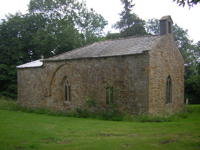
The church is dedicated to All Saints and is a grade II* listed building of ironstone dating from the 12th century, with later additions and restorations. The font is also 12th century.[3]
The parish of Croxby was abolished in 1936 when it became part of the parish of Thoresway.[4]
Croxby Hall is a grade II* listed building of red brick dating from 1730.[5]
References
- ^ "Pastscape". Croxby DMV. English Heritage. http://www.pastscape.org.uk/hob.aspx?hob_id=351782&sort=4&search=all&criteria=croxby&rational=q&recordsperpage=10. Retrieved 26 June 2011.
- ^ "Lincs to the Past". Croxby DMV. Lincolnshire Archives. http://www.lincstothepast.com/DMV-REMAINS--CROXBY/231965.record?pt=S. Retrieved 26 June 2011.
- ^ "British Listed Buildings". Croxby Church of All Saints. English Heritage. http://www.britishlistedbuildings.co.uk/en-196411-church-of-all-saints-thoresway. Retrieved 26 June 2011.
- ^ "Vision of Britain". Croxby Civil Parish. University of Portsmouth. http://www.visionofbritain.org.uk/relationships.jsp?u_id=10409767&c_id=10001043. Retrieved 26 June 2011.
- ^ "British Listed Buildings". Croxby Hall. English Heritage. http://www.britishlistedbuildings.co.uk/en-196413-croxby-hall-thoresway. Retrieved 26 June 2011.
External Links
Categories:- Lincolnshire geography stubs
- Villages in Lincolnshire
- West Lindsey

Wikimedia Foundation. 2010.