- Whycocomagh, Nova Scotia
-
 St. Andrew`s Presbyterian Church in Whycocomagh, Nova Scotia
Whycocomagh (Why-cog-ho-mah) is a small Canadian rural community in the province of Nova Scotia. The population in 2001 was 854 residents.[1] It is located on the eastern edge of Inverness County in the central part of Cape Breton Island. The community sits on the northwestern shore of St. Patrick's Channel, an arm of Bras d'Or Lake. Whycocomagh is a Mi'kmaq word which means 'Head of the Waters'. Nearby is a Mi'kmaq reserve where wooden sculptures and baskets are made.
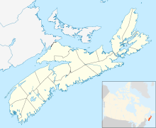
 Whycocomagh in Nova Scotia
The community is bisected by the Skye River, with the Whycocomagh and We'koqma'q First Nations (a Mi'kmaq community, (pop. 624)[1]) located west of the river, whereas the community of Whycocomagh is located east of the river and is dominated by descendants of English and Scottish settlers who came to the area in the 18th and 19th centuries; these settlers took to calling the area "Hogamagh".[2]
Highway 105, the Trans-Canada Highway runs along the Bras d"Or Lake shore through the area. The beauty of Whycocomagh was noted by Alexander Graham Bell, who is known to have stated that "Whycocomagh is the Rio de Janeiro of North America" due to the picturesque island off its shores.[citation needed]
Whycocomagh features several gas stations, several local restaurants and a farmer's market. The Whycocomagh Education Center, where the Whycocomagh Eco Centre is located, also serves as an Elementary school for the surrounding area.
External links
References
- ^ a b NS Community counts
- ^ Peter Rankin, featured artist at Down to Earth
Coordinates: 45°58′36.07″N 61°7′4.7″W / 45.9766861°N 61.117972°W
Categories:- Communities in Inverness County, Nova Scotia
- General Service Areas in Nova Scotia
- Inverness County, Nova Scotia geography stubs


Wikimedia Foundation. 2010.